July 4th at Paradise
Bad Idea, or the Best Idea?
✍️ • 🕑 July 3-4, 2023 • Tags: Mt. Rainier National Park • marmots • mountain goats • lakes • Places: Reflection Lakes • Box Canyon • Cougar Rock Campground • Paradise, Mt. Rainier National Park
There is a “sell-buy” email list at work, which acts as a very dysfunctional corporate Craigslist. Dear lord, it is inefficient to get 100 emails a day about cellphones and cars. But, another ‘c’ category piques my interest: campsites.
Colleagues in distant departments frequently re-sell campground reservations, and I almost always see them immediately after they’ve been snagged. (Getting a campground reservation in the first place in the high season is often a massive challenge.)
In late June, I happened to see one, one night reservation for July 3rd to 4th at Cougar Rock campground in Mt. Rainier National Park. I was eager to return to Paradise and its surroundings, and I felt like having a tent site would give me a great opportunity to actually explore and take in the park better.
Also, I roped a friend into camping with me. (His response to the initial invite was “I could be convinced” to come camp with you.) I still wasn’t feeling 100%, and it seemed like a good idea not to be alone in these extremely popular woods.
Read on for an excessive quantity of pictures…
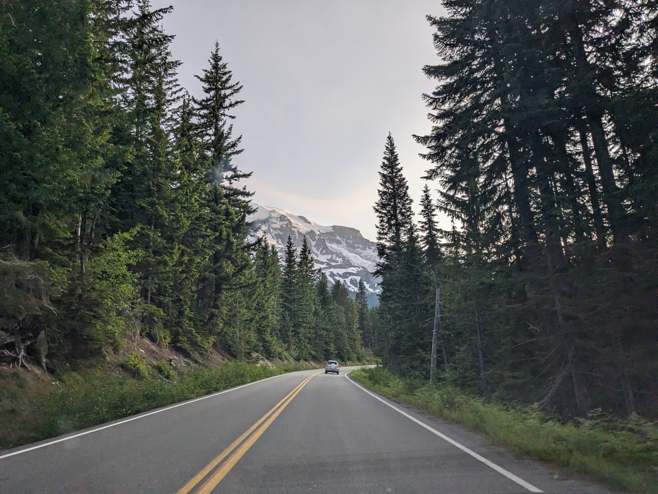
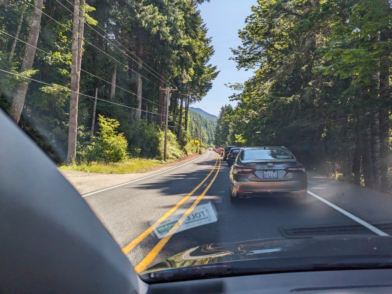
Julie Forth fell on a Toosday, and I took the Monday off, hoping that I could drive down to Mt. Rainier National Park and beat the infamous, horrendous, back up that happens constantly at the park entrance.
Except, I had already started moving my things into Chelsea’s apartment, and I was constantly confused about where my belongings were. Trying to move, pack for an overnight campground stay, and prep for an upcoming longer visit to the Sunshine Coast, was a lot for my still-fatigued bones, and I got a later start than I hoped for.
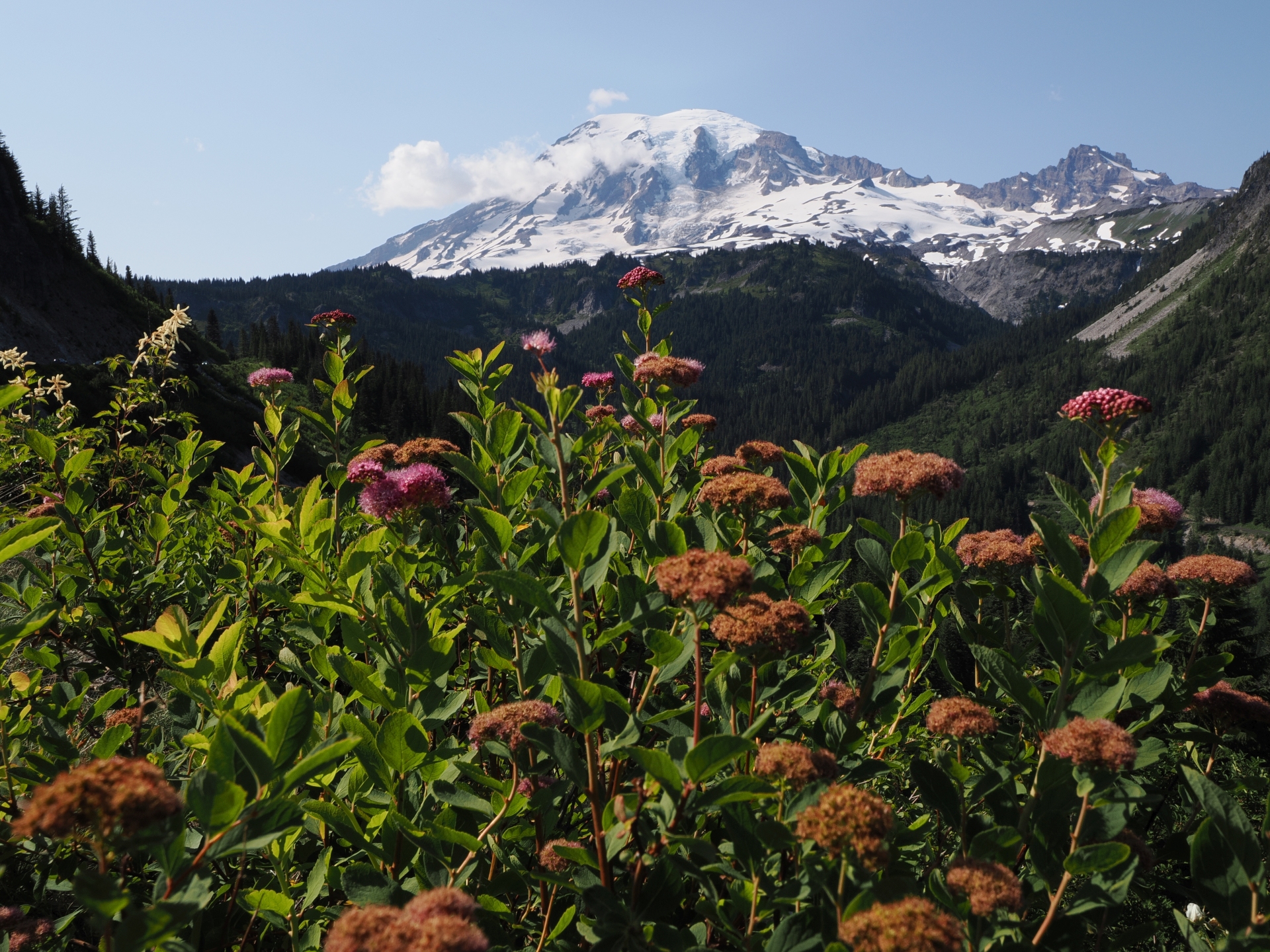
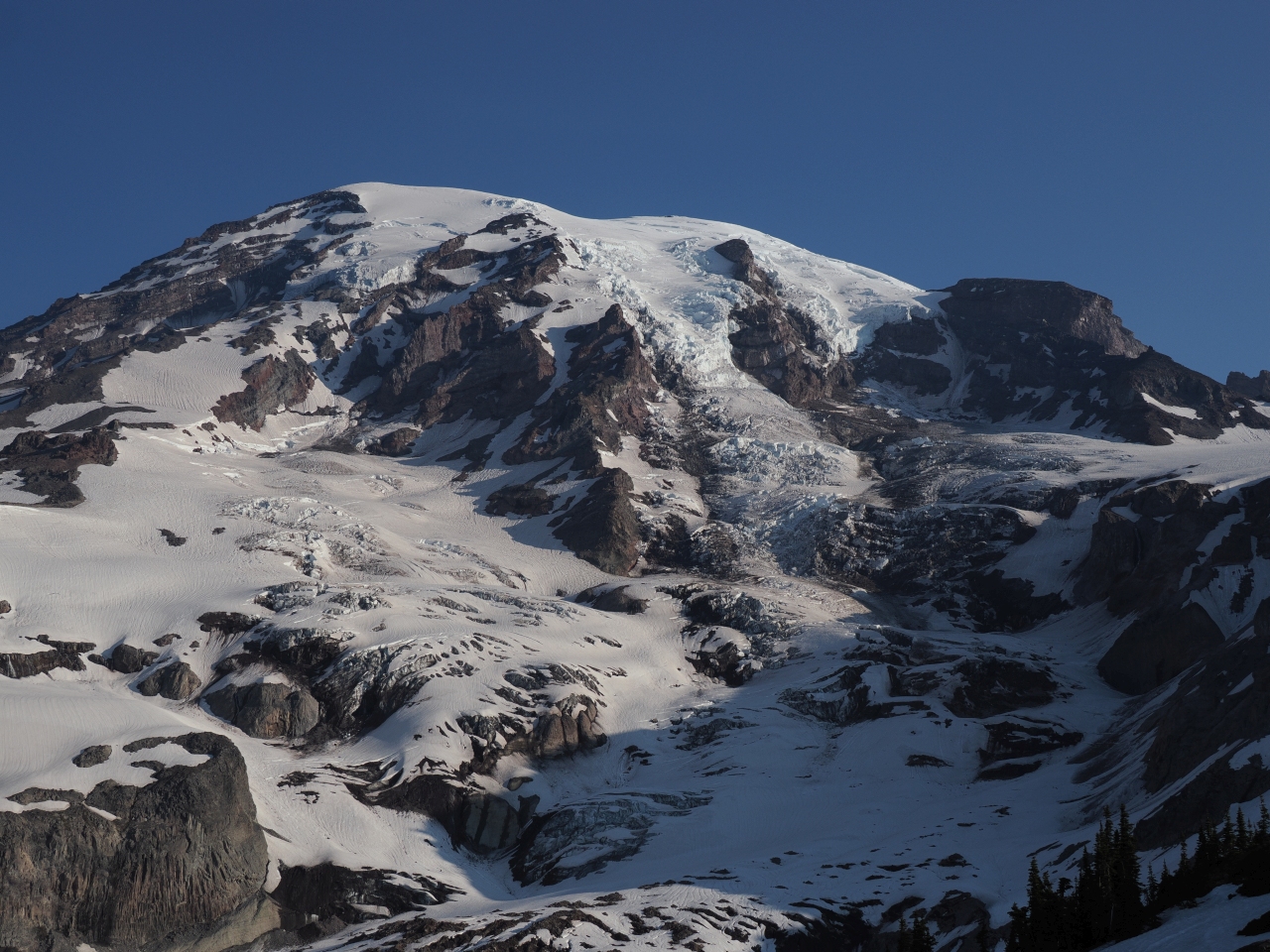
Mt. Rainier National Park
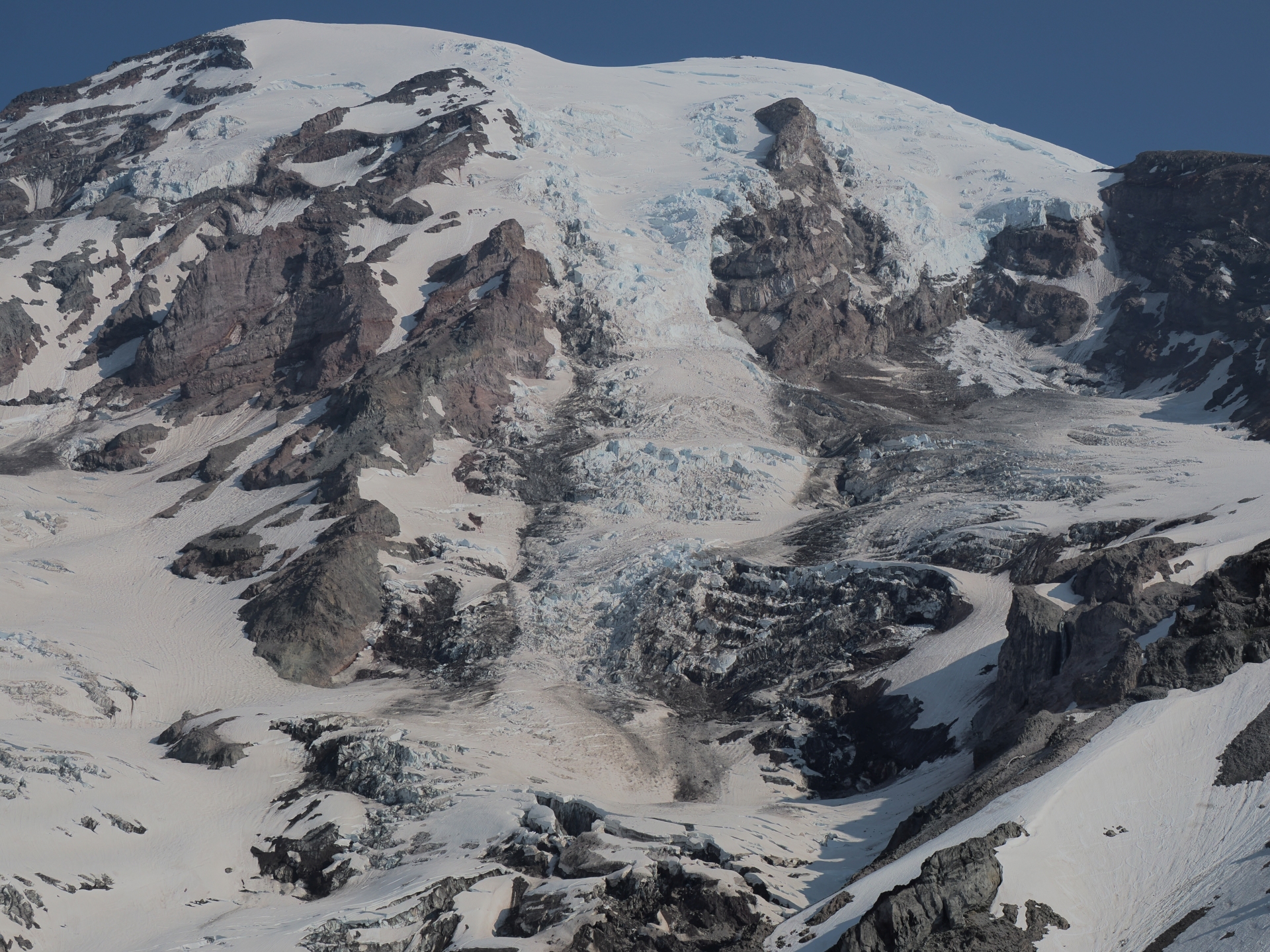
Its main attraction is the titular mountain. With its summit at 14,441 ft., Mt. Rainier is the highest in the state of Washington and the Cascade Range, and the most prominent in the continental United States. It's also an active volcano, one of the most dangerous in the world.
The mountain is home to 26 major glaciers and miles of permanent snowfields. It provides easy road access to alpine meadows, but the consequences of its beauty and popularity include long wait times and overcrowding that may be reduced by introducing timed entry tickets in the future. Much of the park is difficult to access in the winter time. See all posts tagged 'Mt. Rainier National Park'
The consequence: more than an hour of crawling to enter the park. The line was backed up starting around the waffle stick stand. It was a lot of sitting and waiting.
After I finally gained entrance to the park, I stopped by the campsite and set up my tent. My friend, Hh. would join later. In the interim, I planned to explore some more of the non-Paradise stuff near Paradise. I heard that the Stevens Canyon Road was open, meaning I could potentially drive as far as the Sunrise section of the park…
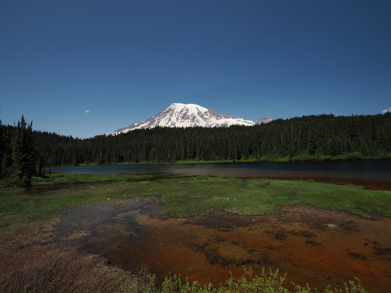
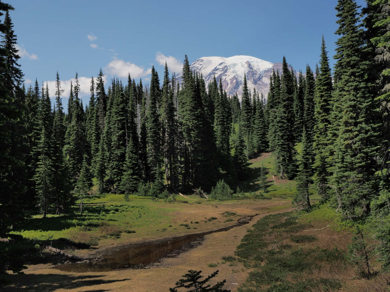
Reflection Lakes
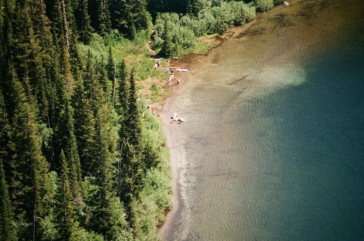
I wanted an easy enough solo hike. Reflection Lakes seemed to fit the bill. What could be easier than a walk around a lake, eh?
| Trail Information | ||
|---|---|---|
| Name | Reflection Lakes Loop | |
| Type | loop / portion of a trail system | |
| Location | Mt. Rainier National Park | |
| State | WA | |
| Country | USA | |
| Miles | 3 | |
| Check out the trails index for information on more trails! | ||
The initial section, home to what could have been the picture perfect view of the mountain reflected in the lake, is easily accessible by car, and was full of visitors making sure to violate Leave No Trace principles by cutting over ropes and trampling on wildflowers and the like.
The roadside view was not quite as Instagram worthy as one would hope, since the wind or whatever meant that the lakes didn’t form a clear picture. The lack of rainfall and summer heat also meant that many of the lakes were dry.
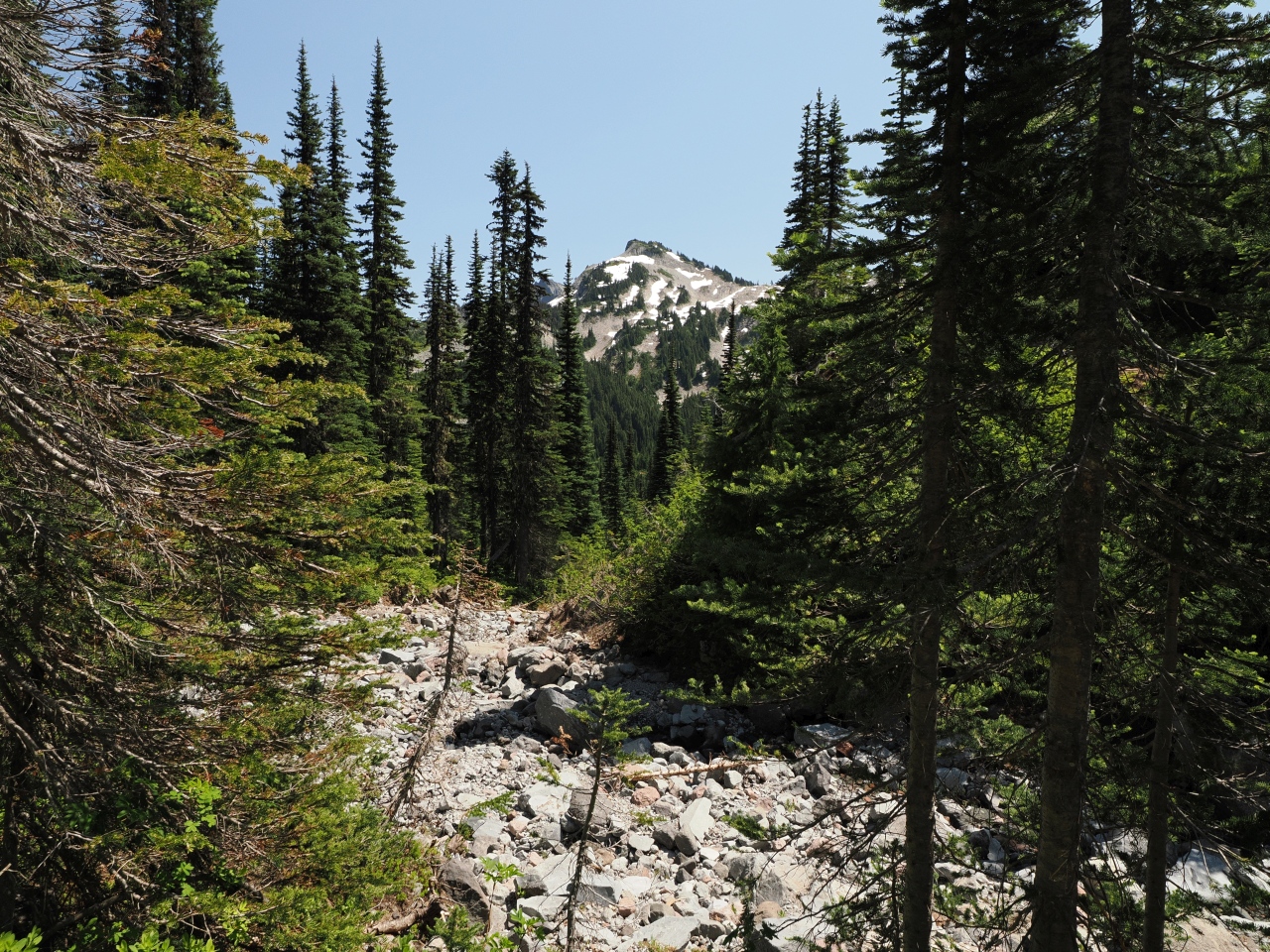
The rest of the trail had a bit more ascent and descent than I expected, and a lot of sun exposure. So even though it wasn’t that difficult, my still not fully recovered body felt a bit weary.
I could feel my energy retreat, my muscles felt a bit shakey. For what, dry lakebeds?

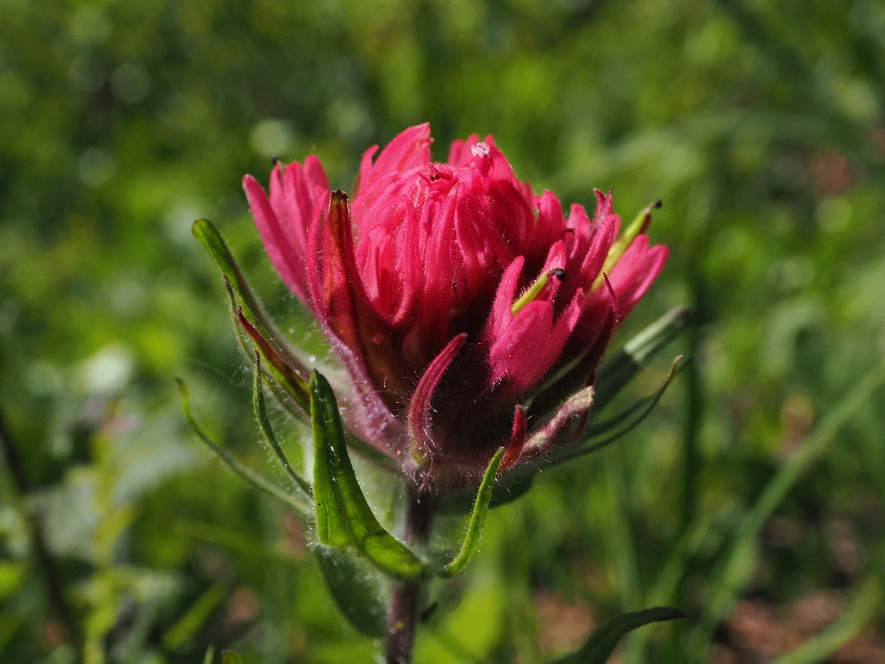
Don’t get me wrong, this trail has some beautiful views, but when it’s so close to Paradise, the thought of those views being so close leaves it adds bitter to the sweetness.
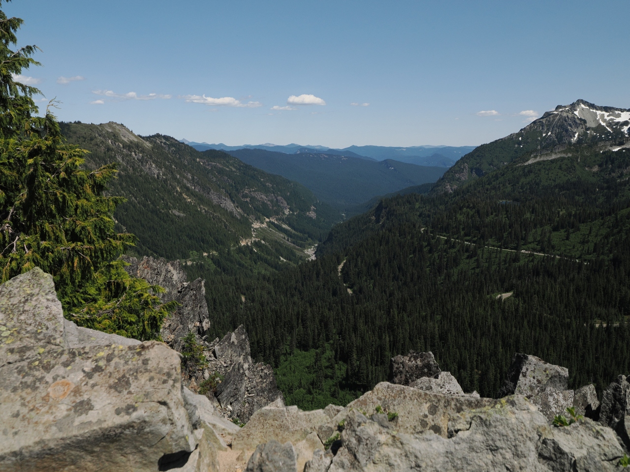
The Road Beyond Paradise
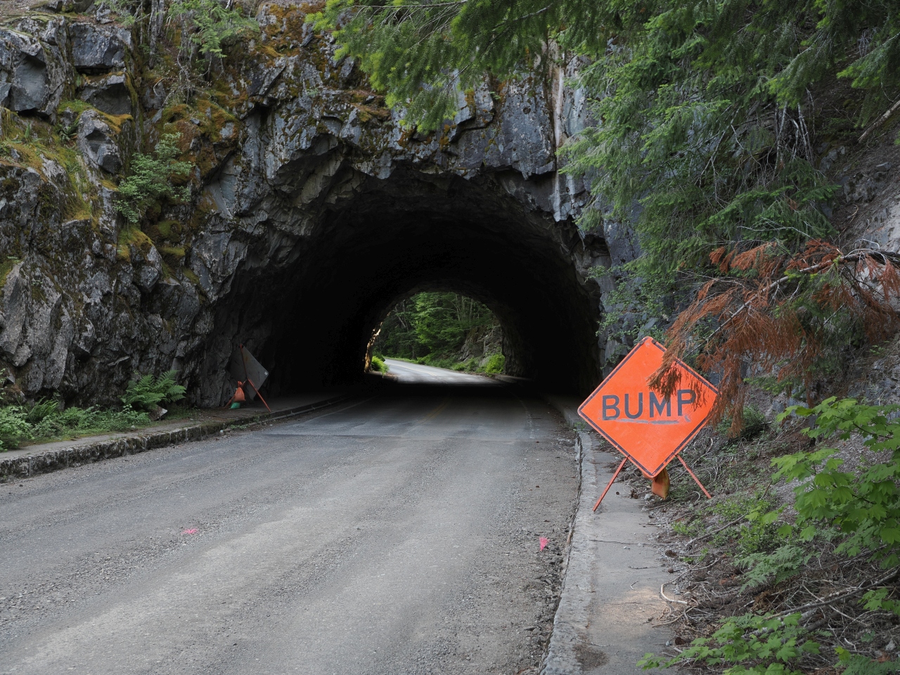
As I ventured past Reflection Lakes, I hit sections of the road that were closed many, many days for repair work. There were numerous one lane stretches, and it was clear to me that the maintenance work was absolutely necessary.
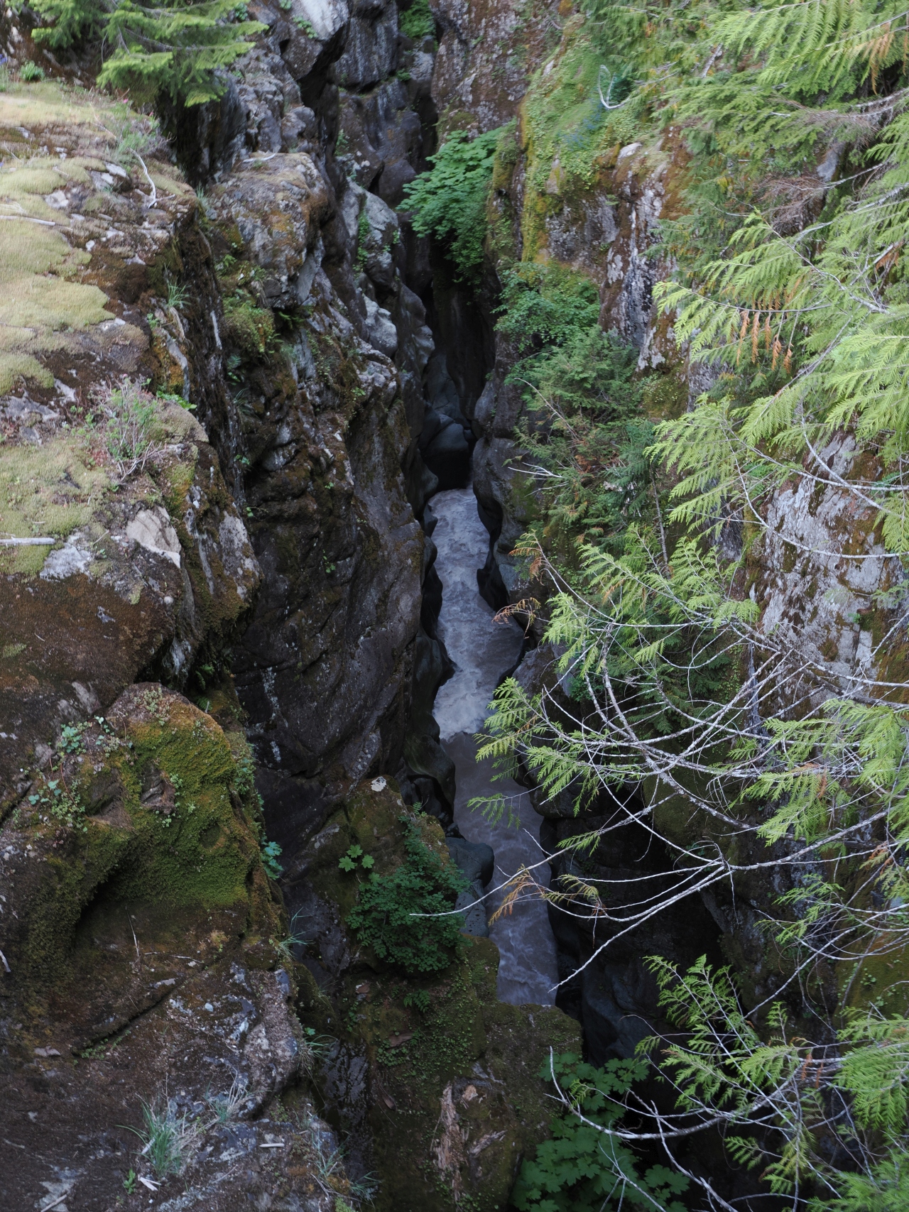
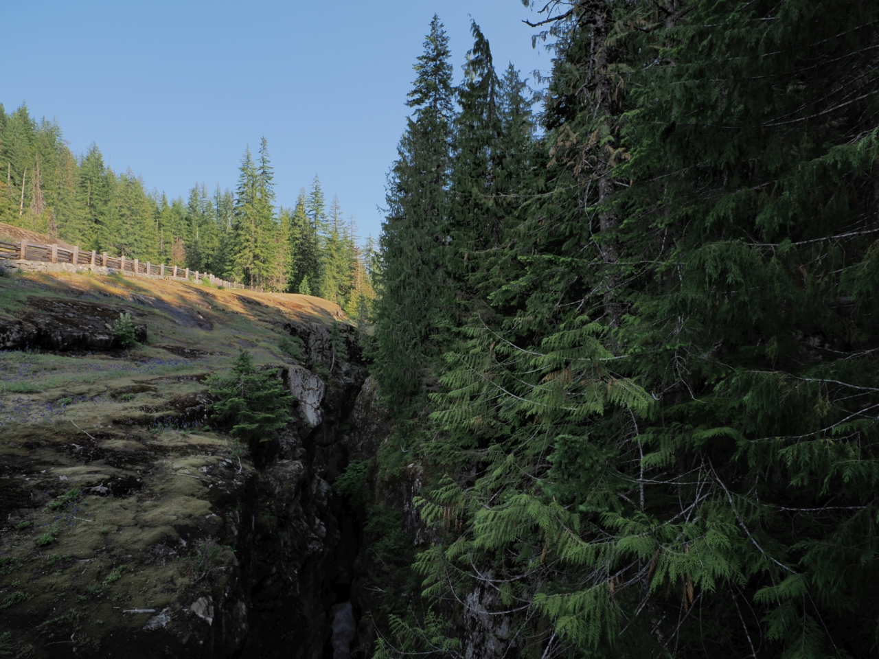
I went as far as Box Canyon. It’s 115 feet deep, but quite narrow, a slot canyon carved by the Cowlitz River.
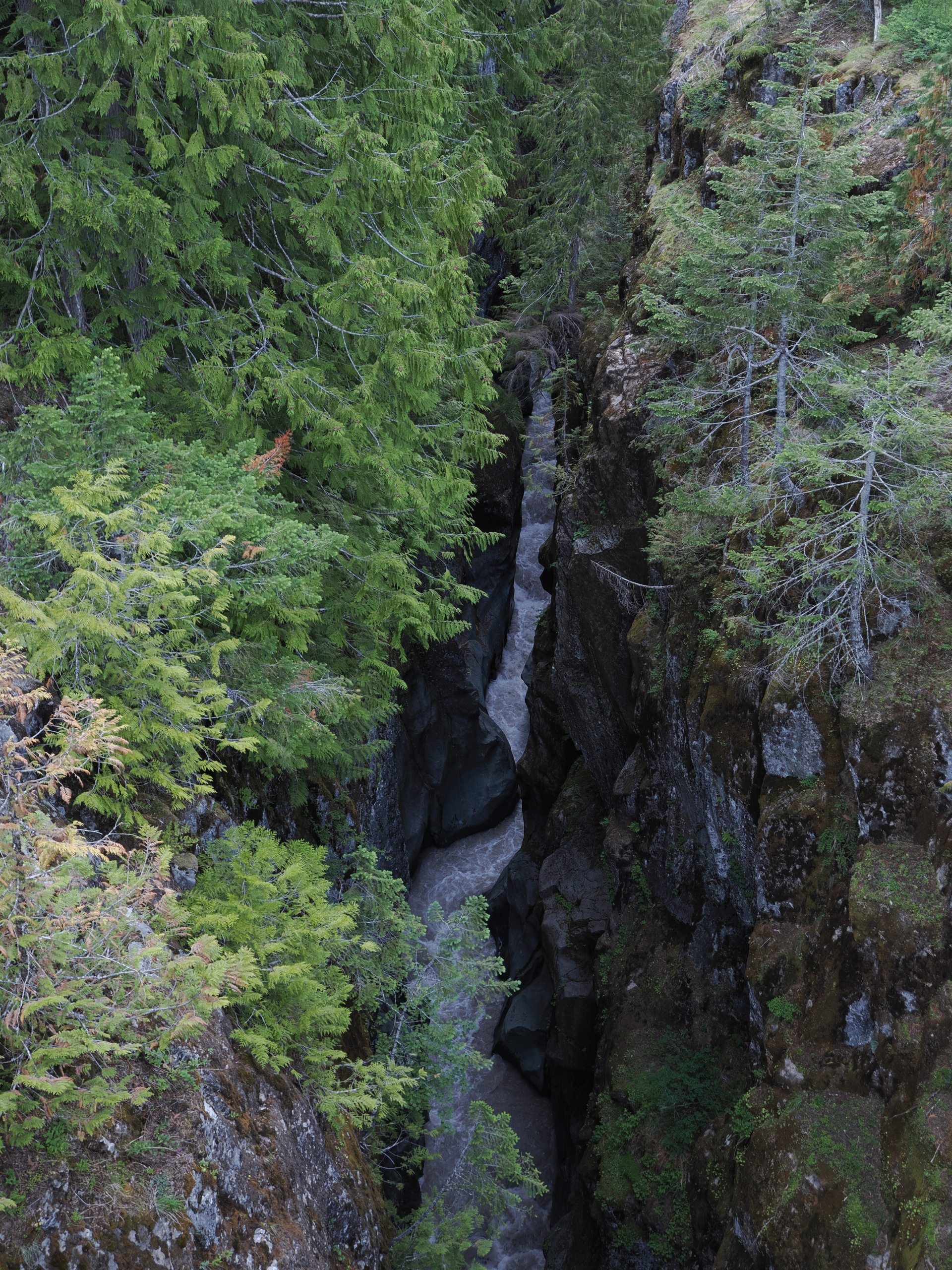
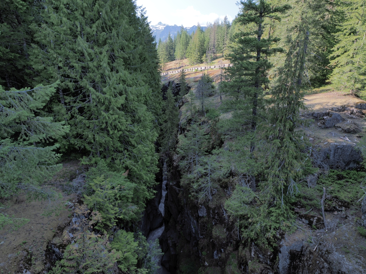
There’s a little trail around it with a couple of bridges, a small picnic area, and some signage that had seen far, far better days.
Camping
As campgrounds go, Cougar Rock is a typical national park primitive campground. The sites are on the smaller, more closely packed end of the spectrum, without views of Mt. Rainier. But, you can’t beat it for its convenient location, past the park entry queue.
I was out of service before I heard from Hh about his planned arrival time, but fortunately I wasn’t waiting for too long. He pulled up, and I grilled some smokies from last year’s trip to Vancouver, and he shared some cheese. We hung out for a while.
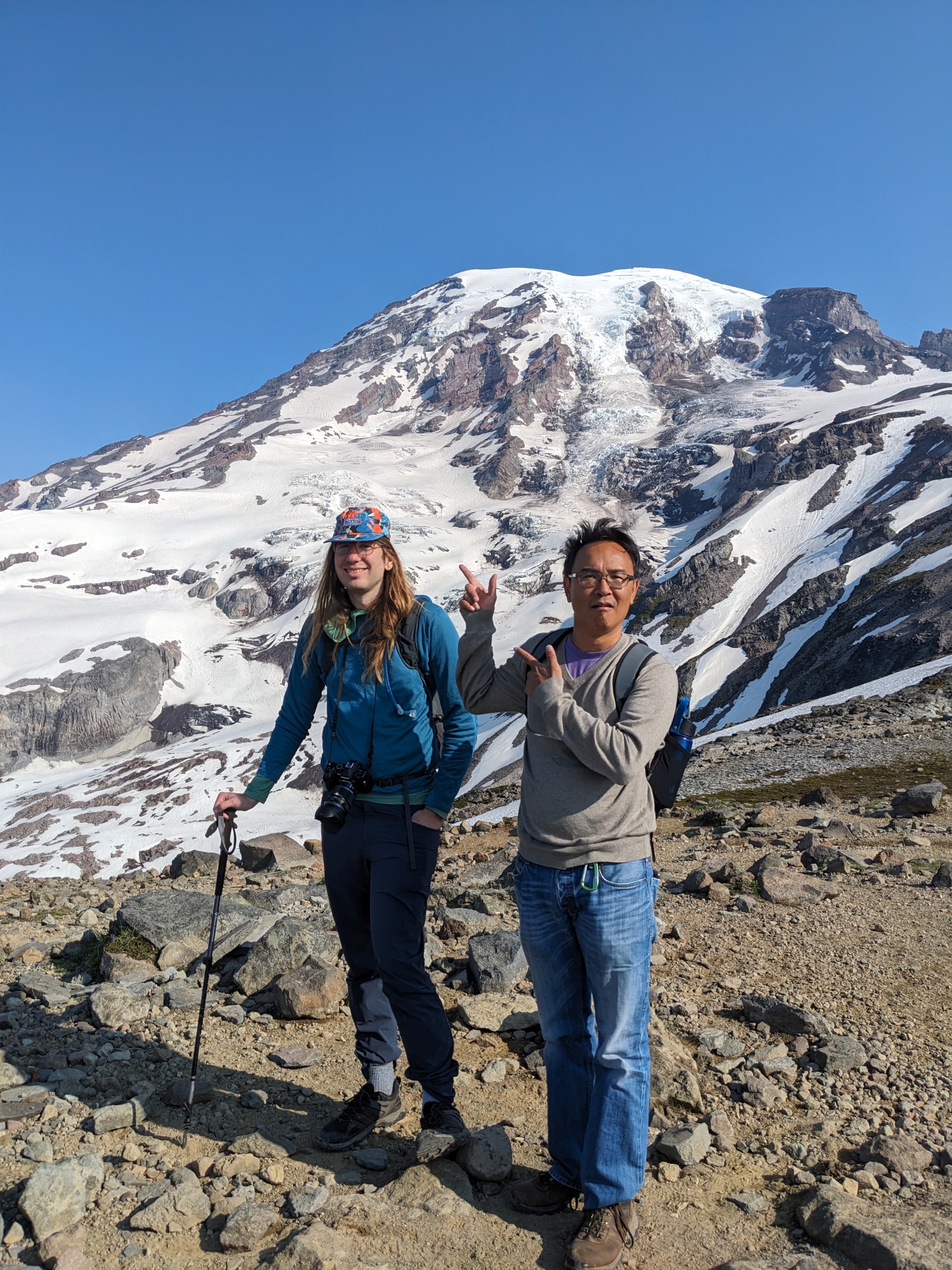
I slept in my tent. Hh slept in his car, after removing the boat to make space. We decided to get up a little after the sunrise and go for a hike together, and maybe a paddle afterwards. (The campsite was certainly not large enough for two cars, without mine being parked in, so I would need to wake Hh to leave anyway.)
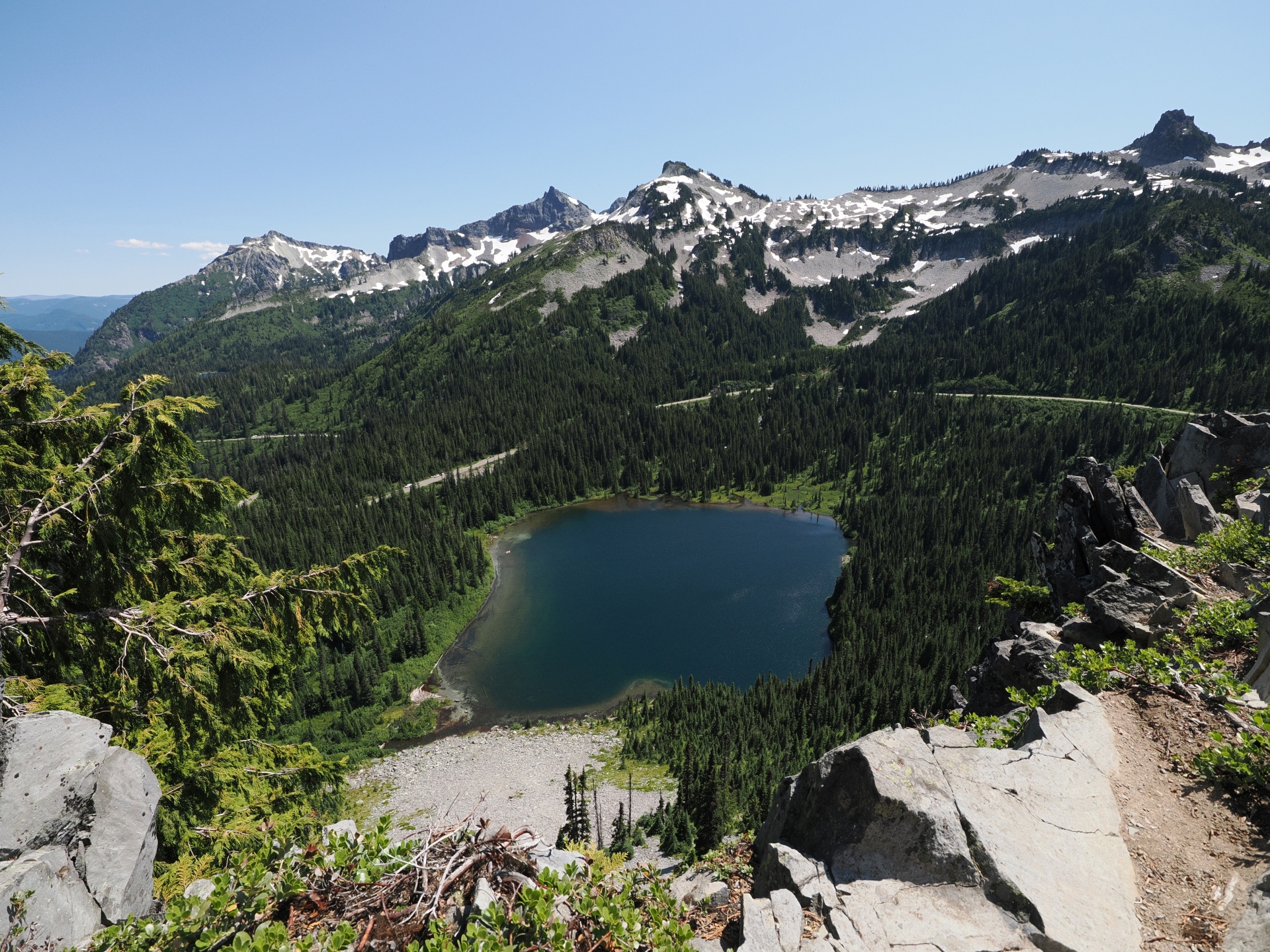
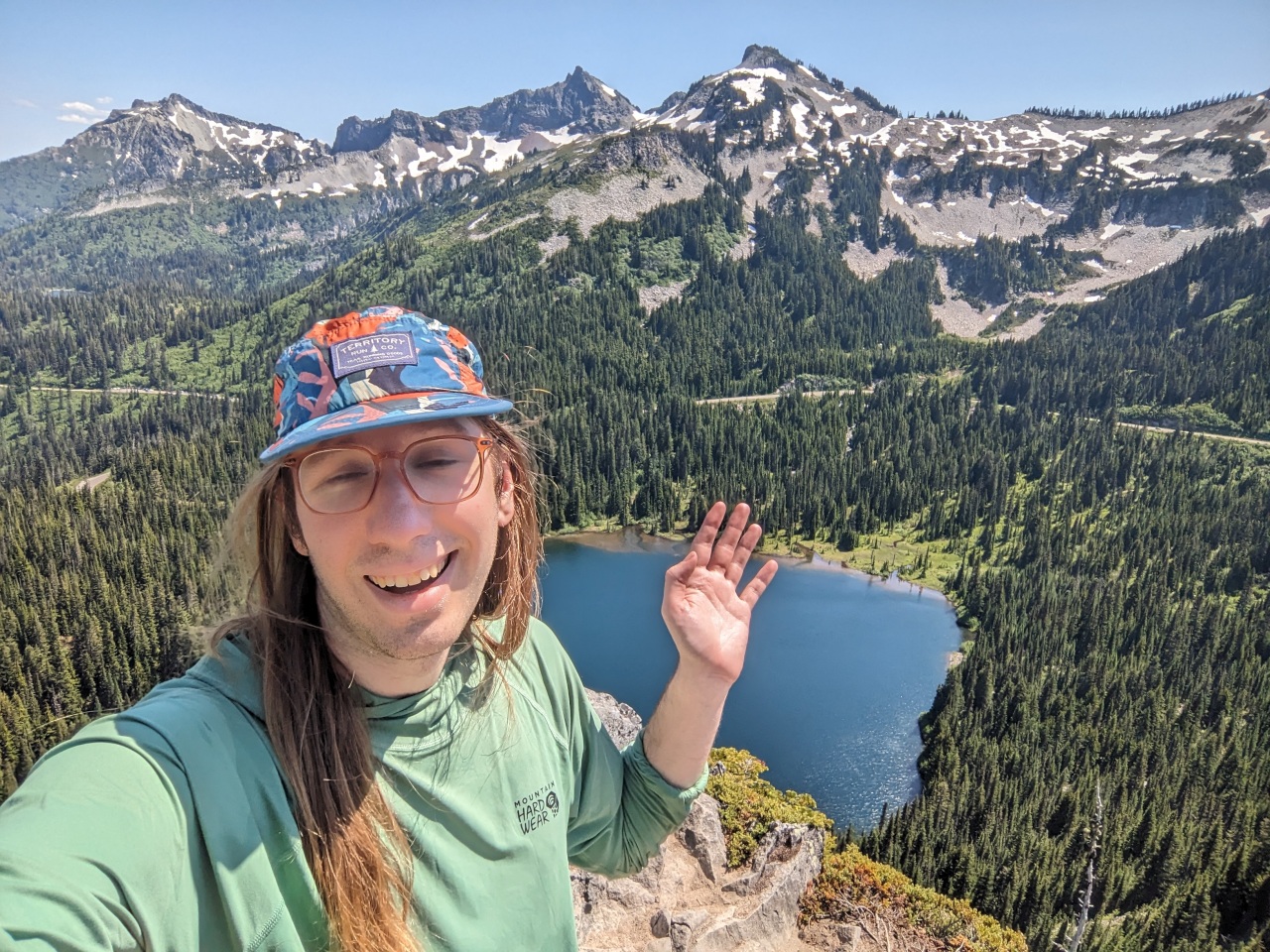
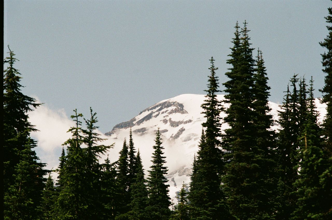
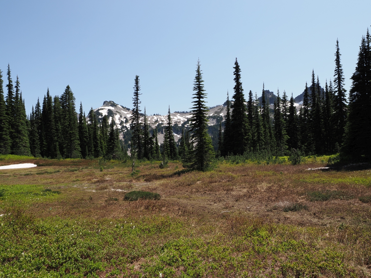
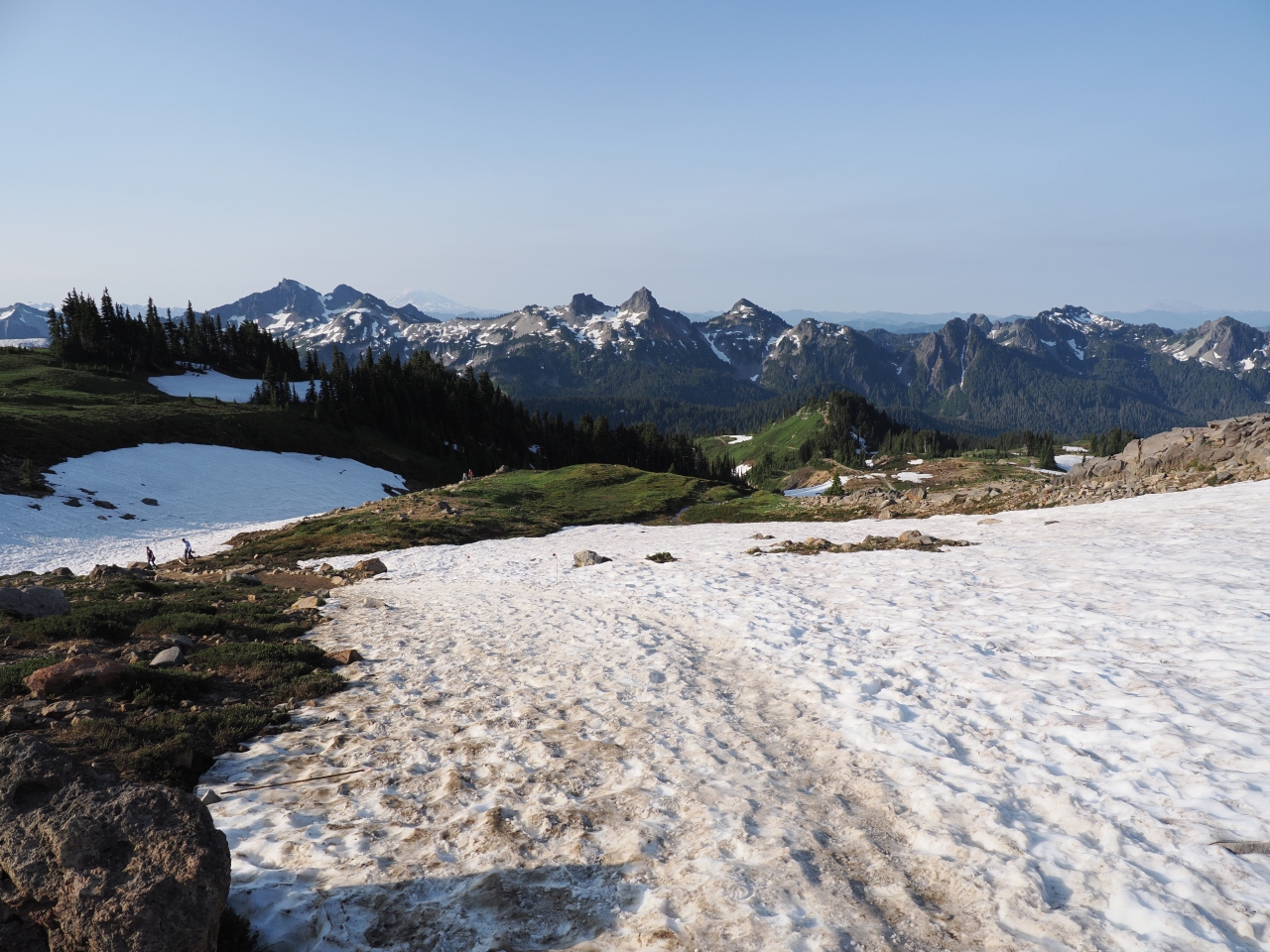
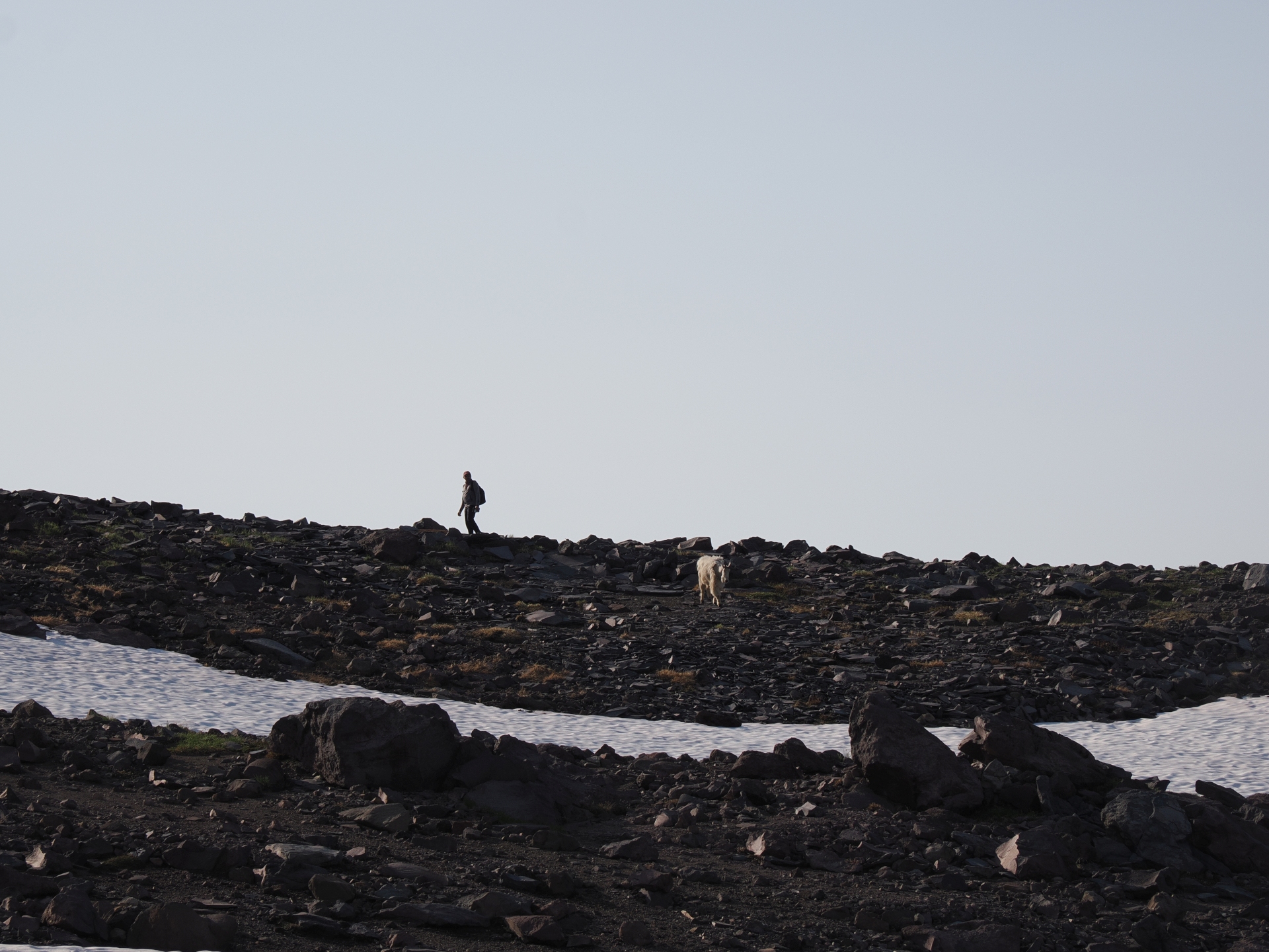
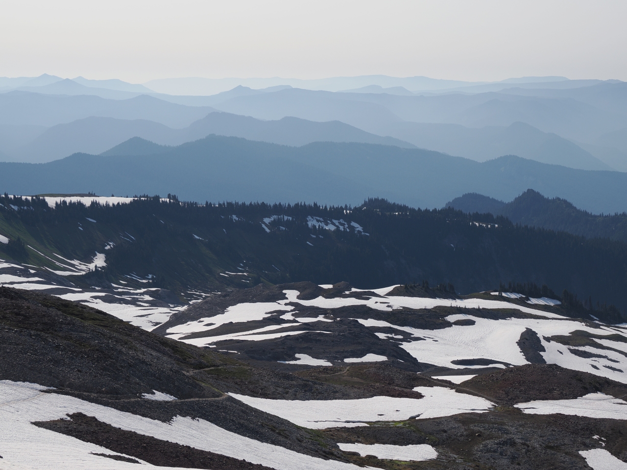
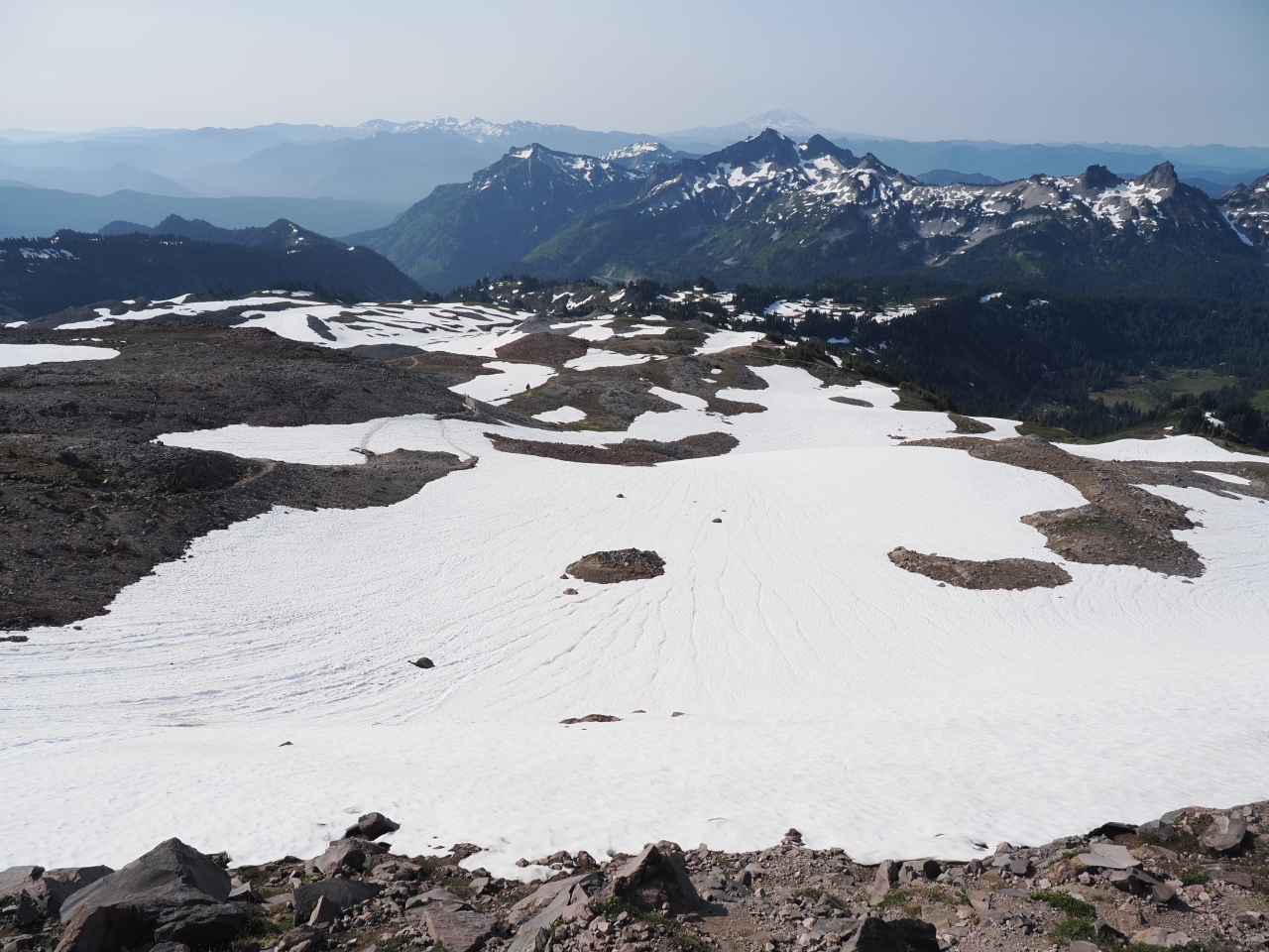
High Skyline Just After Sunrise
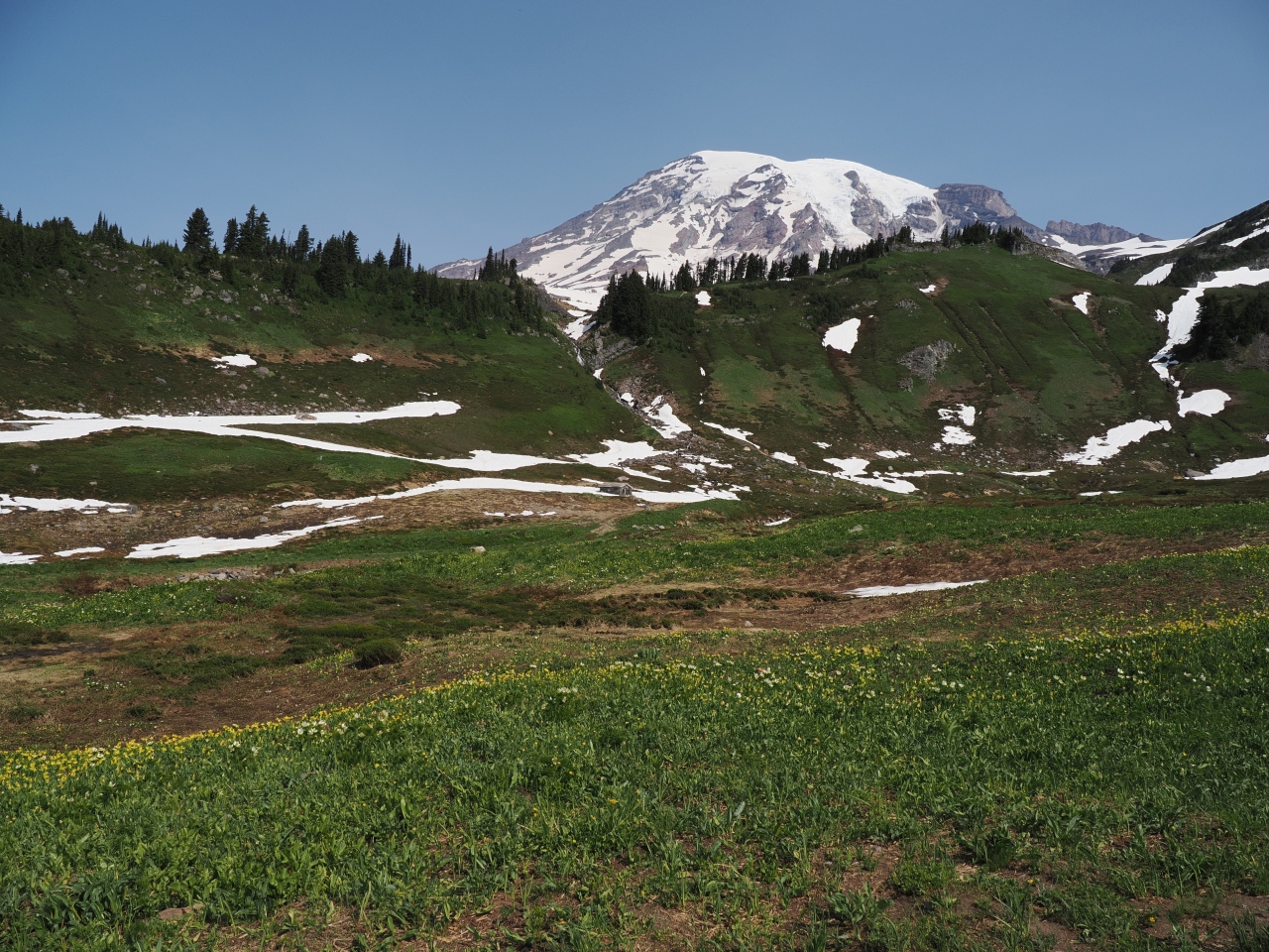
Sunrise woke us up, and sunrise was pretty early. So, we were able to get out of the campground and get up to Paradise quickly. The parking lots, normally filled, were empty.
| Trail Information | ||
|---|---|---|
| Name | Golden Gate / High Skyline Loop | |
| Type | loop / portion of a trail system | |
| Location | Mt. Rainier National Park | |
| State | WA | |
| Country | USA | |
| Miles | not sure | |
| Check out the trails index for information on more trails! | ||
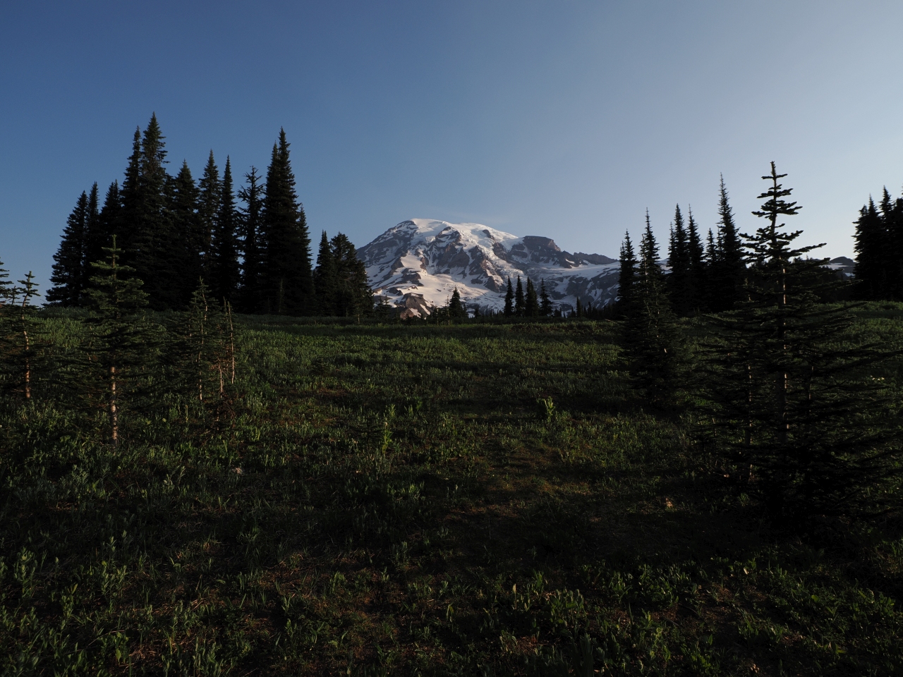

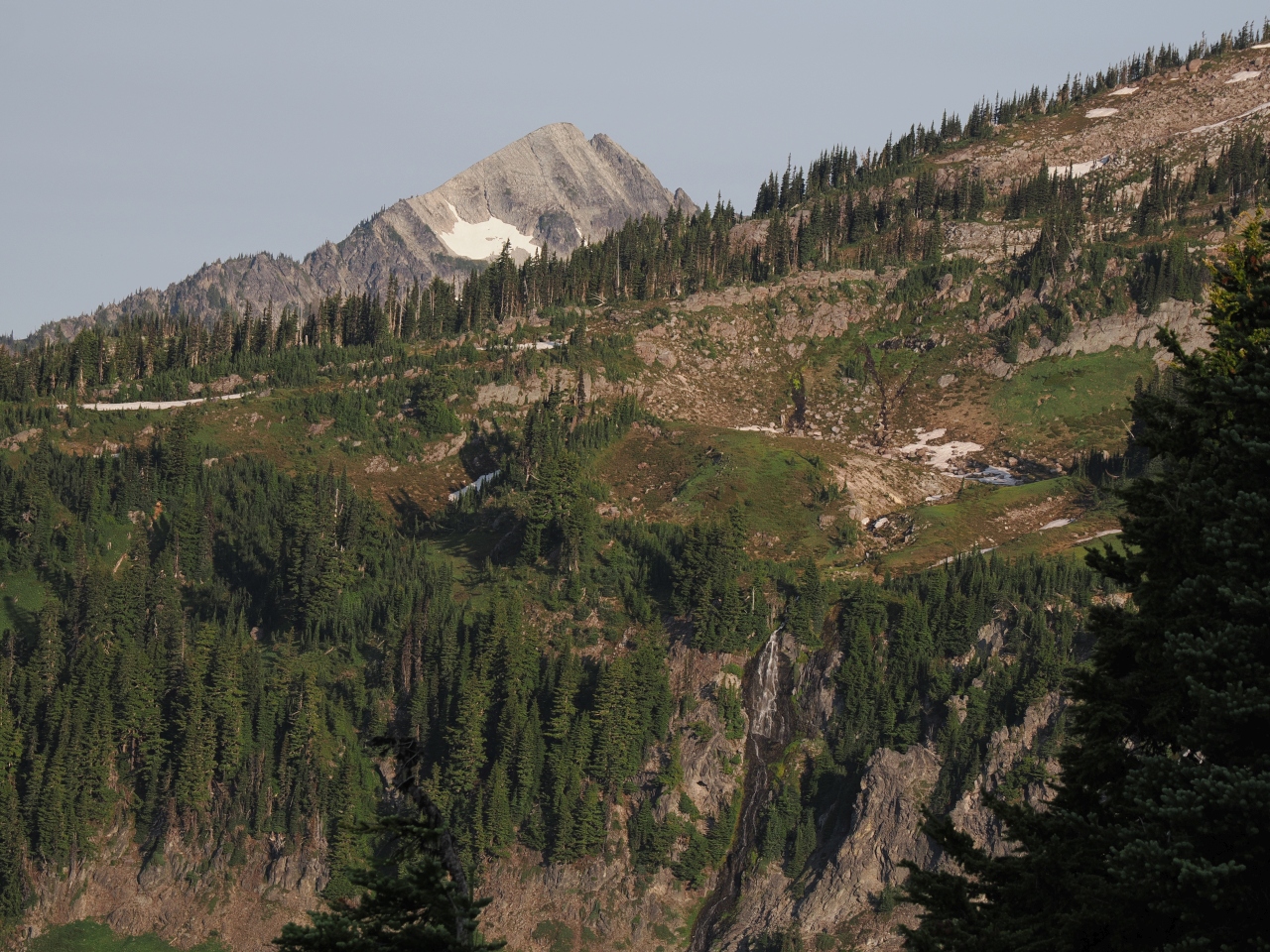
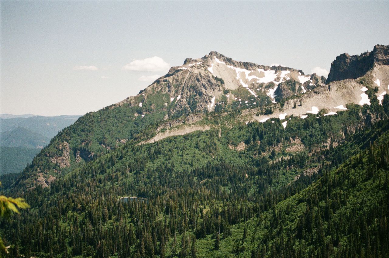
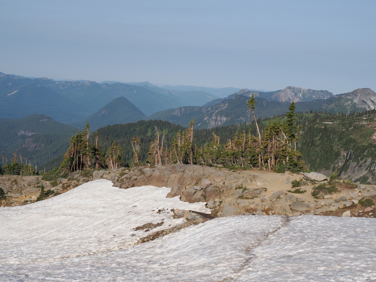
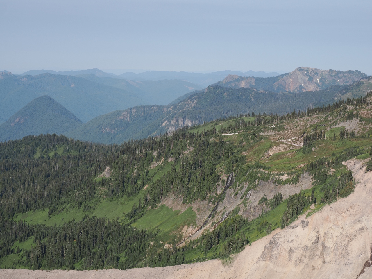
But as we continued, we were pleasantly surprised by a few things. The trail still had snowy patches, but it was much less snowed in than I was expecting. The views were so enchanting, and the crowd was so thin that it was hard to not continue.
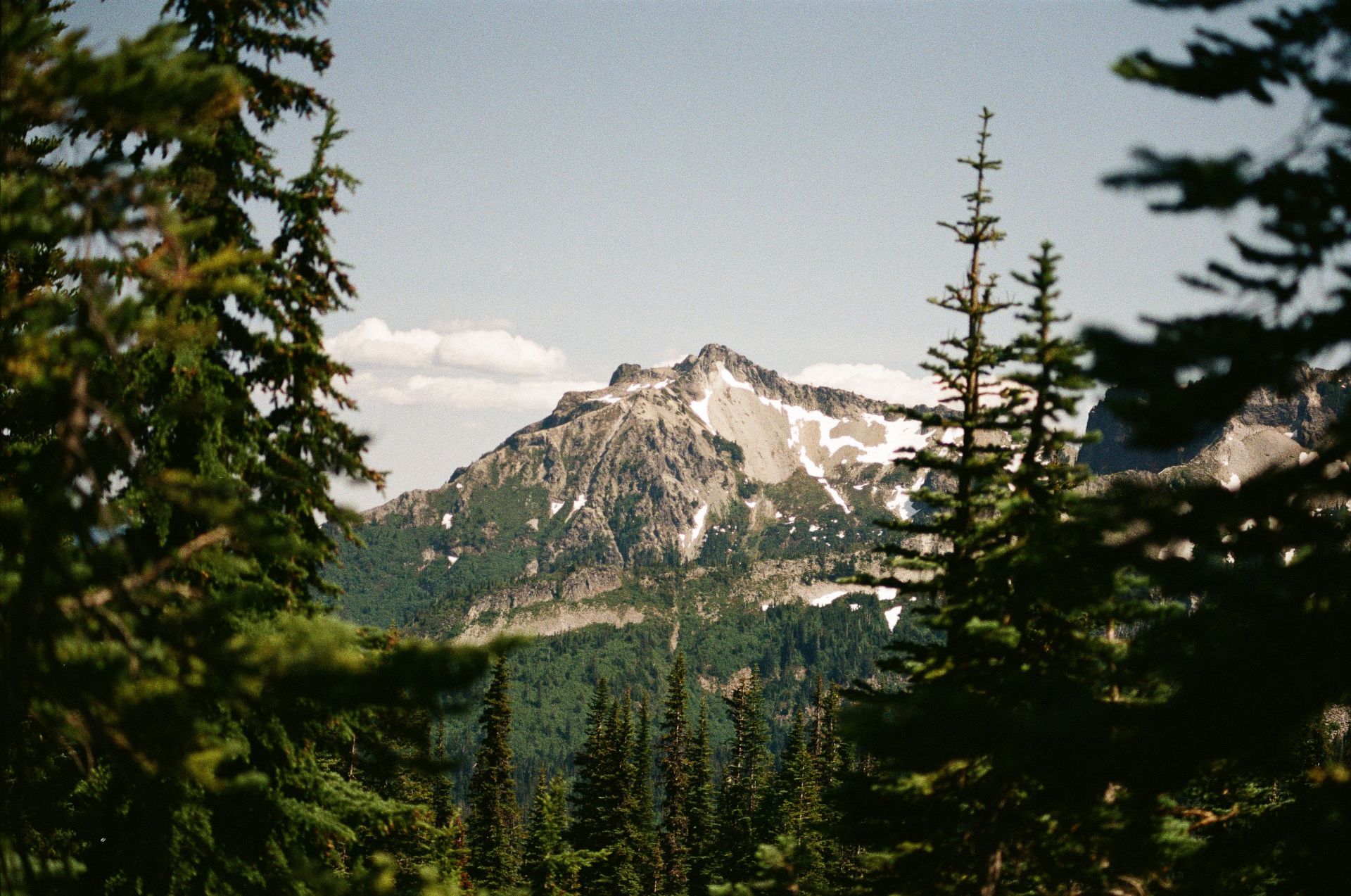
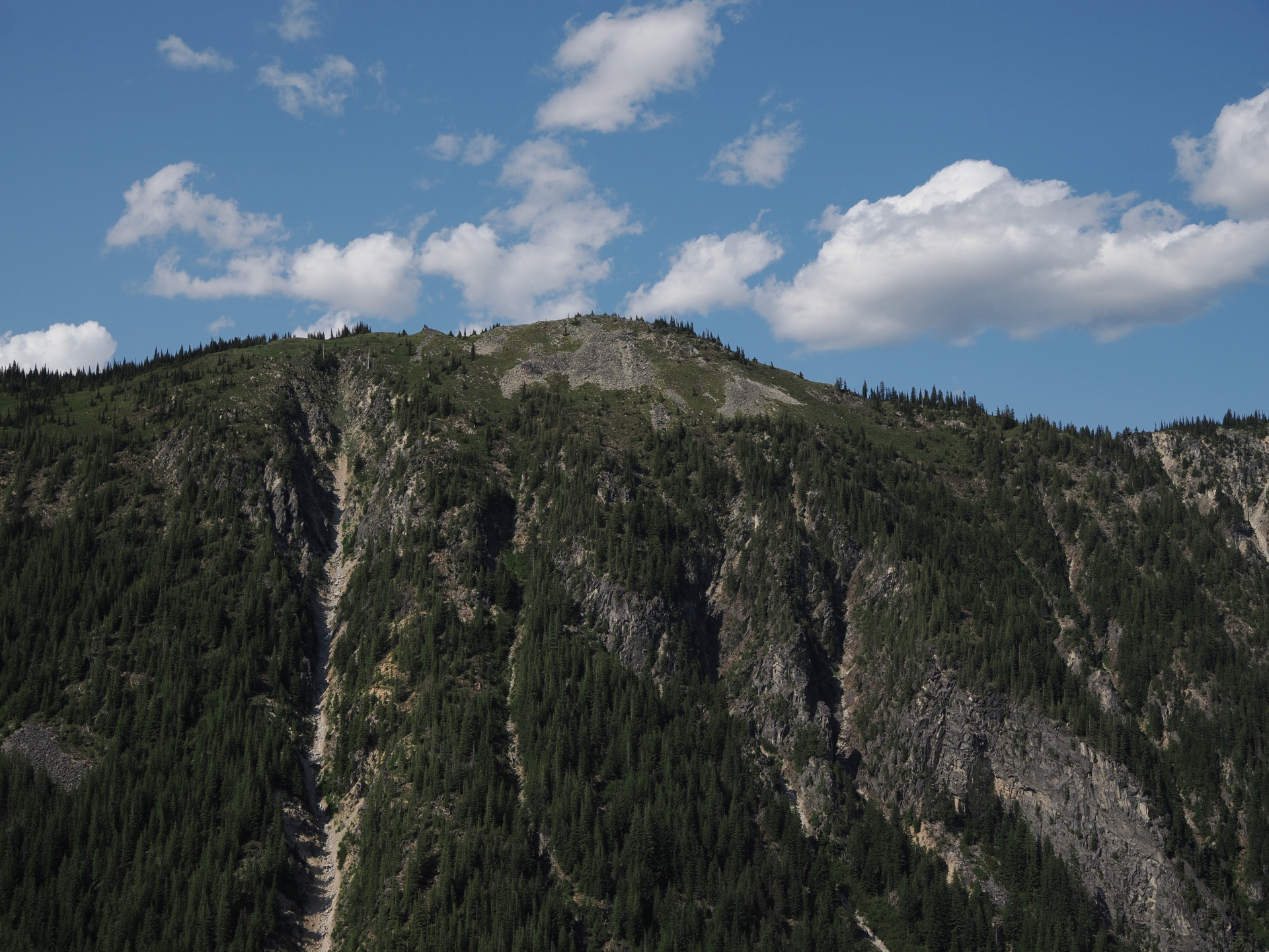
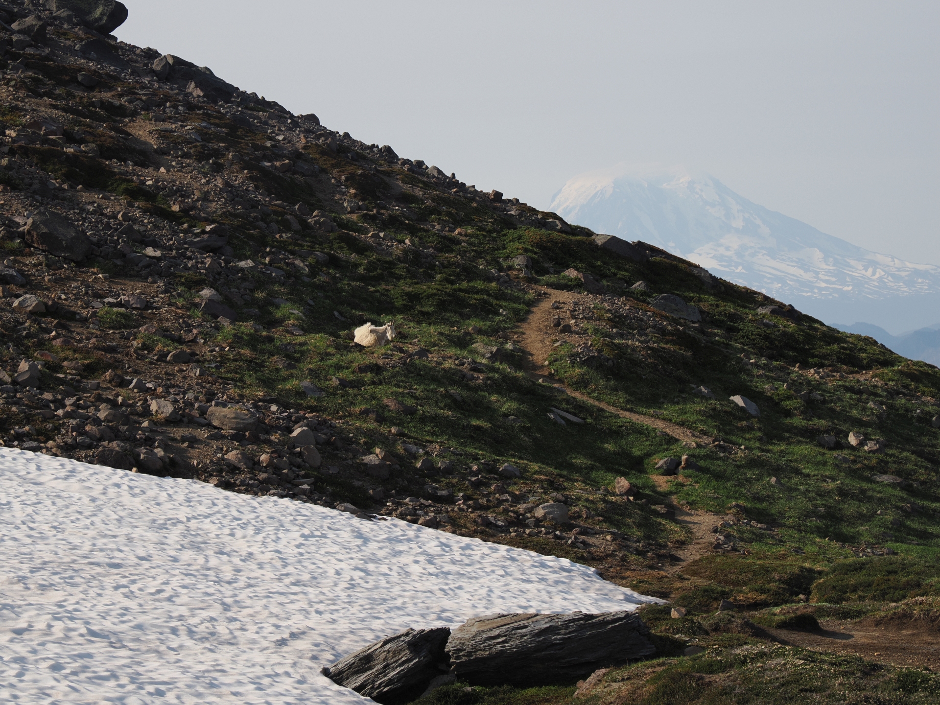
And so, at a junction in the trail system, we headed towards the High Skyline trail, which is basically the same as the Skyline loop, only that the path reaches a higher altitude.
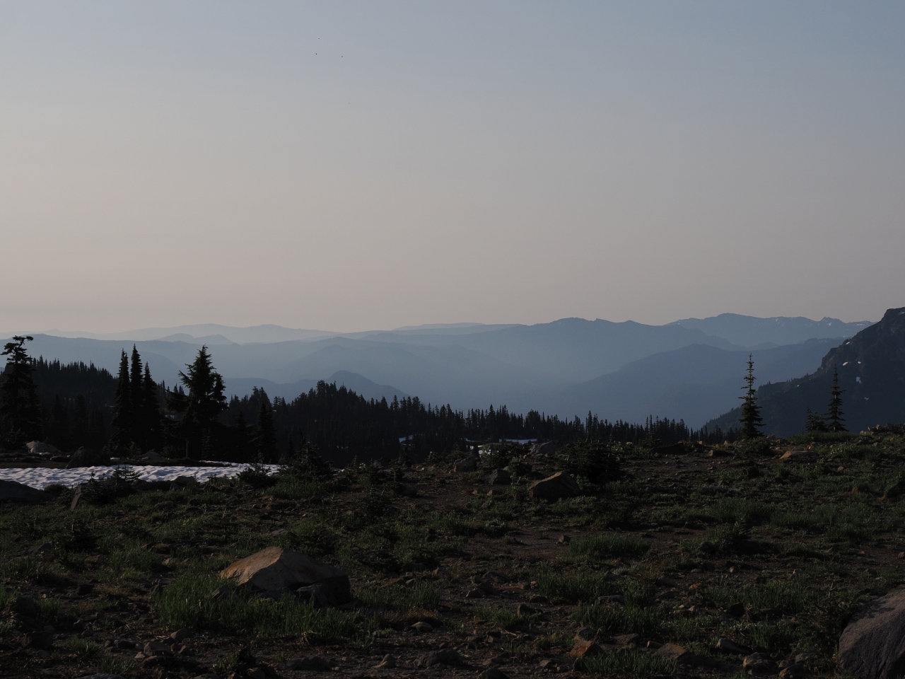
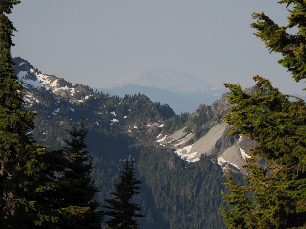
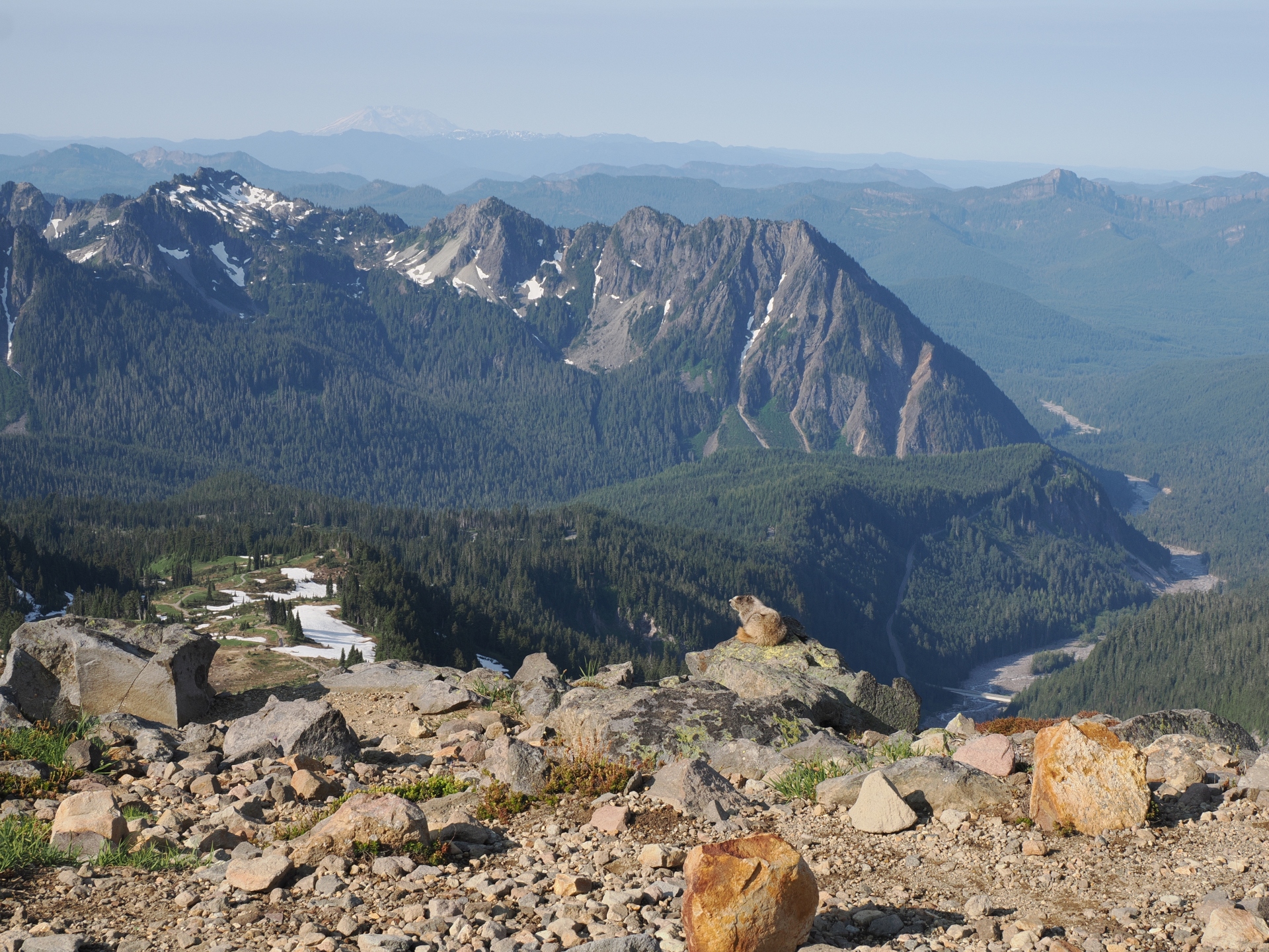
In the distance, Mt. St. Helens and Mt. Adams, other major Cascade stratovolcanos, were faintly visible on the horizon. It was an utterly clear morning.
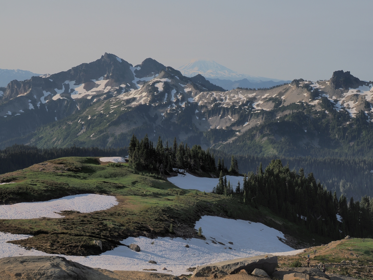
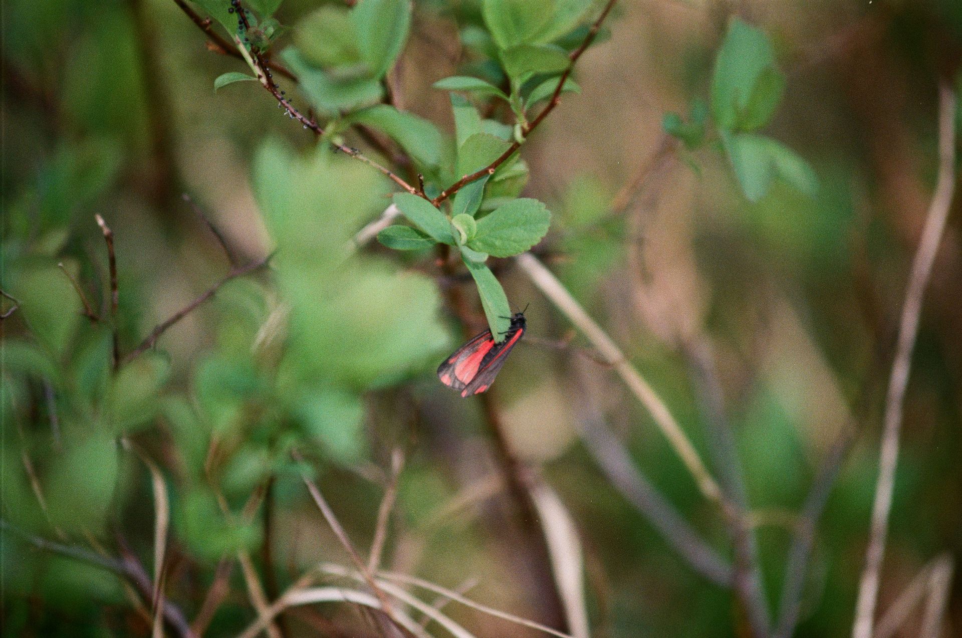
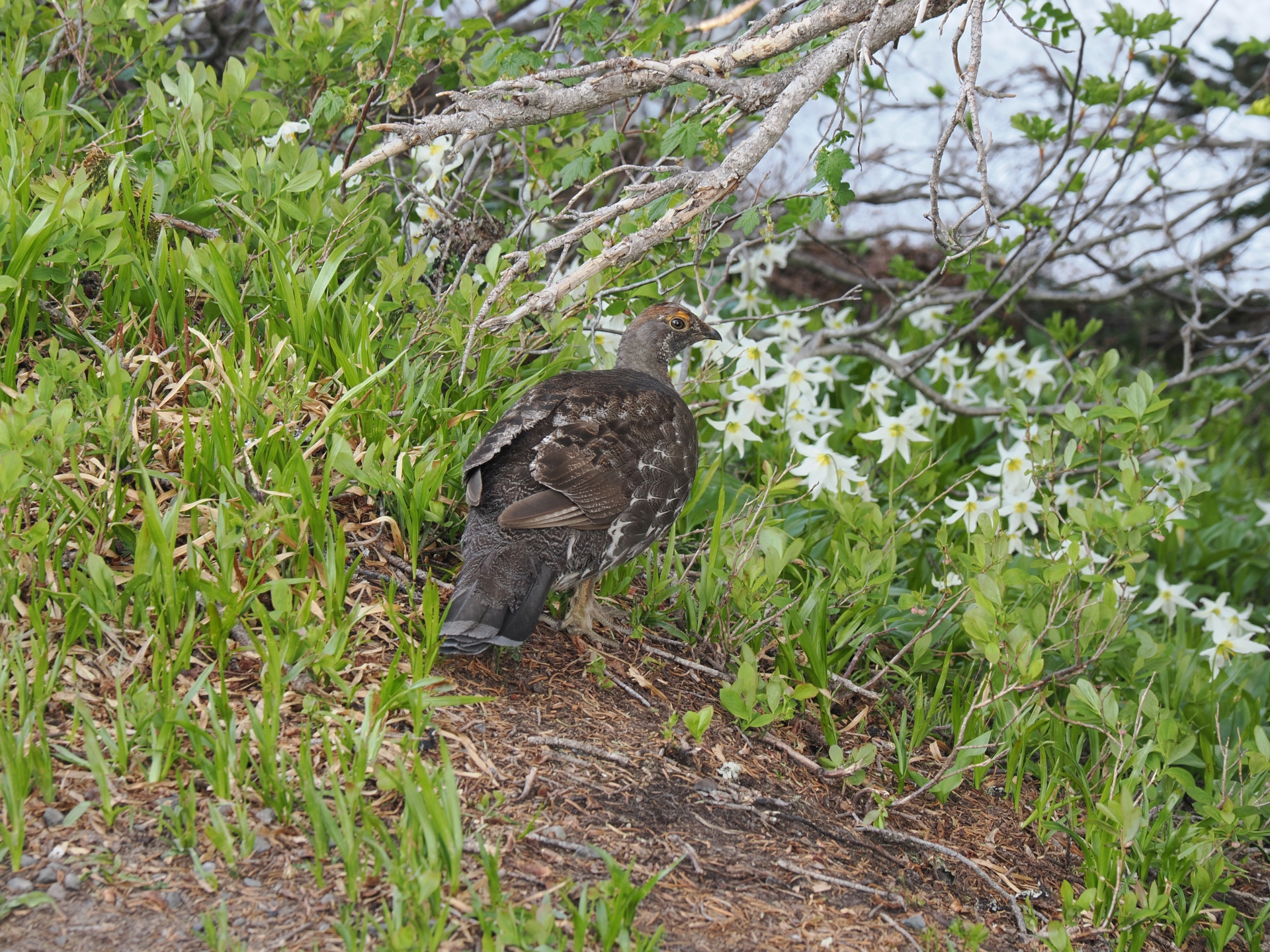
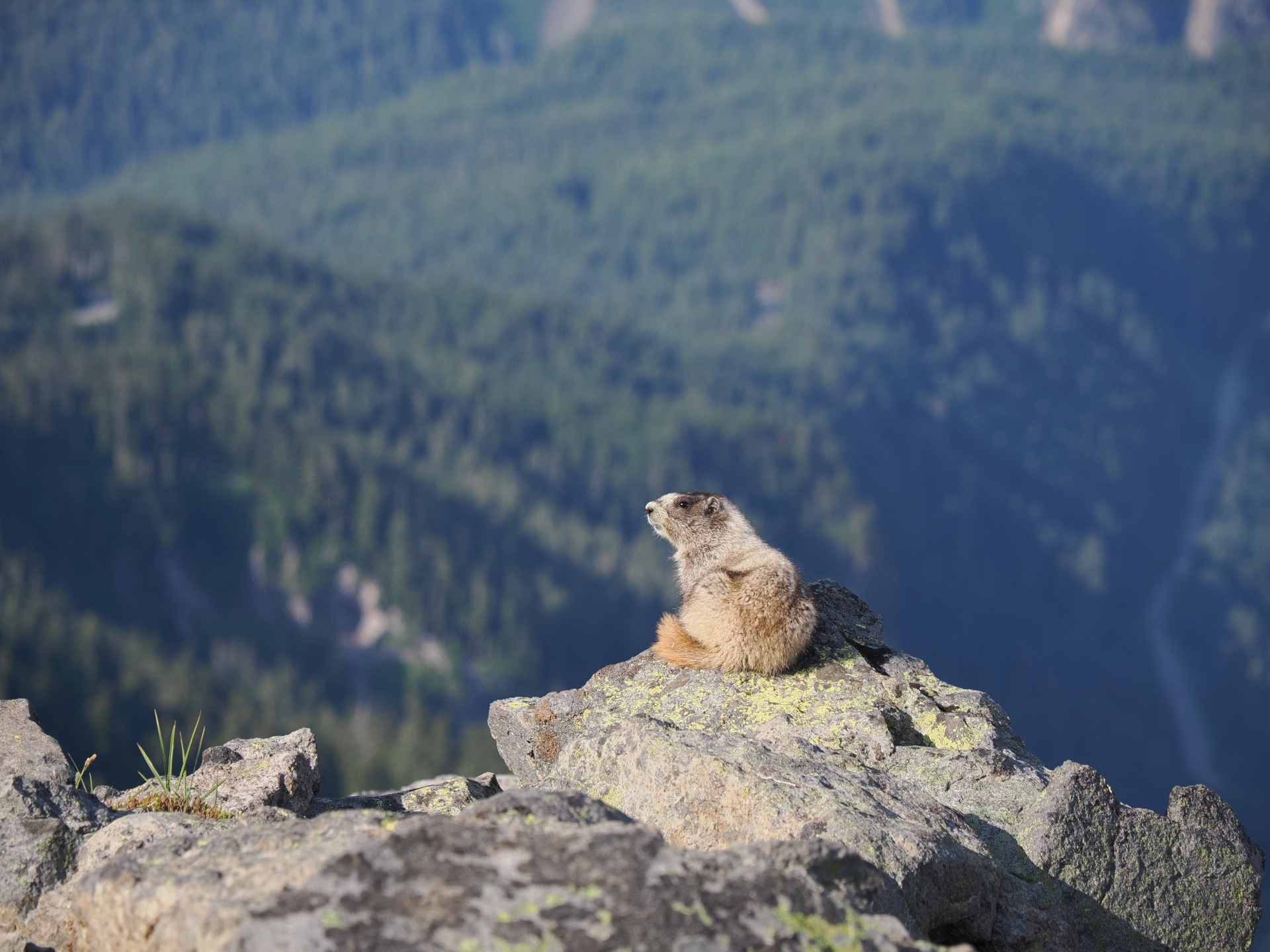
We passed by mountain goats and marmots, and meadows still yet to explode with wildflowers.
We also got rather close to the junction between the High Skyline trail, and the Mountain itself, where better equipped climbers were headed to practice traversing glaciers or snowfields. Basecamp was just around the corner.
And from there, we descended.
A few hours had passed, and more and more visitors were trickling into Paradise.
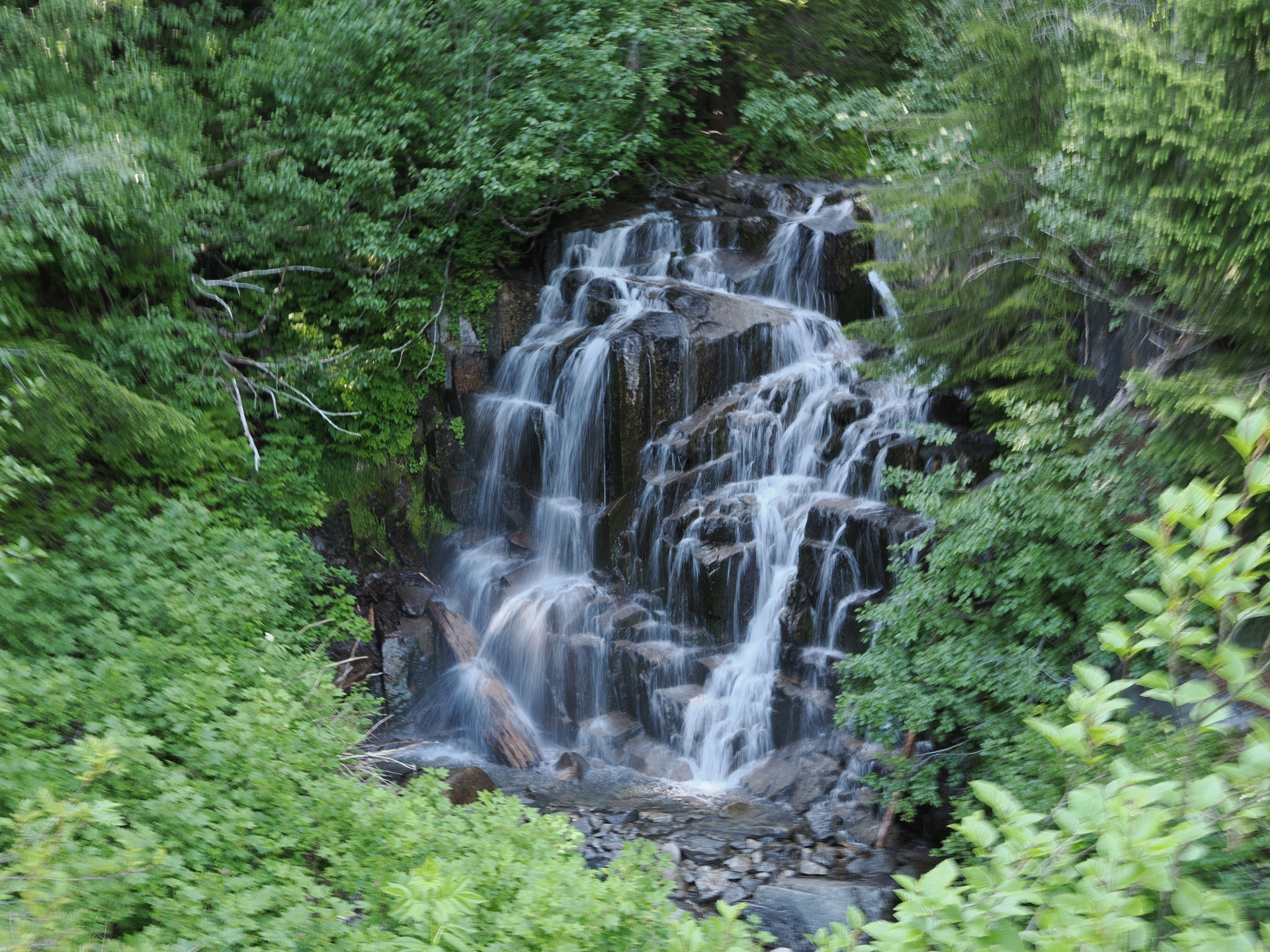
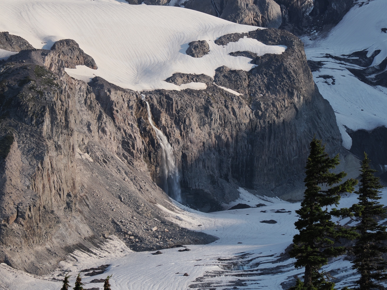
By the time we reached the paved sections of the trail system, and a closed overlook to a waterfall, the spell was mostly broken. More and more people had arrived.
Cars hovered around the full parking lot like vultures, waiting for me to leave.
Hh and I had talked about going paddling, but after our early morning wake up, and our early hike, we both decided we weren’t up for it. In his words:
“Ah well, you can’t go on the lake all the time. Sometimes you need to go up the mountain.”
Thanks for reading!
If you enjoyed this post, you might enjoy these 5 similar posts:
- 2022-09-02 —A Taste of Paradise at Mt. Rainier National Park
- 2022-12-29 —From Smoke to Snow
- 2020-10-24 —Old Logger's Path
- 2022-09-09 —Dead-End Detour
- 2022-10-13 —In the Land of the Nisg̱a’a (On the Wrong Day of the Week)