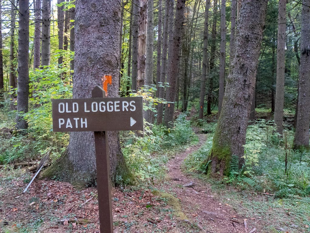
Old Logger's Path
✍️ • 🕑 October 1-4, 2020 • Series: Attractions of Pennsylvania • Tags: hikes • streams • backpacking • hiking and camping • sunsets • sunrises • bird photography • Places: Masten
Okay, so I finally, finally, finally got around to doing some really serious solo hiking/camping.
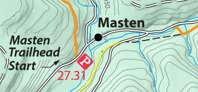
I hiked Old Logger’s Path, a 27.31-mile loop trail in the Loyalsock State Forest, up in Lycoming County in North Central Pennsylvania.
I spent the first four days of October there, Thursday night to Sunday morning.
This is the first time I went backpacking (hiking and then camping overnight) since… 2013, when I hiked a section of the St. Paul trail with my friend and classmate Allison, which basically consisted of a really scenic hike up a mountain, and where I made some incredibly stupid choices, such as… somehow carrying more lemonade on me than actual water.
Fortunately, I’ve learnt from my experiences.
Enough to backpack solo?
Warning: a LOT of images follow, which is part of why it took me so long to finish this post.
Background Information
| Trail Information | ||
|---|---|---|
| Name | Old Logger's Path | |
| Type | loop | |
| Location | Loyalsock State Forest | |
| State | PA | |
| Country | USA | |
| Miles | 27.31 | |
| Difficulty | moderate | |
| Check out the trails index for information on more trails! | ||
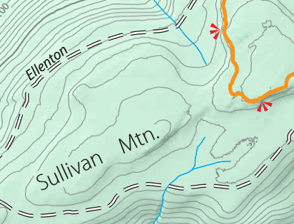
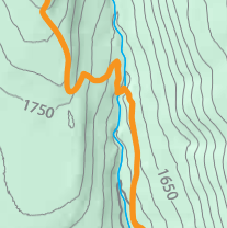
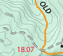
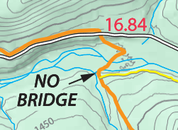
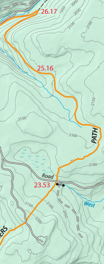
Trail Map
For a full map of the trail, you can find one on the Loyalsock State Forest Webpage which dates to 2017. The pdf specifically is here, but I don’t necessarily trust that this more direct link will stay live. I will be referencing this map as I describe my route, so for full context, it may be useful to look at. The stream crossings were really easy, in part because the area had been experiencing a drought. This was a double-edged sword, though, as it meant there would be fewer opportunities to collect water.
What Is A State Forest?
Loyalsock State Forest is a Pennsylvania State Forest.
There are a lot of cool things about state forests. For starters, many of them allow backpacking. You can camp in the Loyalsock State Forest for free without a permit, so long as you are backpacking and not staying in the same location for multiple nights.
Less cool, perhaps, is that state forests aren’t just set aside for conservation purposes. Instead, the Department of CNR describes it (and other state forests) as a “forest at work.”
This means, that besides recreation, there may be some tinder harvesting, gas drilling, and other sundry activities.
This is a far cry from the absolute devastation and destruction wrought on many of these forests through industrial use in the 1800’s and 1900’s, but it also means that scars from very recent human activity remain visible.
However, there are some forms of human activity within the forest that are very visible, destructive, and disappointing, even though they would be far worse under different ownership. We’ll see more of that as we go.
My overall sense is that the State Forests provide extremely valuable conservation efforts, and it is far better that these hands rather than more industrious ones.
I should note also that it came as no surprise that the forest I decided to hike in was not a first-growth forest. I mean the trail is Old Logger’s path, and through these conservation efforts, it is hard to imagine the devastation in the past.
Thursday Night
The trail was about a 3.5 hour drive from my corner of Southeastern PA, so I decided it would be a good idea to drive in the night before, camp, and then get an early start on Friday morning.
I didn’t particularly want to get up early, drive a long distance, and then immediately start backpacking.
My drive north was through a series of treacherous local mountain highways. The speed limit jumped from 55 mph down to 25 and back with regularity. The road signs declared that trucks needed to be in their low gears, and sharp curves. The grades were steep and the curves were sharp.
But hey, I know how to drive, and ultimately it was an uneventful journey.
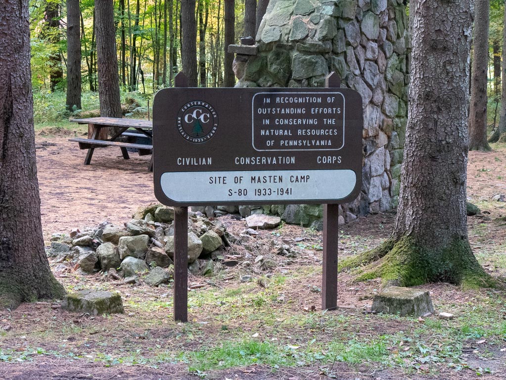
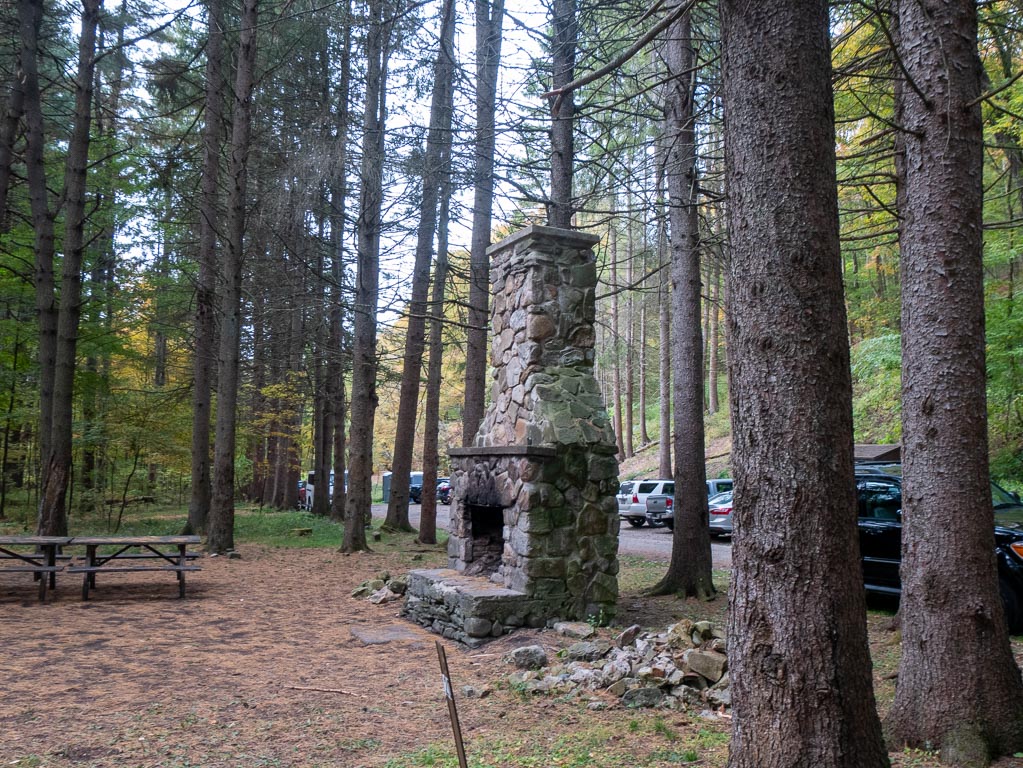
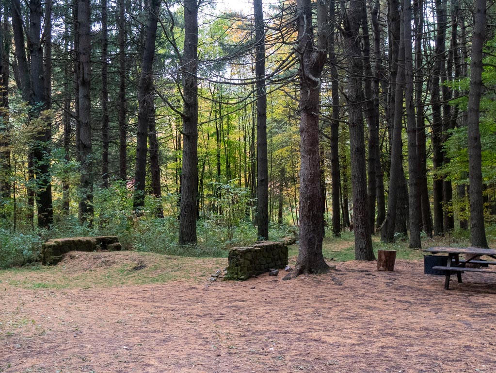
The trailhead in Masten is also home to permit-only campsites (call the forest office), as well as single-night camping for backpackers in a designated area. (No permits required.)
When I rolled in, there was a very loud group of ten or so men drinking beer, who kindly offered me one. I declined, since it was already around 11:30 PM, and I had not yet set up my tent.
I made camp, and proceeded to sleep about as well as you’d expect.
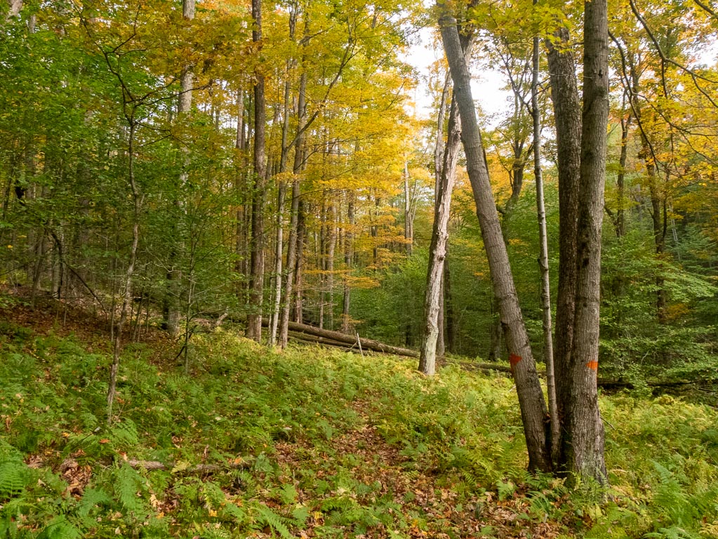
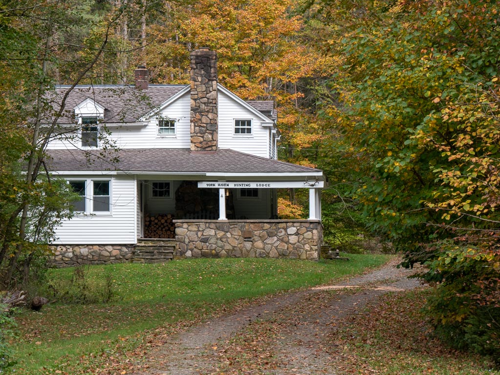
Civilian Conservation Corps
Incidentally, the campground is also the site of former Civilian Conservation Corps barracks (Wikipedia) so it’s an interesting enough spot in its own right.
These photos were taken on Sunday morning just before I left, and they show what the place looks like in daylight.
Friday
Starting out
The Old Logger’s Path is a loop, and most people prefer to hike the trail clockwise. In that direction, the climbs are less steep, so it is an easier hike.
I hiked it counter-clockwise, taking on steeper grades. I had a few reasons for my decision:
- The trail was super popular that weekend and virtually everyone was hiking clockwise. By hiking in the opposite direction from most of the foot-traffic, I would have shorter intersections when I passed folks.
- The trail map was marked that way with useful ascending mile markers.
- The trailhead to go counter-clockwise was right near the parking lot, whereas the clockwise start was on the other end of town.
However, by going counter-clockwise I did make a lot of extra work for myself….
Other things I did to create more work for myself?
I neglected to empty my pockets, and accidentally had two cellphones with me, as well as a sundry assortment of useless objects. I carried a bit more food than I needed, most of which was sodium-heavy food that needed to be cooked with water. I carried mostly water bottles whose threads did not fit that of my water filter, which certainly did not prevent me from safely filling them, but which definitely made the process more annoying.
Besides those things, nothing I did was too egregious.
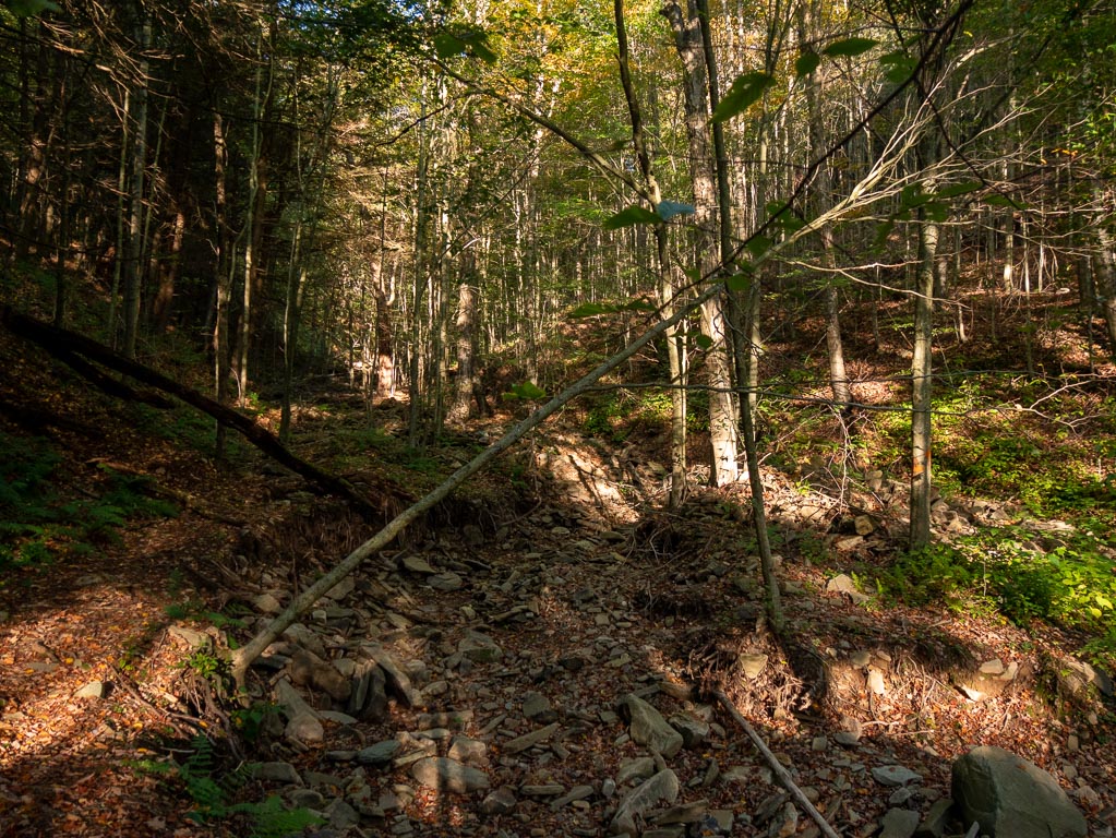
Once I started the trail, a few things were very clear.
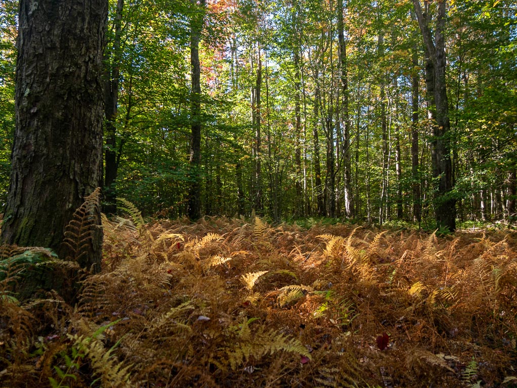
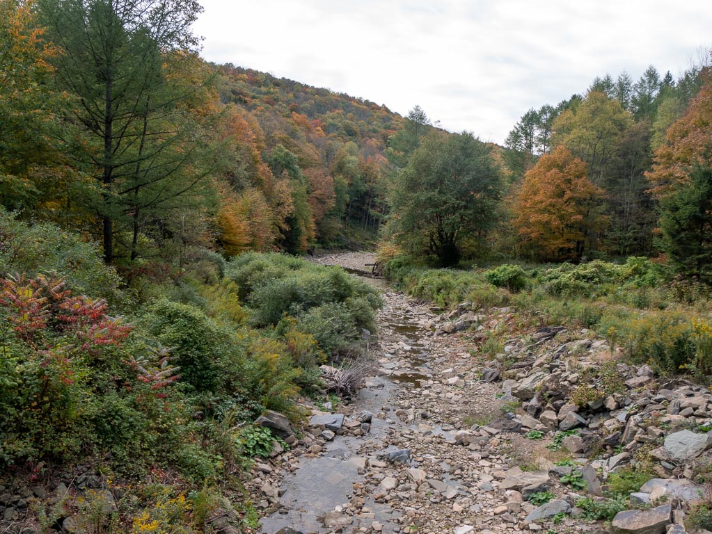
There had been a drought in the area this year. A lot of ferns were brown and a lot of streambeds were dry. Reports of the unreliability of various water sources were to be believed.
And, as streams are among the more obvious landmarks on the map… it would be a bit more difficult to track progress. It was ambiguous to me which dry stream beds normally would have carried a significant enough amount of water to be on the map.
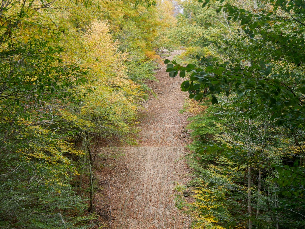
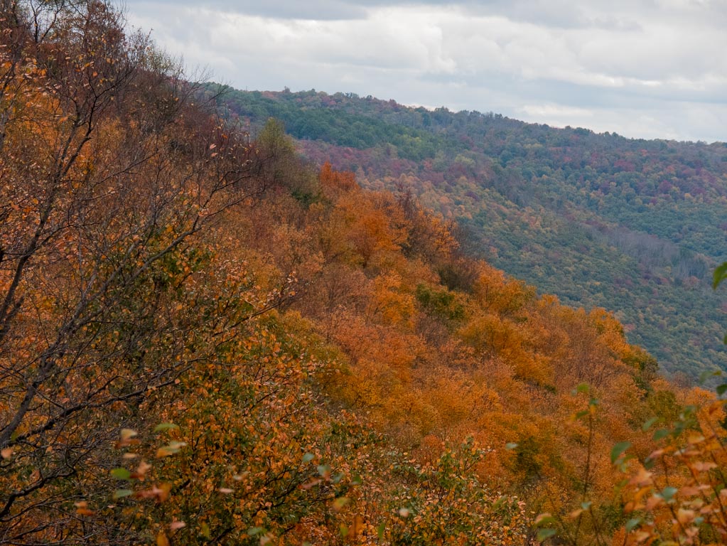
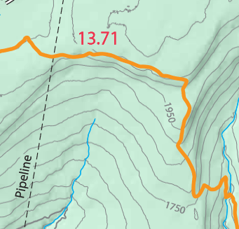
Pipeline
The trail crosses “pipeline” at four times. The pipeline itself runs at an impressively steep grade, as the map indicates.
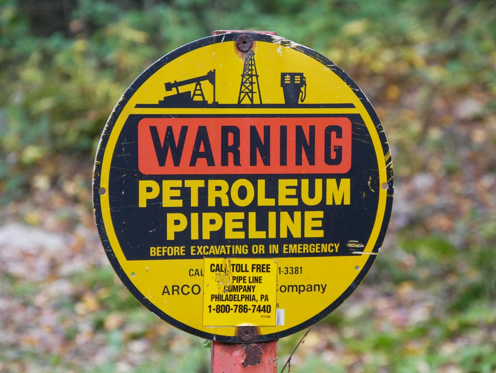
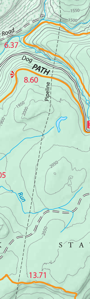
With each pass, it provides a dramatic view, but a sad one.
The pipeline is a scar on the landscape.
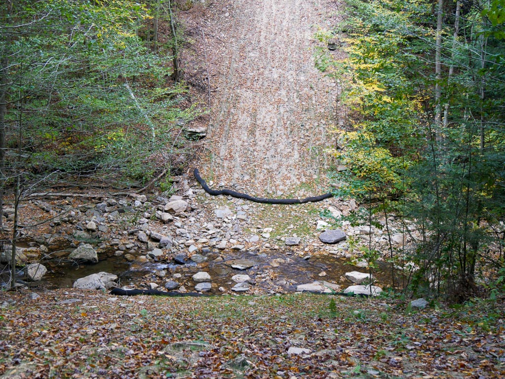
I cooked some Spätzle, had a lunch break, and replenished some water near this first pipeline crossing.
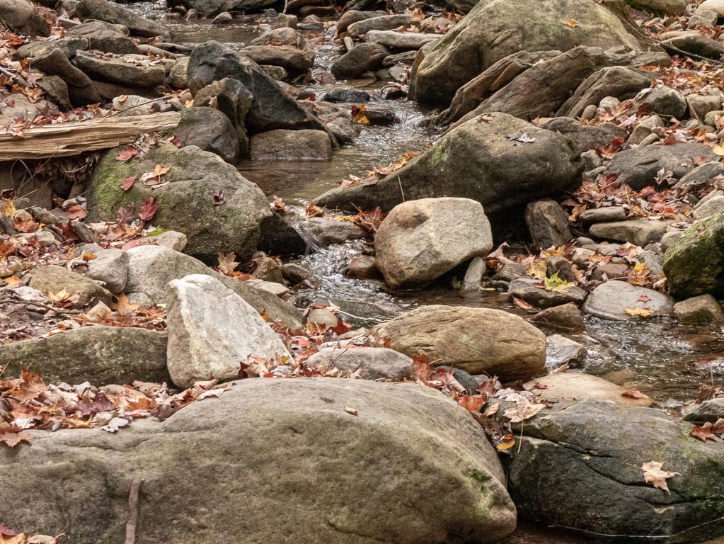
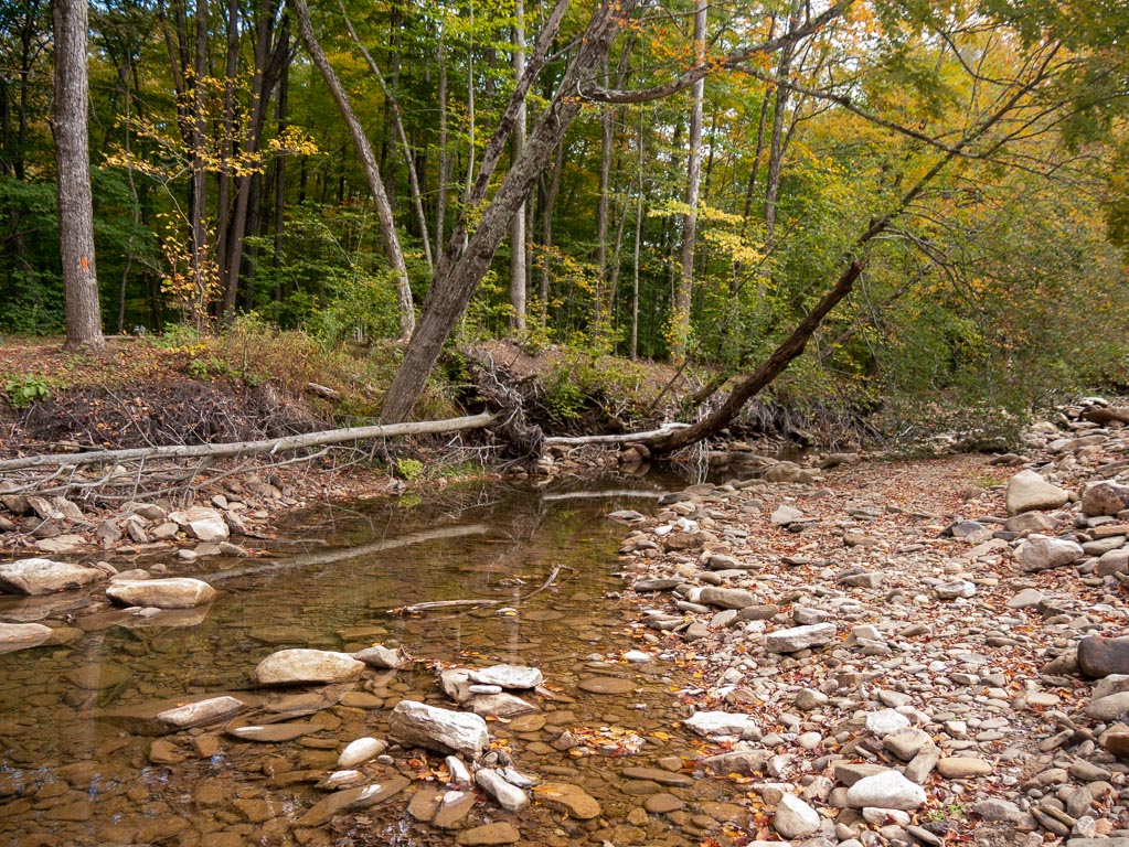
Confluence
One of the most famous views along the trail is where a few streams meet.
Because of the drought in the region, the streams were much lower than usual, and I could get quite close to them.
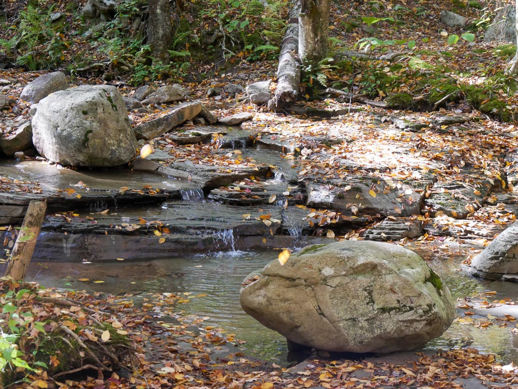
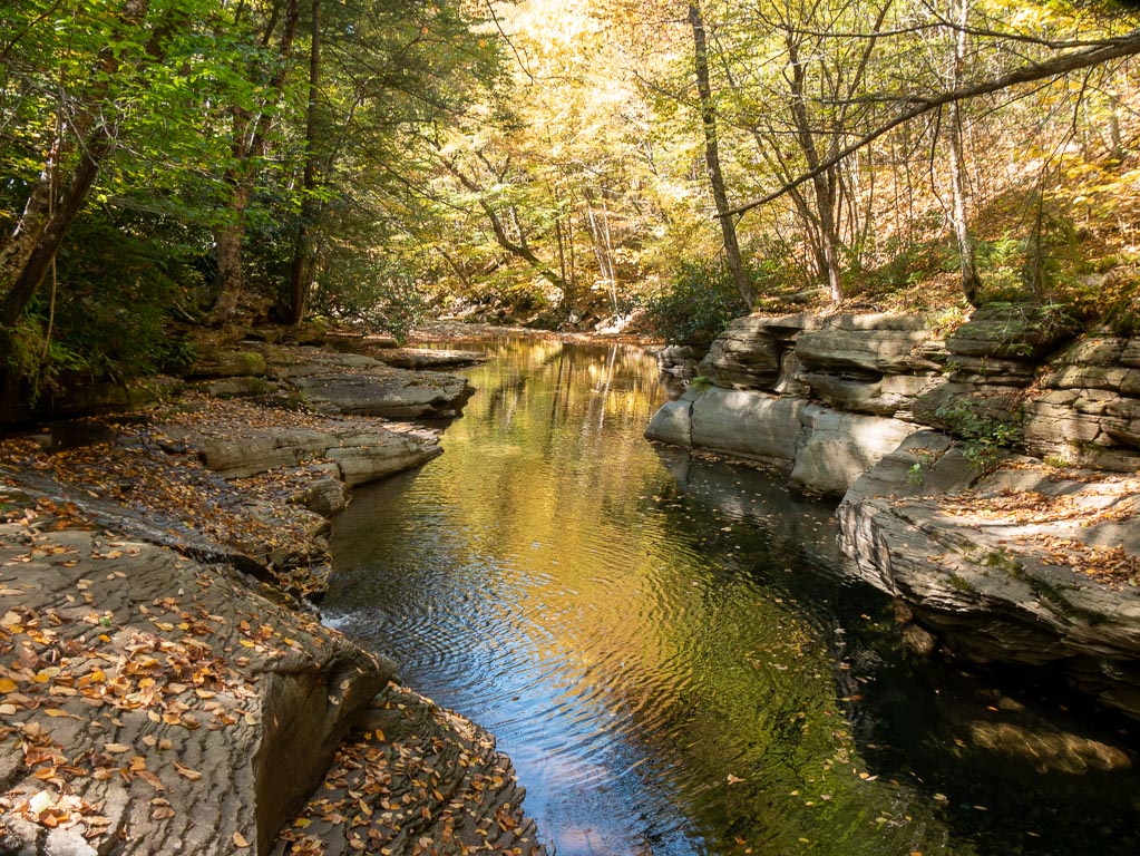
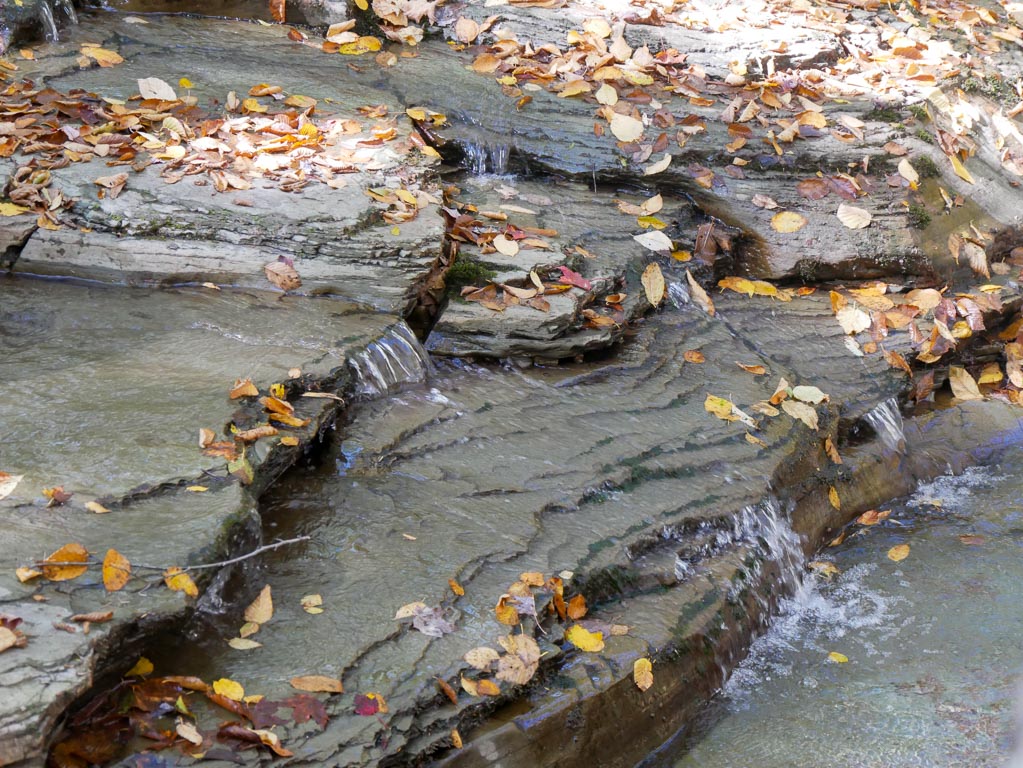
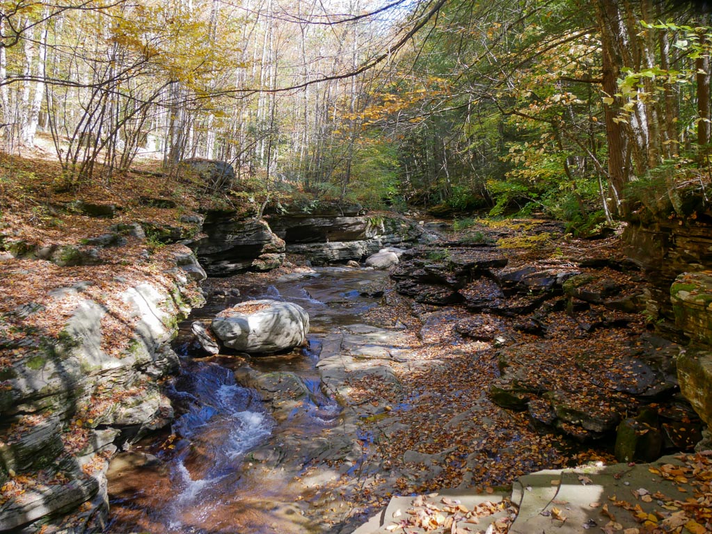

However, this view was less impressive than it normally would have been. I certainly didn’t mind that I had it on the first day of hiking instead of at the end of my trip.
Fair warning: under current conditions, there isn’t a real water source for quite a while after the trail says goodbye to these streams.
(There were a few trickles here and there, but nothing robust.)
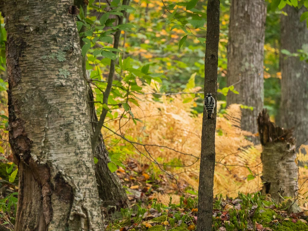
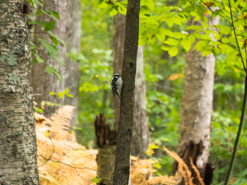
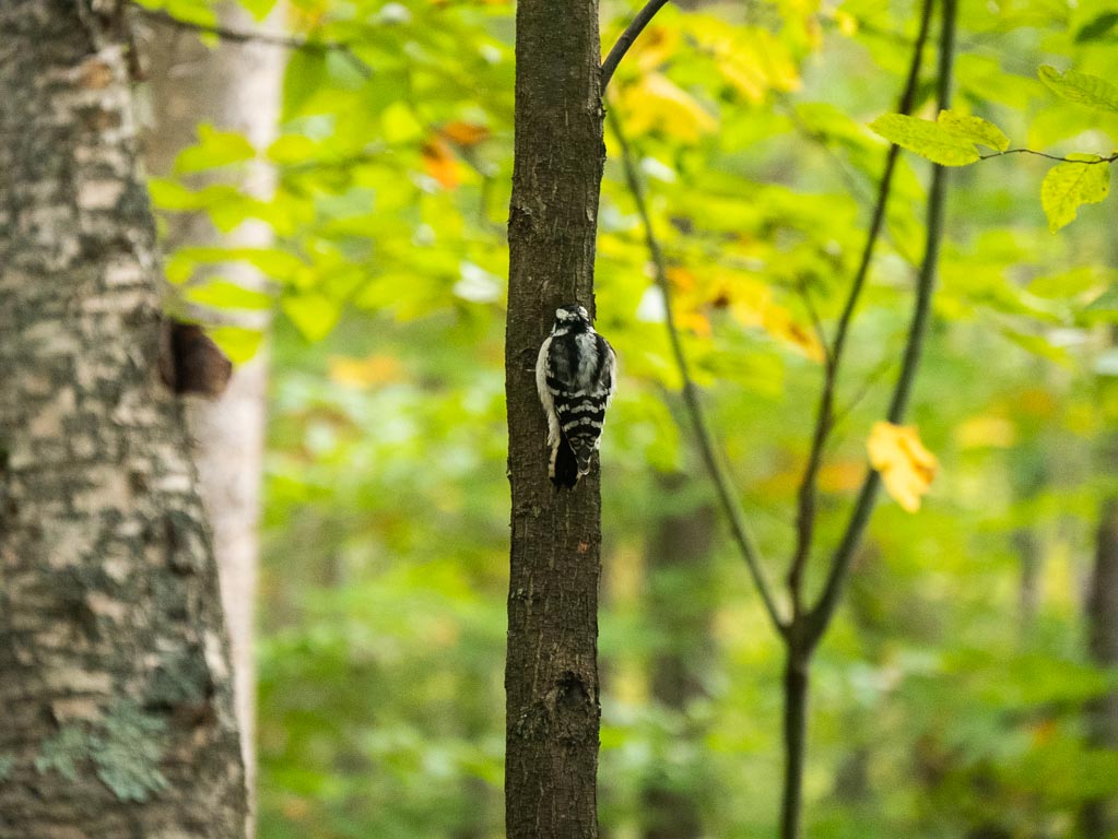
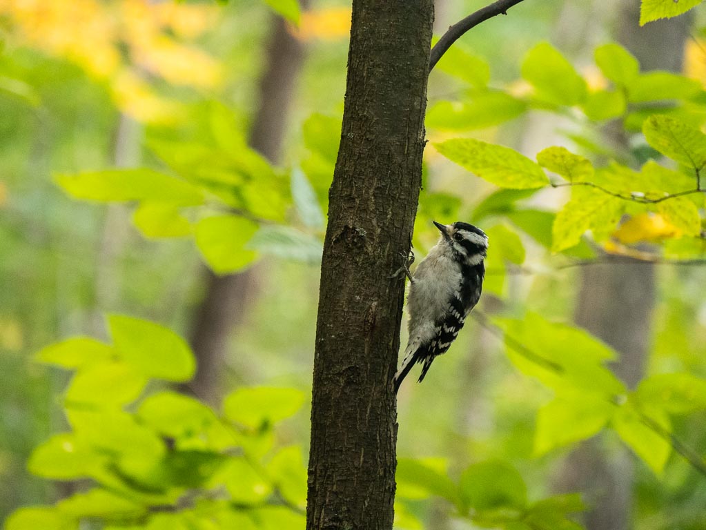
Downy Woodpecker
As I huffed and puffed uphill, feeling the effects of caffeine withdrawal, I paused for a moment to catch my breath and spotted a particularly fluffsome woodpecker close ahead.
I was able to get my camera out and approach quite closely to the woodpecker without startling her, and the moment made me thankful that I was taking breathers as I continued uphill.
One of the later pipeline crossings
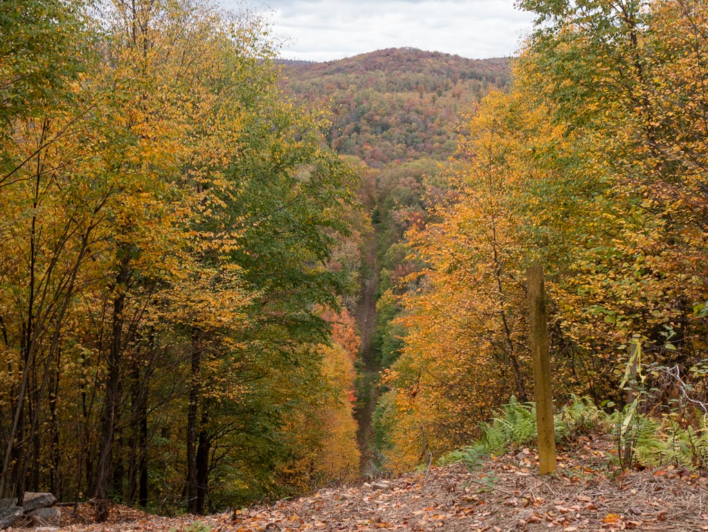
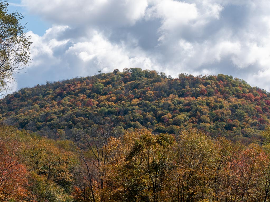
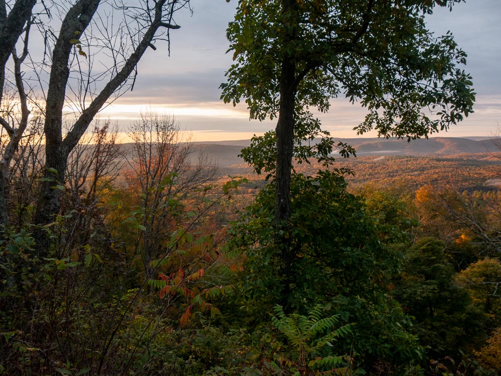
Mt. Sullivan
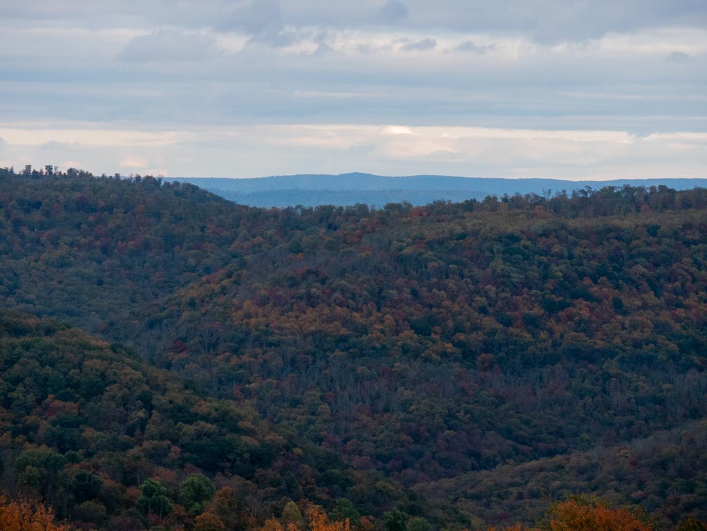
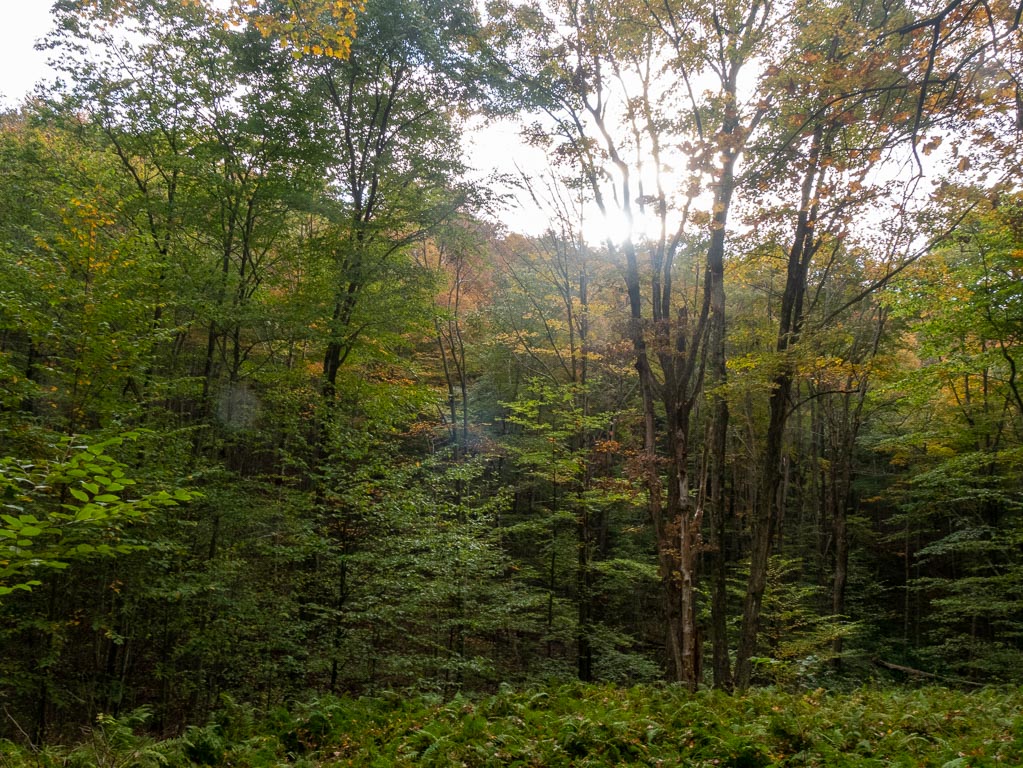
On the first day of hiking, there were a few lovely and entirely natural vistas that were not the result of clear-cutting a path for a pipeline.
These looked out upon Mt. Sullivan.
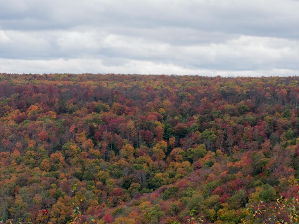
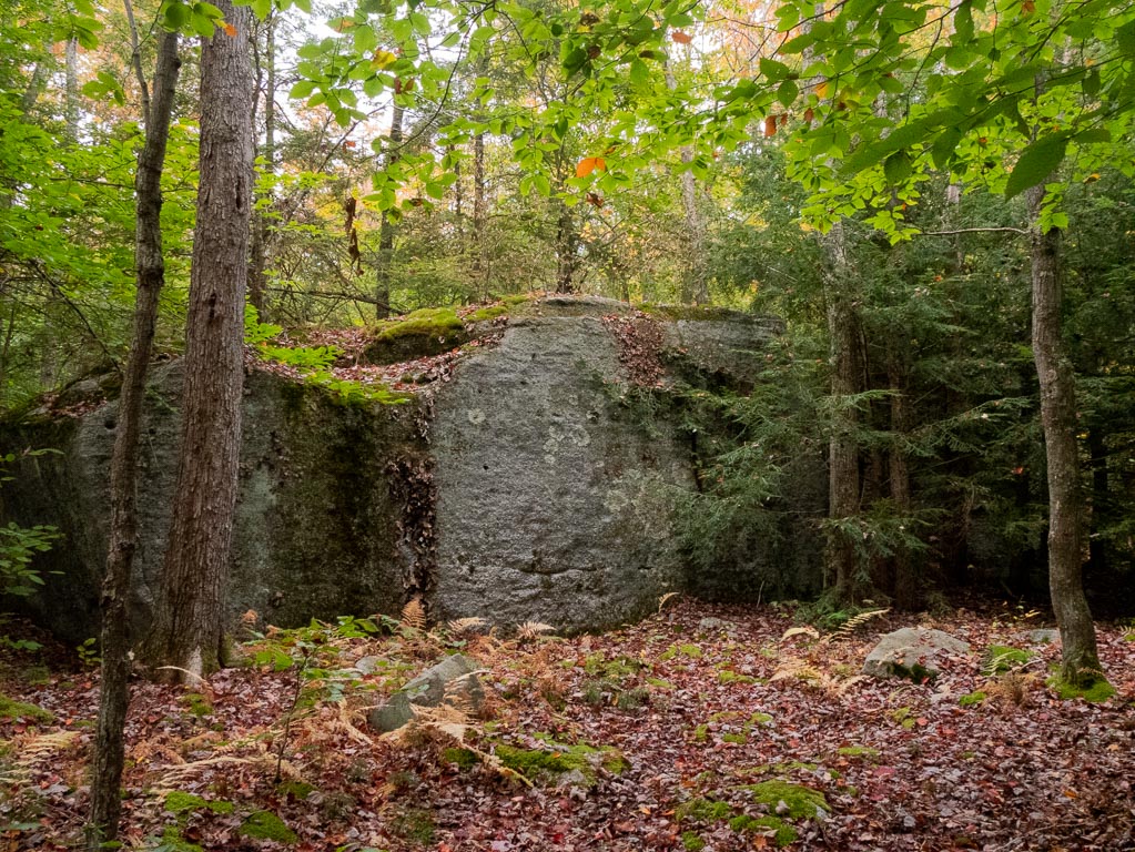
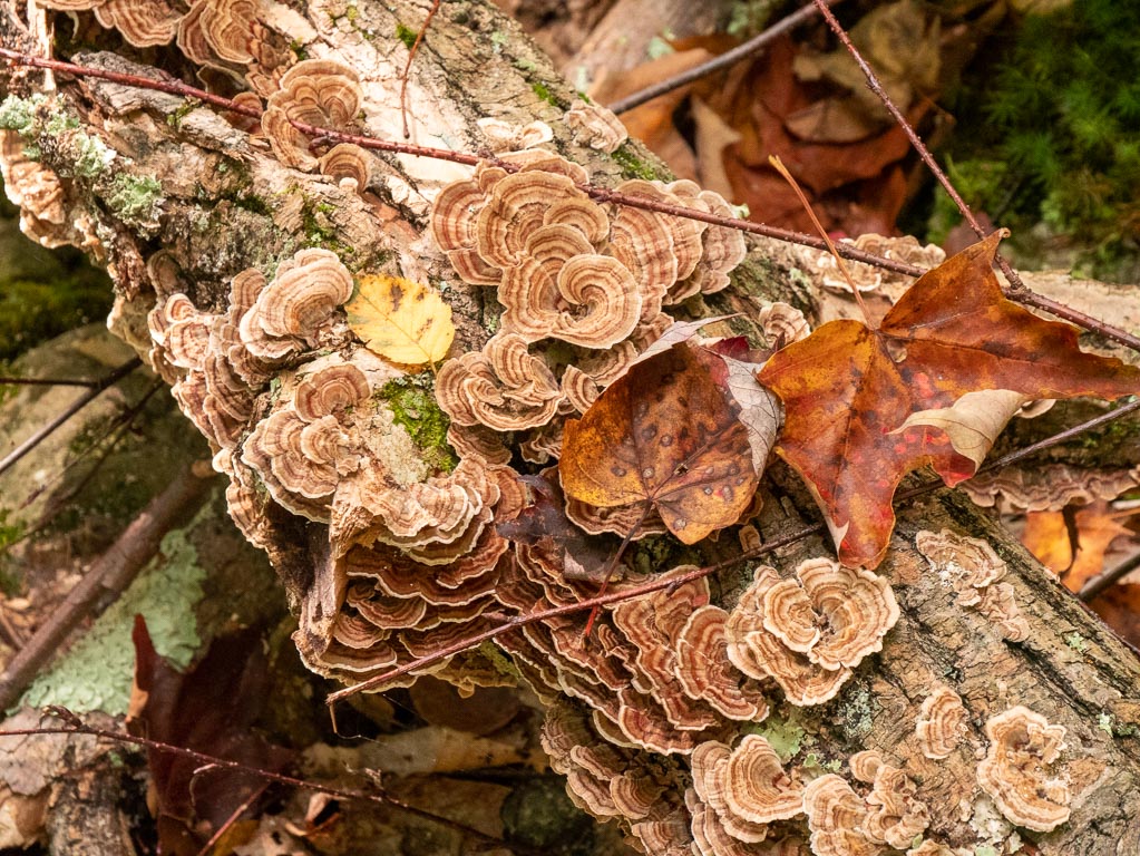
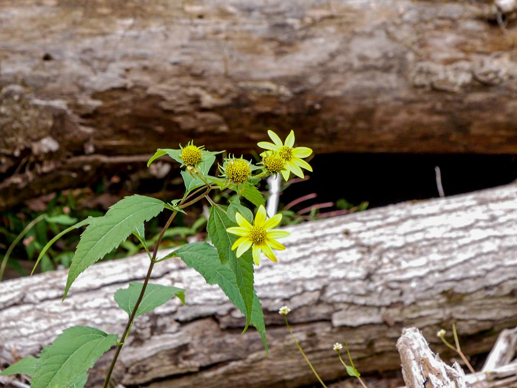
Near the vistas are some of what the map labels “Big Rocks”, as well as this gorgeous mushroom.
Winding down
I walked, and walked, and walked, and naturally I felt increasingly tired, and a bit anxious about all of the things I had to do.
Things like eating dinner, and setting up camp. Things like not running out of water, and letting my down sleeping bag loft so it would keep me warm.
At 6PM exactly, I was slightly confused by a downed tree in the path. I paused got my bearings, checked the time, and immediately decided that it was time to settle in for the night.
I decided to made camp in the nearest sort of clearing, doing my best to secure stakes in rocky ground with lots of dead leaves.
It was alright, but if I continued around a few more bends, there was a spot that would have been much nicer. Alas!
I set up my tent and sleeping system, cooked and ate dinner, tied my food bag to a tree, and passed out. I slept pretty much solidly from around 7PM to 3AM, and was in my tent and bag for about twelve hours of mostly very solid snoozing.
It helped that I was surrounded by complete silence, and not boys, beer, and country music.
But, after the first day, ye ol nerves were gone, and most of the hard work was behind me.
In total, I hiked roughly thirteen miles, with about 1,500 feet in elevation gain, so I hiked nearly half of the trip in terms of mileage, and exactly half the trip in terms of elevation gain.
It was overly strenuous, and I probably would have benefited from a gentler start, particularly since I also had all of my own anxieties about sleeping in the backcountry alone, and whether I would really accomplish all of the things I needed to accomplish. (Cooking, replenishing water, bathrooming, not having bears steal food, not leaving traces, not injuring myself, ensuring that I had enough water, etc.)
I had wanted to get as much of the trail out of the way on the first day as I could. I was more excited for the Southern loop, which I’d tackle on days two and three.
I rested, knowing that most of the hard work was done.
Most of it.
Saturday
Saturday was just an awesome day.
I crossed a few streams and had plenty of opportunities in the early part of the day to drink water and replenish my supplies. I also got to see some really gorgeous vistas.
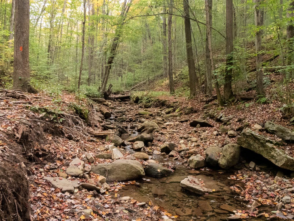
Long Run Crossing
(This is the next robust water source after the last one, though there was a paltry trickle in between.)
The first landmark of the day was the Long Run crossing, where I collected some much-needed water, and easily traversed some rocks which formed a bridge over the stream.
Afterwards, I dutifully marched my 100ft up hill away from my water source, and prepared a hearty morning meal of some mixture of dehydrated cheese spätzle and chana pulau.
I jammed them together in the pot with reckless abandon.
It was warm, salty nourishment, and probably one of the most enjoyable meals I ate during my trip. However, I also realized that there was no way in hell I was going to finish two dehydrated meals that I jammed in a pot together in the early morning. So, I packed it back up, hoping that the drawstring bag & pot lid full of holes were sufficient to keep the slop from making a mess in my backpack. (They were.)
It was also during this period that quite a few other hikers (going the opposite direction) crossed paths with me. As they did so, I felt the extra energy needed to go counter-clockwise was worthwhile. #SocialDistance
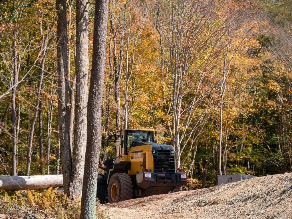
Worksite
Eventually, the Old Logger’s Path did that thing it does occasionally where it shared its path with another trail or a road.
Typically, I welcomed this, as it was a pretty sure way to know for sure that I had my bearings on the map, and I could track how far I had gone.
This roadway was a little bit different, because it clearly led directly into a construction site, which lay dormant.
I’m not sure exactly which of the forests’ numerous “productive activities” normally happened here.
I do know that I felt the harsh rays of the mid-morning sun, and that I initially missed my turn back on to the trail proper.
This was a blessing for you, dear readers, for it means that I was able to capture these photographs of the rare “forest bulldozer” in its natural habitat.
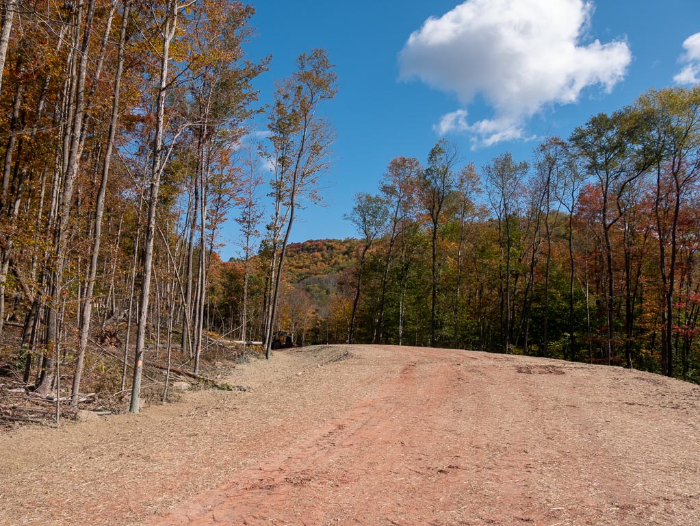
Between this area and plesant stream there was a (very) brief stretch with a pretty extreme downward grade.
Pleasant Stream Crossing
Pleasant Stream is the crossing they warn you about in big letters on the map. Given the drought, it really wasn’t so bad, and I imagine it couldn’t have been too much worse normally.
(Sometime before I took these pictures, I accidentally whapped a number of camera settings when I thought I had switched it off. It took me a while to get these right. Besides originally being grossly over-exposed, these pictures were also taken in JPG without RAW files, in a special video burst mode, and were bracketed so that each photo was a burst of images with different white balance settings. I am both amazed at the options this camera has, and annoyed at myself for… using them.)

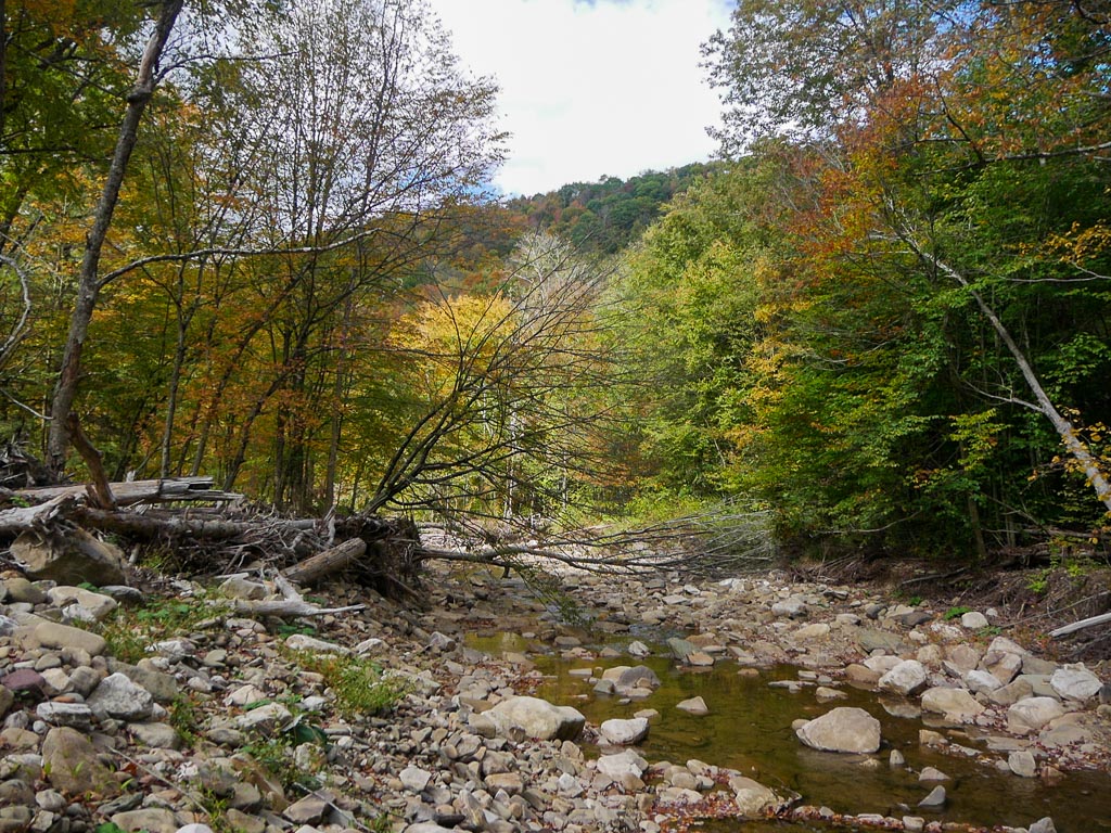

Fair warning: under current conditions, there isn’t a real water source for quite a while after this.
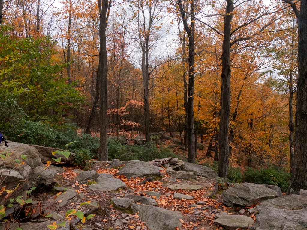
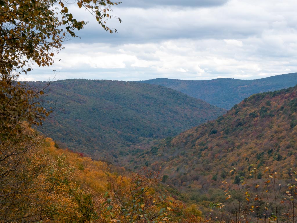
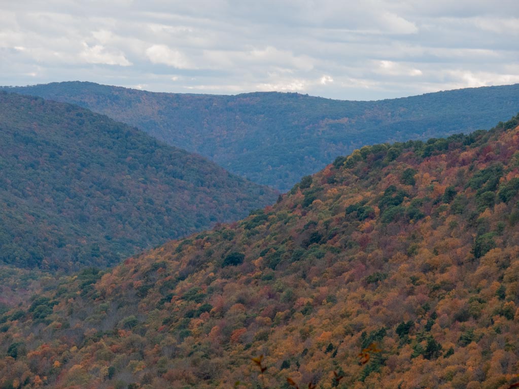
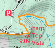
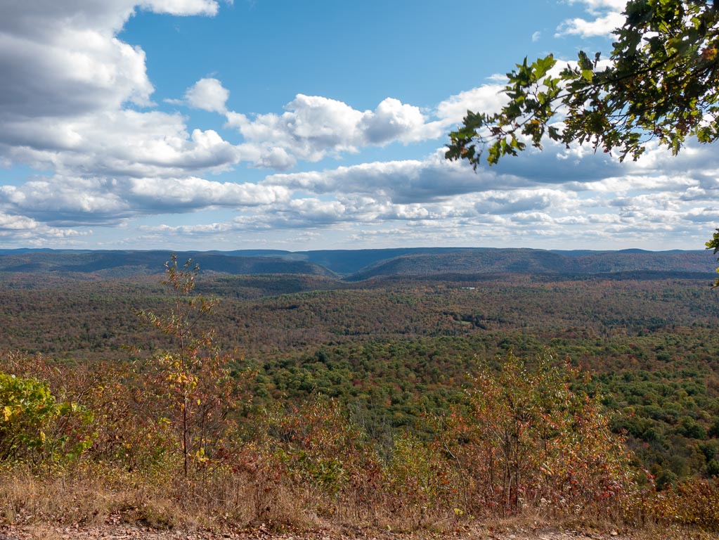
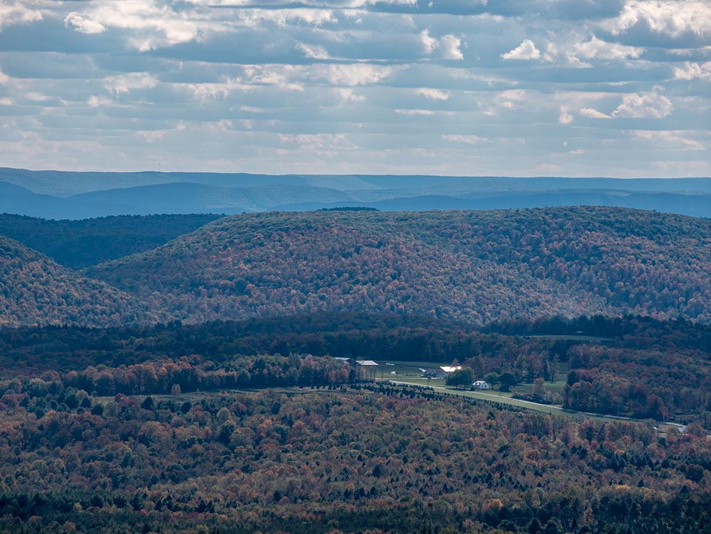
Sharp Top Vista
Sharp Top Vista is arguably the most famous point on the trail. It is known as a premiere view, and since it has parking very close by, it is an easy point to hang out at. I got there close to noon, and it was pretty swamped with people, some of whom had finished a picnic lunch.
I rested, ate some cashews, fixed the settings on my camera that I bumped earlier in the day, took some pictures, and eventually moved on.
The angle of the sun was also quite high, so my photographs probably would have been better if I was there at a different time.
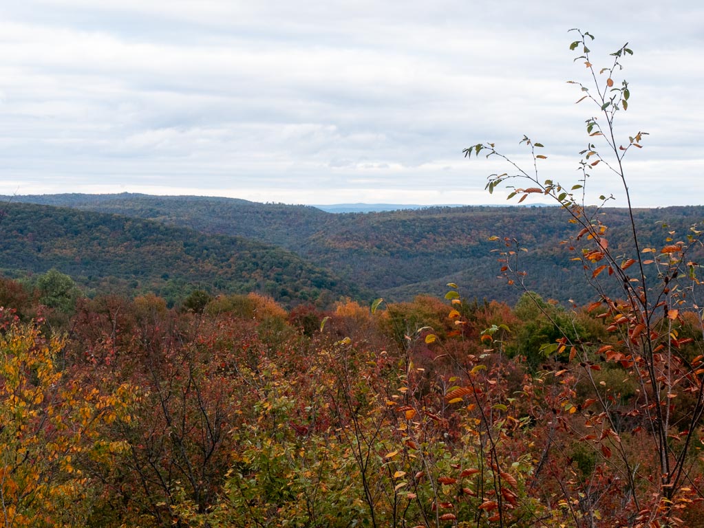
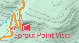
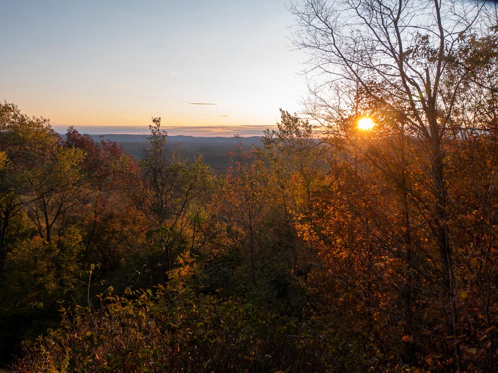
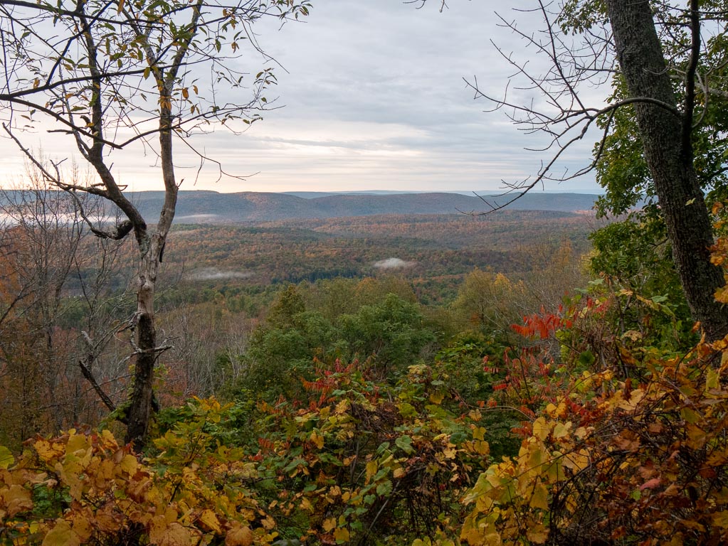
Sprout Point Vista (Sunset)
I started to feel increasingly weary during the decent-ascent between Sharp Top vista and Sprout Top Vista, but I decided to push on. (Or at least, to keep going until I hit a campsite better than the one where I had spent the night before.)
From my reading of the map, Sprout Top Vista and a lean-to shelter weren’t too far away, though they were up a somewhat steep incline.
I kept going, and I easily made it arriving at the shelter around 5:30PM.
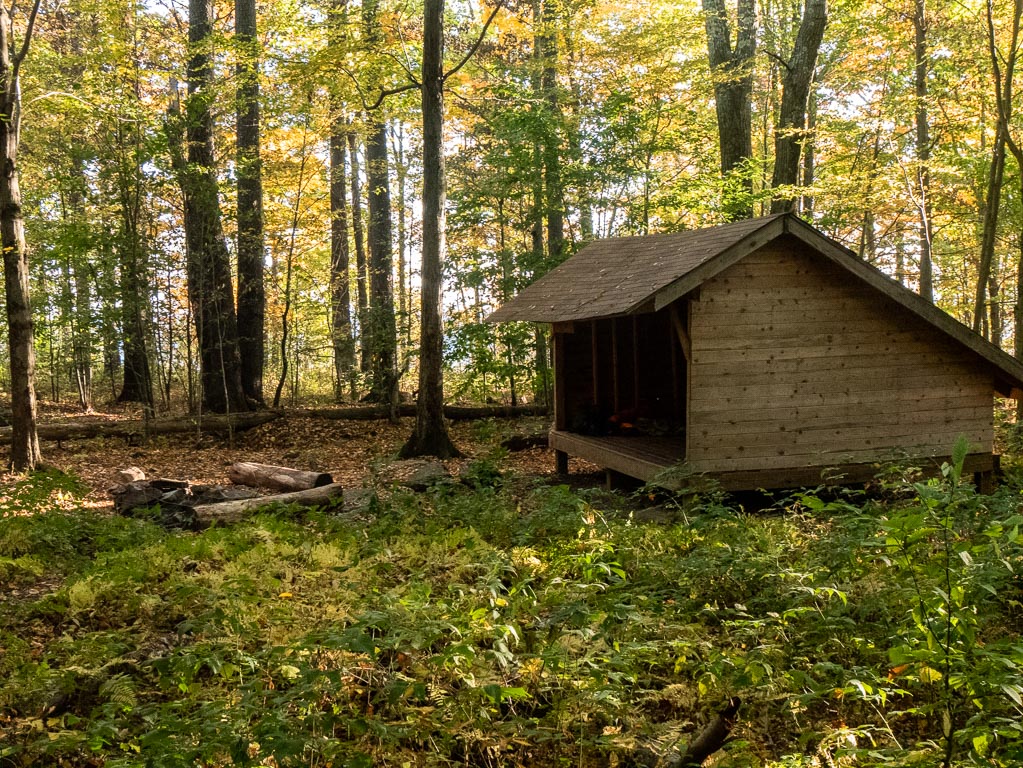
I set up my tent in the lean-to, aided by the rocks that had been left around the illegal fire ring. I was alone.
I headed to the vista to take some pictures, and heat up another mediocre, sodium-rich meal.
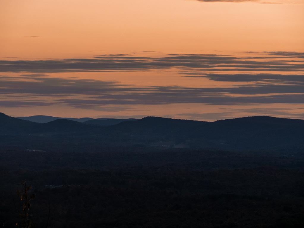
I ate and watched the sun begin to set.
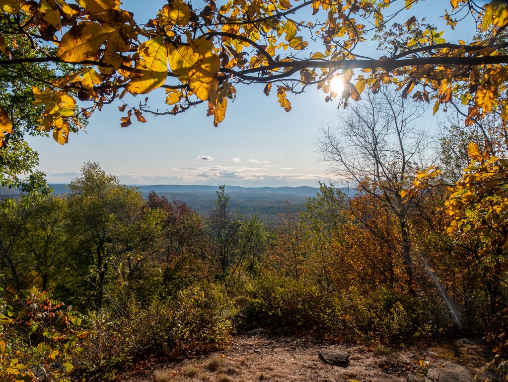
I was completely alone until some other hikers came by and set up camp right at the vista.
I thought it more prudent to sleep somewhere with more wind protection, particularly given that my recollection of the weather forecast was that it would be somewhere around 35-38 degrees F that evening, hence my desire to use the lean-to.
I even had cellphone service, so I called my mom and told her not to worry.
This was the first contact I had with the outside world.
A few moments later, I heard the news: Donald Trump had contracted COVID-19 the previous day.
I retired to my tent, where the wooden floor was a poor match for my trekking poles as tent poles (which I should have also secured with rocks), and for my inflatable sleeping pad (which I found it far, far more easy to slide off of than I did atop soft earth.) It was not a great night’s sleep.
Sunday
Sunday was a bitter-sweet end to the trip. It began where Saturday left off, at Sprout Top Vista…
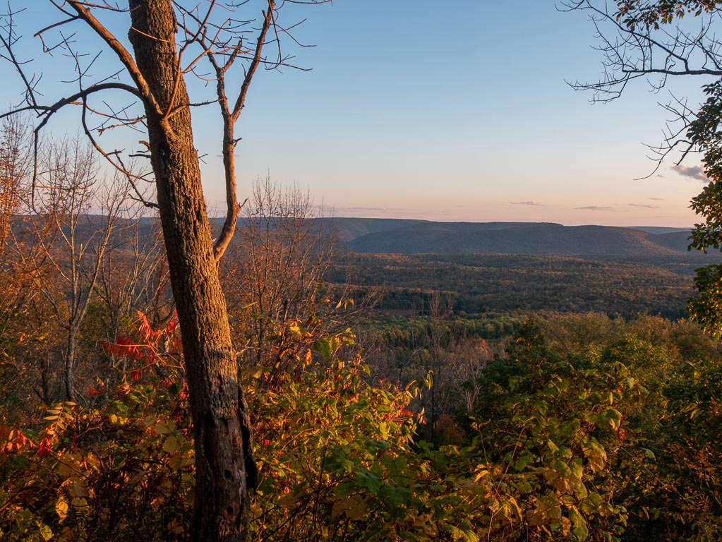
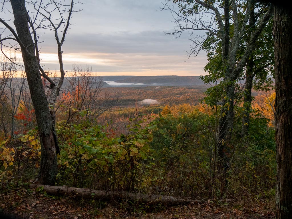
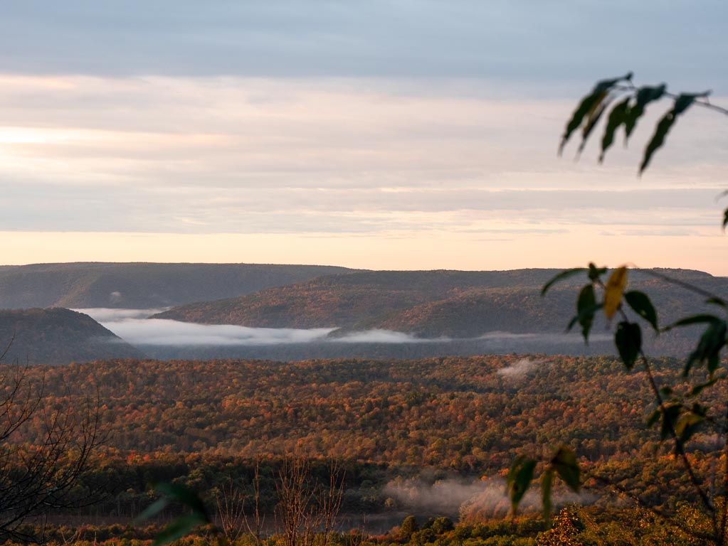
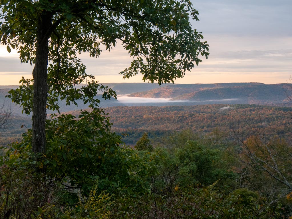
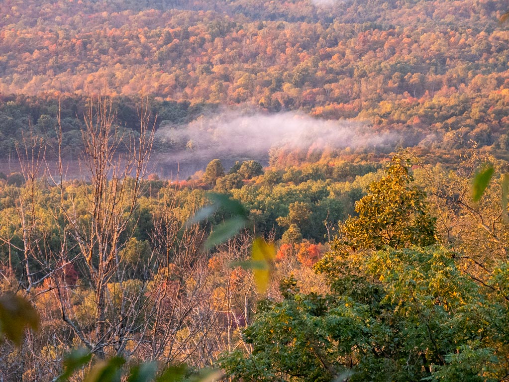
Sprout Top Vista (Dawn)
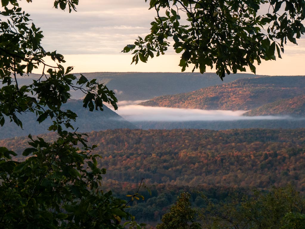
Dawn on Sunday morning was a beautiful thing. I stumbled out of my tent back to the vista, and I got to enjoy one of the most beautiful sights I have ever seen in my life.
I love mist, and I love fog, and it was so glorious to see the sunlight of an early day refracting through the mist that accumulated in the low points of the valley.
It was peaceful. It was tranquil.
It was a great start to my day.
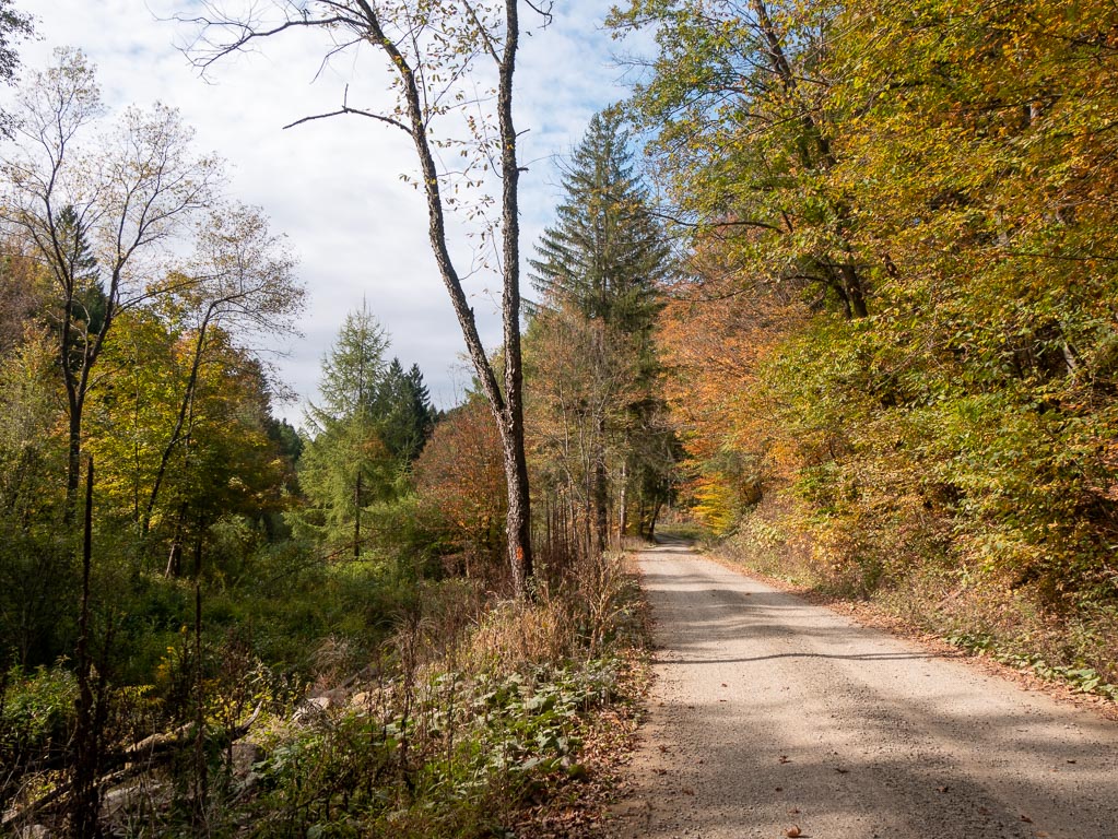
Descent
Yep, as the map indicates, it’s a pretty gradual, curvy descent back towards the front-country.
There’s some walking along ridges, but it’s all pretty subdued and easy.

There was a stream quite close to the end, where I would have stopped for water if I didn’t already have some in my car (along with hard-won Gatorade.)
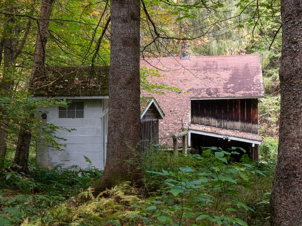
Masten Ghost Town
What do you do with a ghost logging town when it has become a State Forest, and there is no logging to be done?
The answer is that you turn it into a hunting town, full of hunting cabins, and houses with little sheds for shooting at animals from.
I walked past some of these homes, along a windy, seldom trafficked road back to the trailhead, passing streambeds with and without water on the way.
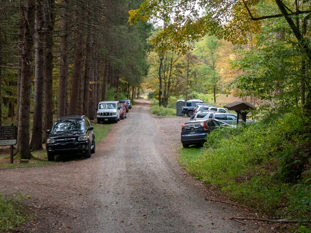
Finally, I made my way back to the (still quite full) parking lot.
I had my gatorade, and I drove home.
This post was part of a series:
Thanks for reading!
If you enjoyed this post, you might enjoy these 5 similar posts:
- 2022-08-29 —That One Overnight Hike I Did With My Mom
- 2021-12-29 —My 11-hour 16.7 mile Haleakala Crater Hike
- 2022-03-31 —Ancient Lakes
- 2022-08-01 —The One Trail I Hike With Colleagues
- 2022-12-26 —To Whitefish And Back Again