The trajectory I had ahead of me was clear. The previous evening I felt compelled to trade Agate Beach for Bonanza Beach, to travel from Naikoon to the Rennell Sound.
open_in_full
info
×
Exif Data For The Selected Image
Camera Make SIGMA Camera Model SIGMA dp0 Quattro Focal Length 14mm Aperture ƒ/4 Exposure Time 1/60s ISO 100
I knew that I wanted to make the most of my day and see as many beautiful sights as I could near Graham Island’s rugged west coast. I also knew that I needed to make my way to Sandspit by the following morning for a tour of Gwaii Hanaas.
And so I meandered back from the Rennell Sound, towards Dajing Giids and Kagan Bay.
This element did not display properly. Do you have JavaScript enabled?
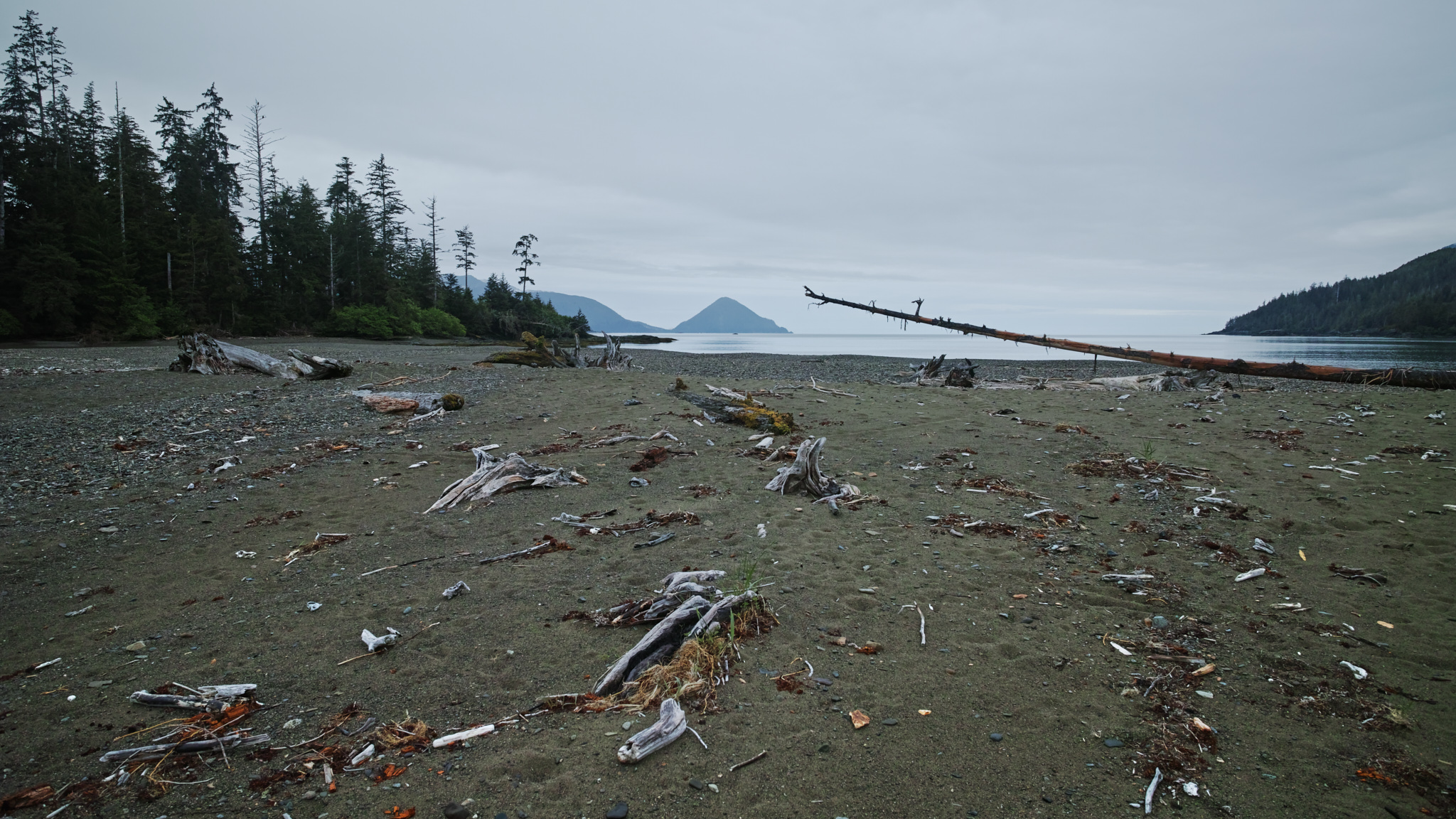
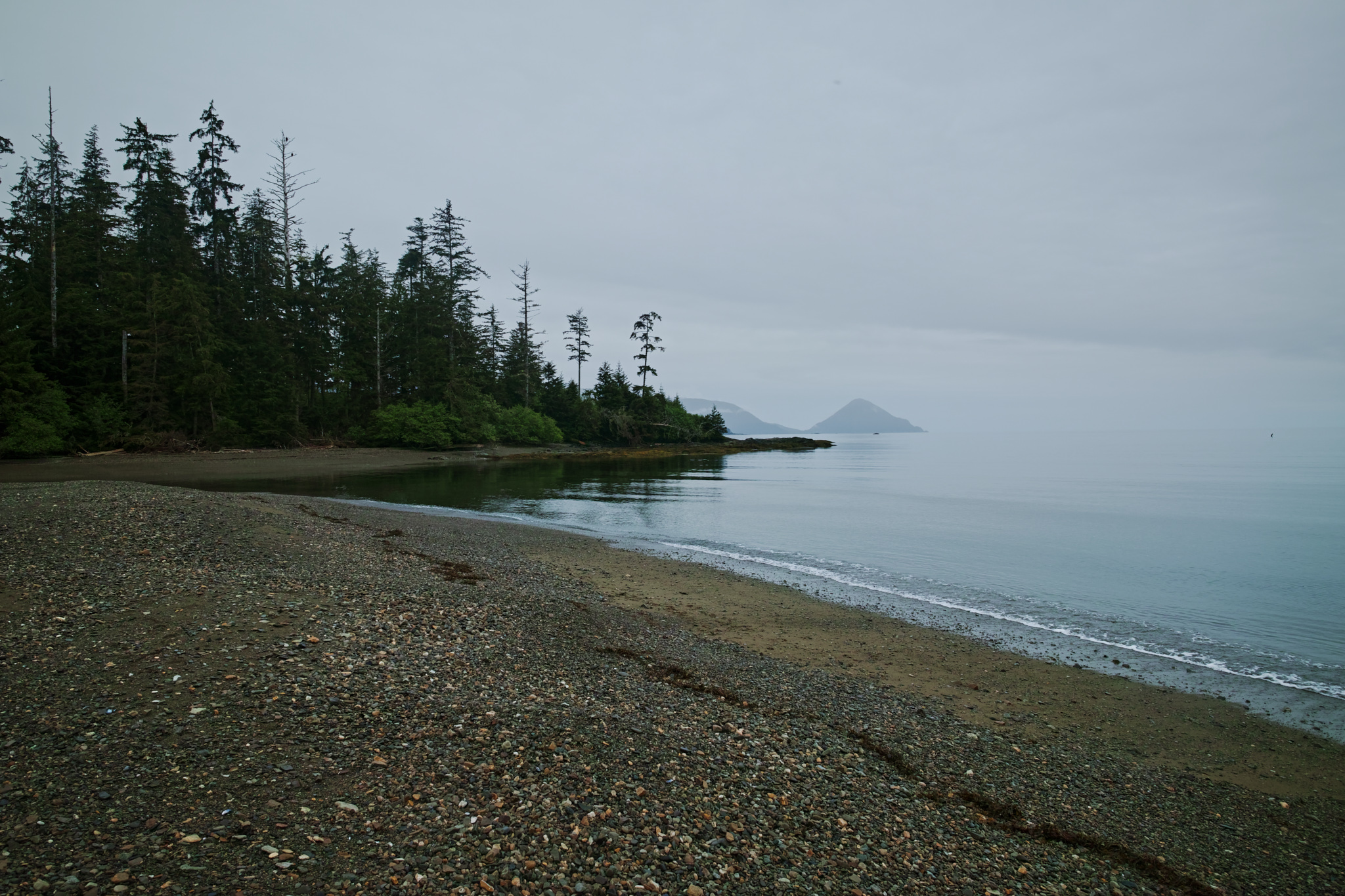
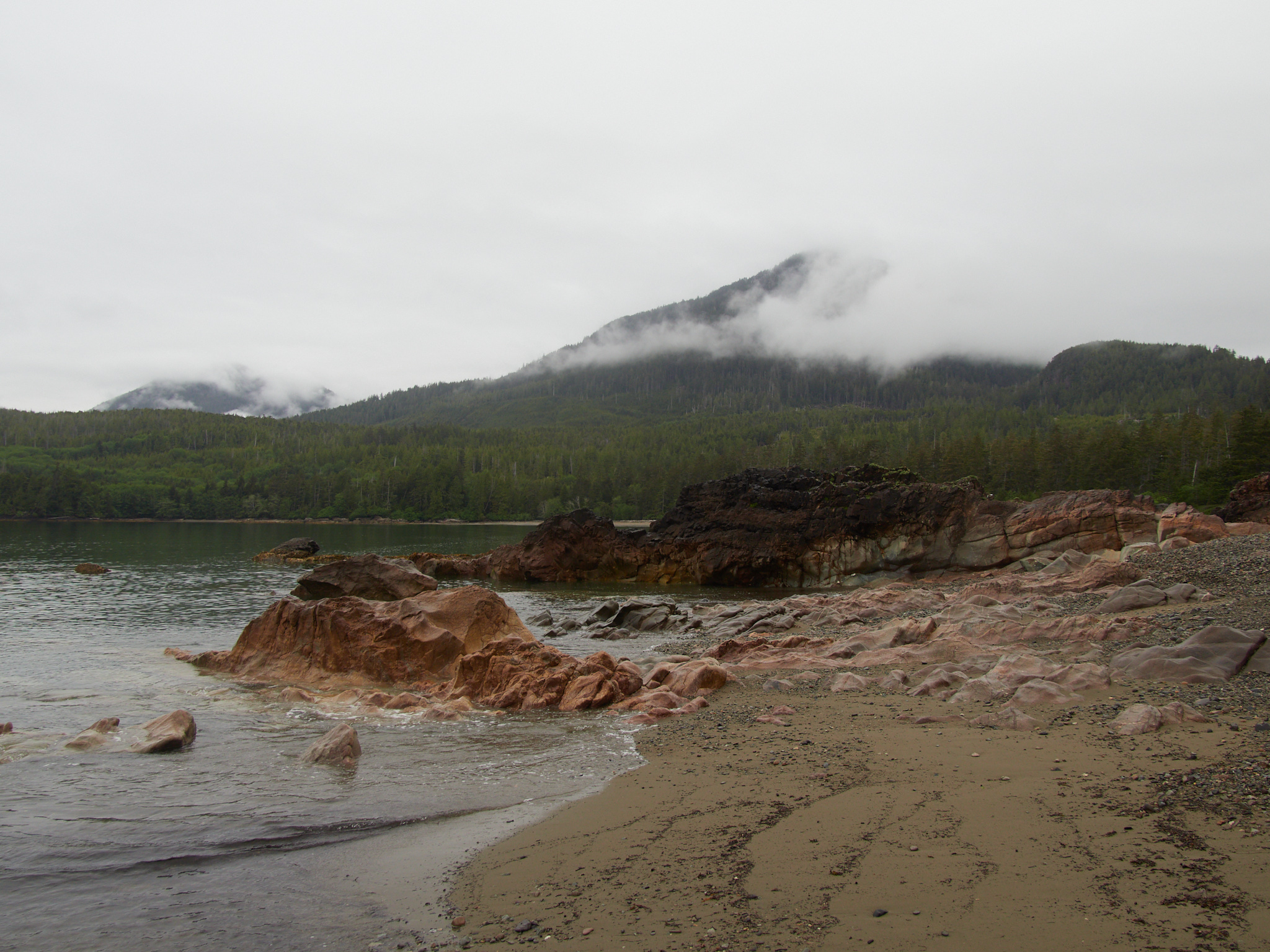
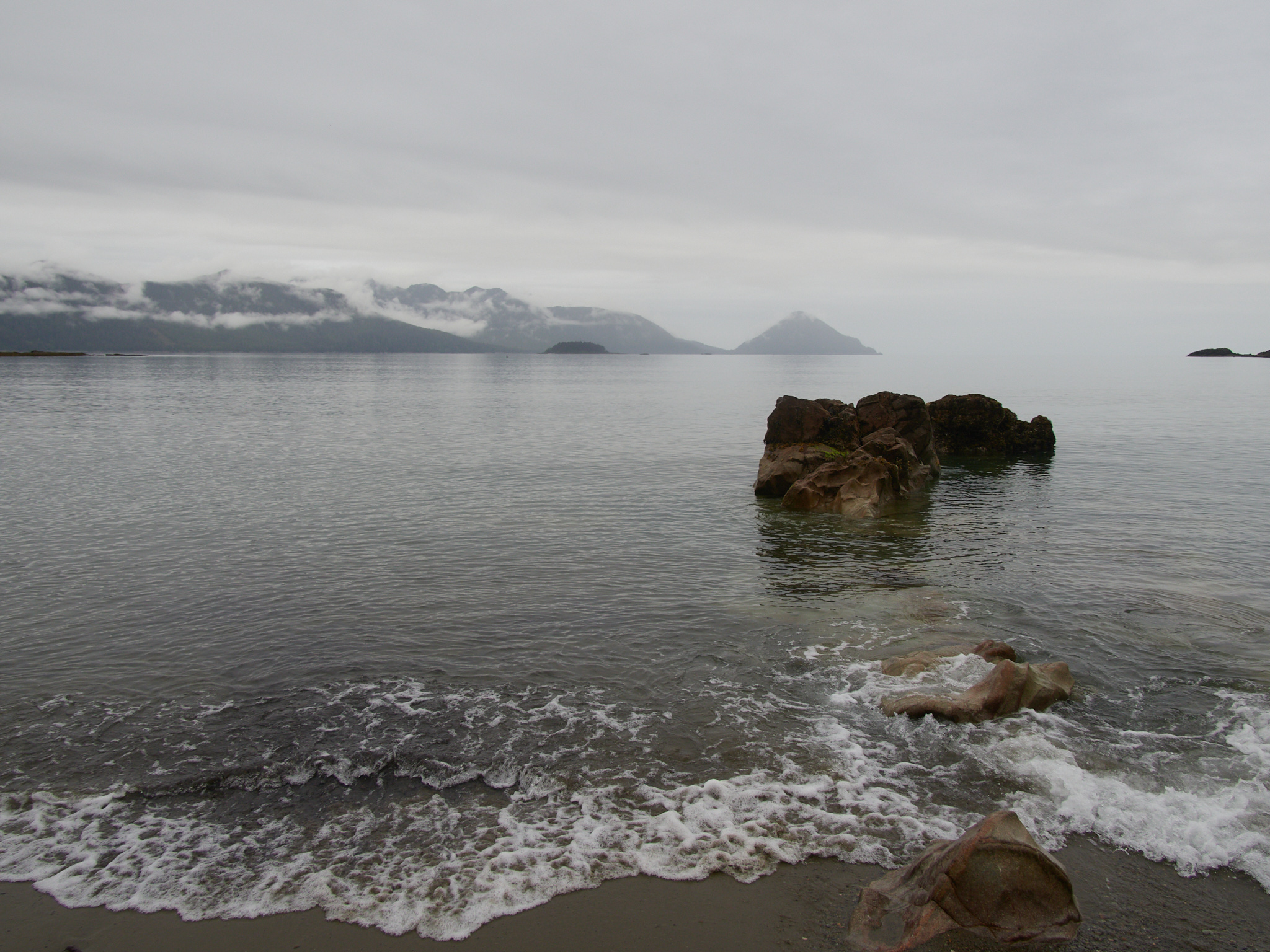
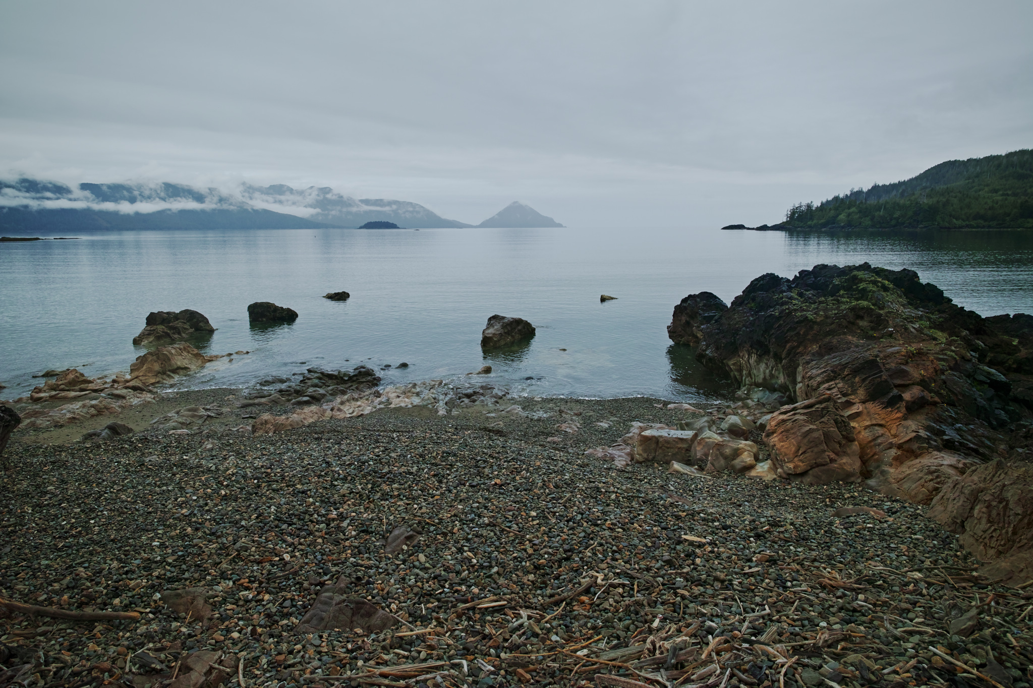
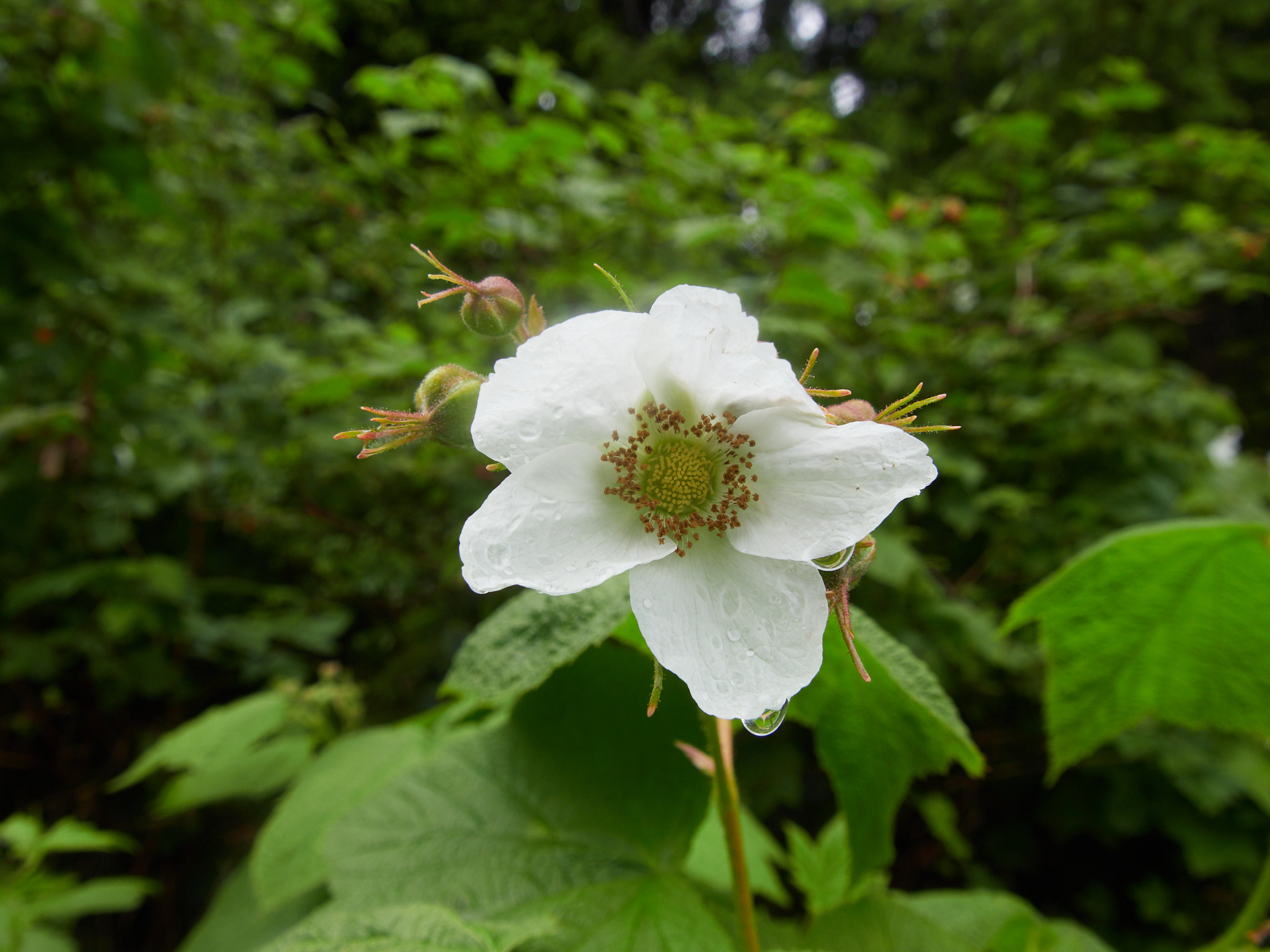
Bonanza Beach (The Morning After)
The beach was spectacular at sunset , but it was no slouch in the morning light.
open_in_full
info
×
Exif Data For The Selected Image
Camera Make SIGMA Camera Model SIGMA dp0 Quattro Focal Length 14mm Aperture ƒ/5 Exposure Time 1/100s ISO 100
open_in_full
info
×
Exif Data For The Selected Image
Camera Make SIGMA Camera Model SIGMA dp0 Quattro Focal Length 14mm Aperture ƒ/5.6 Exposure Time 1/125s ISO 100
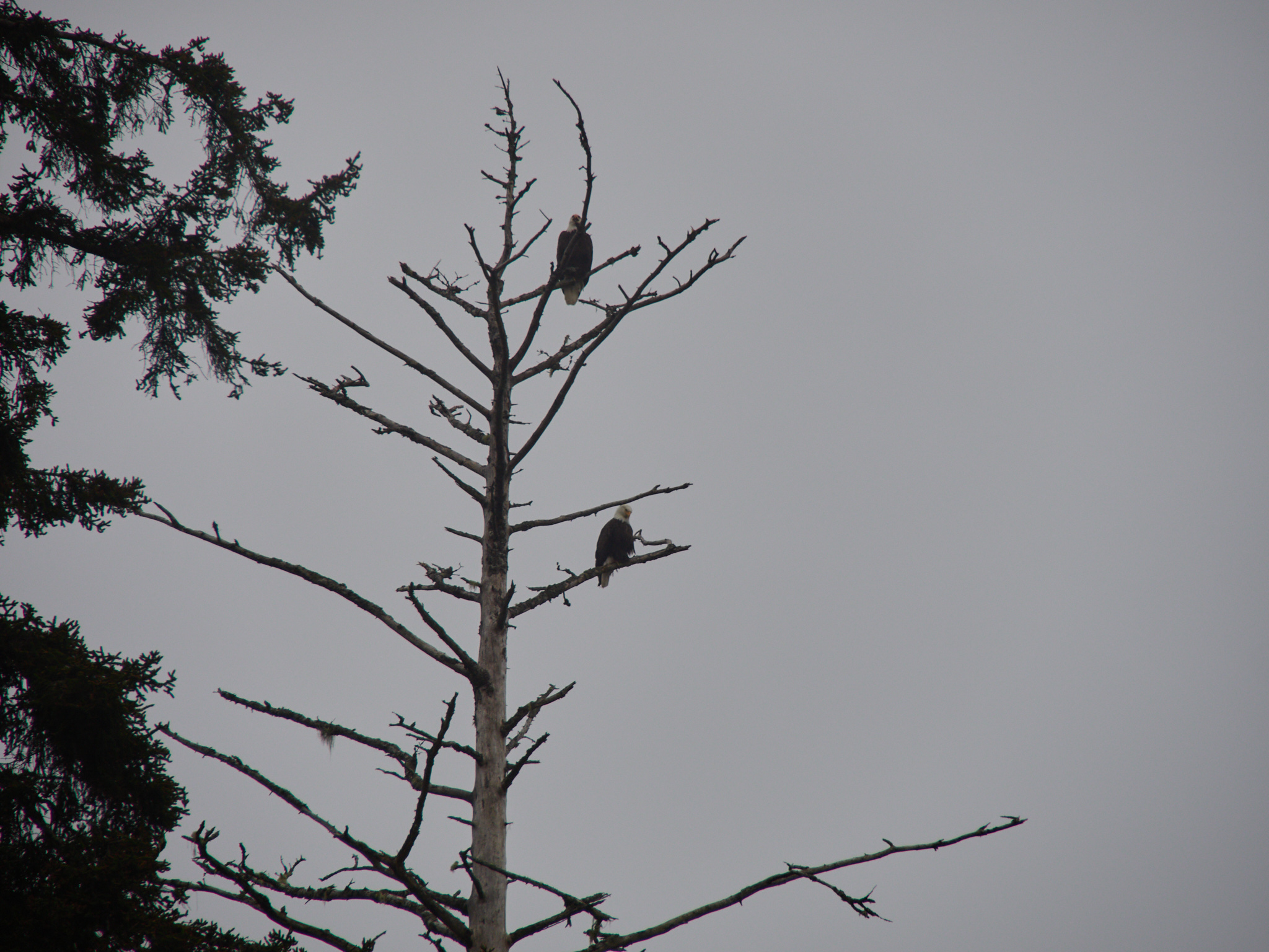
Of course there were eagles
open_in_full
info
×
Of course there were eagles
×
Exif Data For The Selected Image
Camera Make OLYMPUS CORPORATION Camera Model E-M5MarkIII Lens Model OLYMPUS M.12-200mm F3.5-6.3 Focal Length 200mm Aperture ƒ/7.1 Exposure Time 1/400s ISO 200 Exposure Compensation -0.3
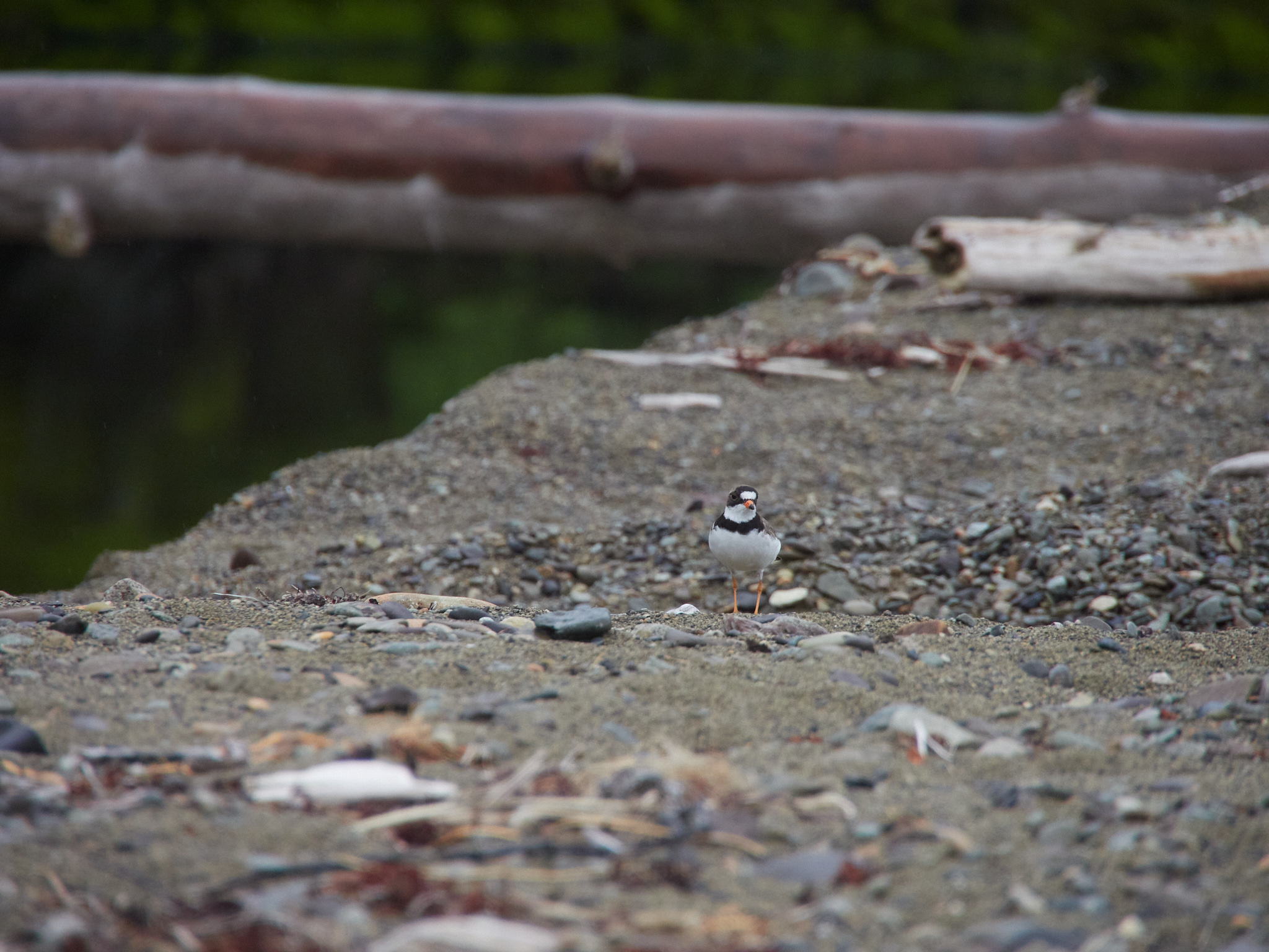
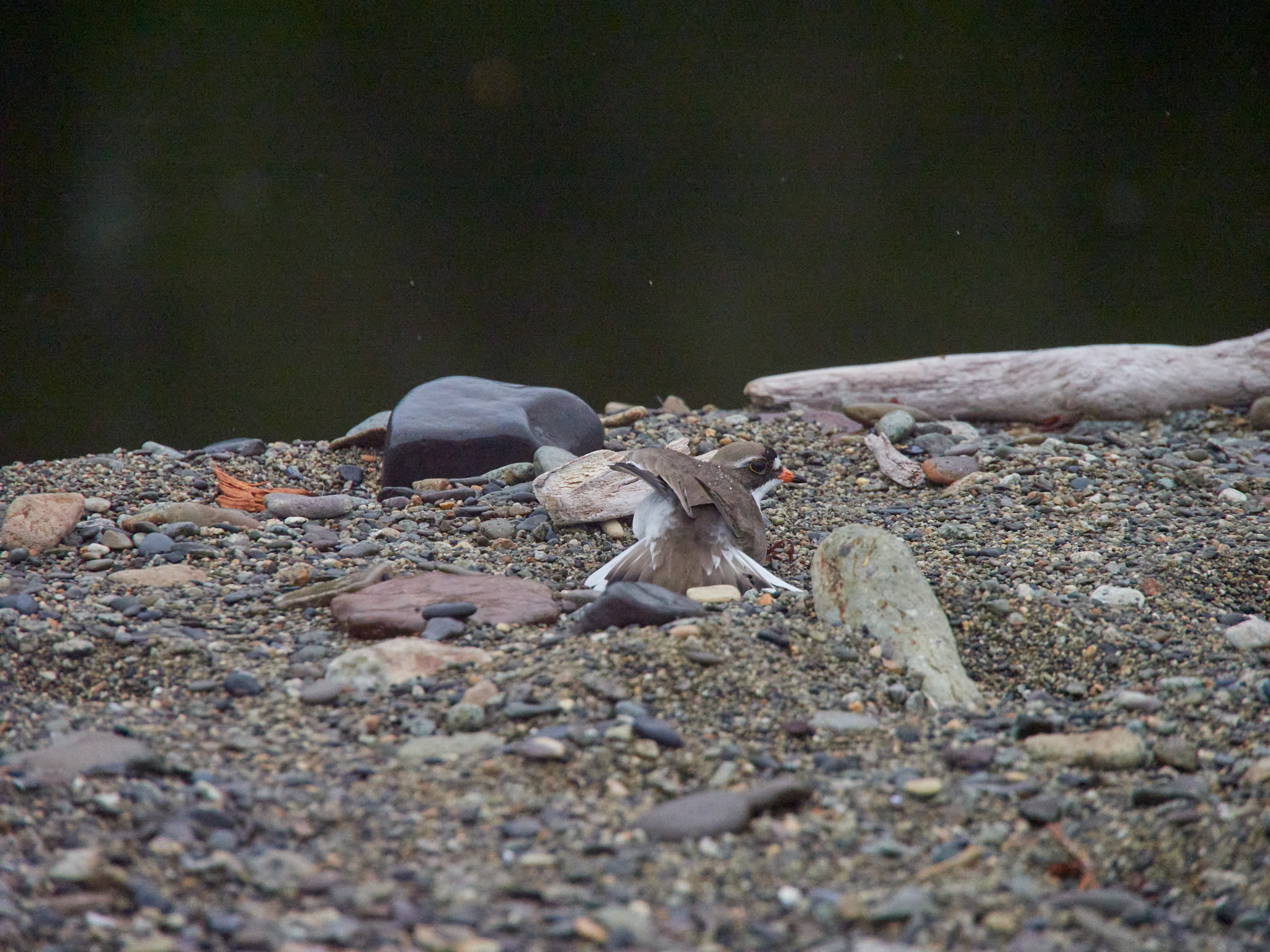
A killdeer by the stream
open_in_full
info
×
Exif Data For The Selected Image
Camera Make OLYMPUS CORPORATION Camera Model E-M5MarkIII Lens Model OLYMPUS M.12-200mm F3.5-6.3 Focal Length 200mm Aperture ƒ/6.3 Exposure Time 1/500s ISO 1600
open_in_full
info
×
Exif Data For The Selected Image
Camera Make OLYMPUS CORPORATION Camera Model E-M5MarkIII Lens Model OLYMPUS M.12-200mm F3.5-6.3 Focal Length 200mm Aperture ƒ/6.3 Exposure Time 1/2000s ISO 6400
open_in_full
info
×
Exif Data For The Selected Image
Camera Make SIGMA Camera Model SIGMA dp0 Quattro Focal Length 14mm Aperture ƒ/4.5 Exposure Time 1/80s ISO 100
open_in_full
info
×
Exif Data For The Selected Image
Camera Make OLYMPUS CORPORATION Camera Model E-M5MarkIII Lens Model OLYMPUS M.12-200mm F3.5-6.3 Focal Length 12mm Aperture ƒ/7.1 Exposure Time 1/250s ISO 320 Exposure Compensation 0.3
open_in_full
info
×
Exif Data For The Selected Image
Camera Make SIGMA Camera Model SIGMA dp0 Quattro Focal Length 14mm Aperture ƒ/5.6 Exposure Time 1/80s ISO 100
open_in_full
info
×
Exif Data For The Selected Image
Camera Make OLYMPUS CORPORATION Camera Model E-M5MarkIII Lens Model OLYMPUS M.12-200mm F3.5-6.3 Focal Length 14mm Aperture ƒ/5 Exposure Time 1/250s ISO 250 Exposure Compensation -0.3
open_in_full
info
×
Exif Data For The Selected Image
Camera Make OLYMPUS CORPORATION Camera Model E-M5MarkIII Lens Model OLYMPUS M.12-200mm F3.5-6.3 Focal Length 14mm Aperture ƒ/5 Exposure Time 1/320s ISO 200 Exposure Compensation -0.3
open_in_full
info
×
Exif Data For The Selected Image
Camera Make SIGMA Camera Model SIGMA dp0 Quattro Focal Length 14mm Aperture ƒ/6.3 Exposure Time 1/100s ISO 100
open_in_full
info
×
Exif Data For The Selected Image
Camera Make SIGMA Camera Model SIGMA dp0 Quattro Focal Length 14mm Aperture ƒ/6.3 Exposure Time 1/80s ISO 100
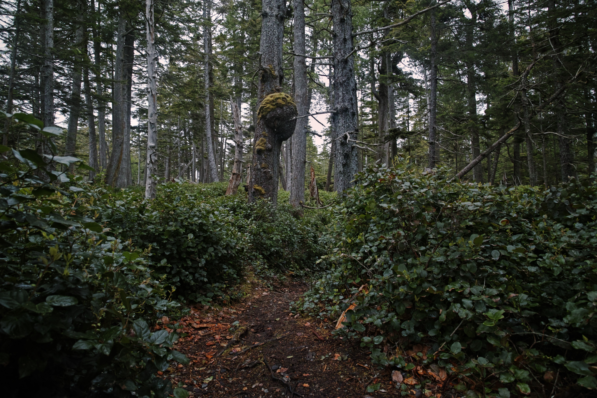
But, soon enough it was time to depart, to carry my things across the short forested walk back to the car.
open_in_full
info
×
Exif Data For The Selected Image
Camera Make SIGMA Camera Model SIGMA dp0 Quattro Focal Length 14mm Aperture ƒ/4 Exposure Time 1/60s ISO 100
open_in_full
info
×
Exif Data For The Selected Image
Camera Make SIGMA Camera Model SIGMA dp0 Quattro Focal Length 14mm Aperture ƒ/4 Exposure Time 1/60s ISO 100
open_in_full
info
×
Exif Data For The Selected Image
Camera Make SIGMA Camera Model SIGMA dp0 Quattro Focal Length 14mm Aperture ƒ/4 Exposure Time 1/60s ISO 400
open_in_full
info
×
Exif Data For The Selected Image
Camera Make SIGMA Camera Model SIGMA dp0 Quattro Focal Length 14mm Aperture ƒ/4 Exposure Time 1/30s ISO 320
The Way Back
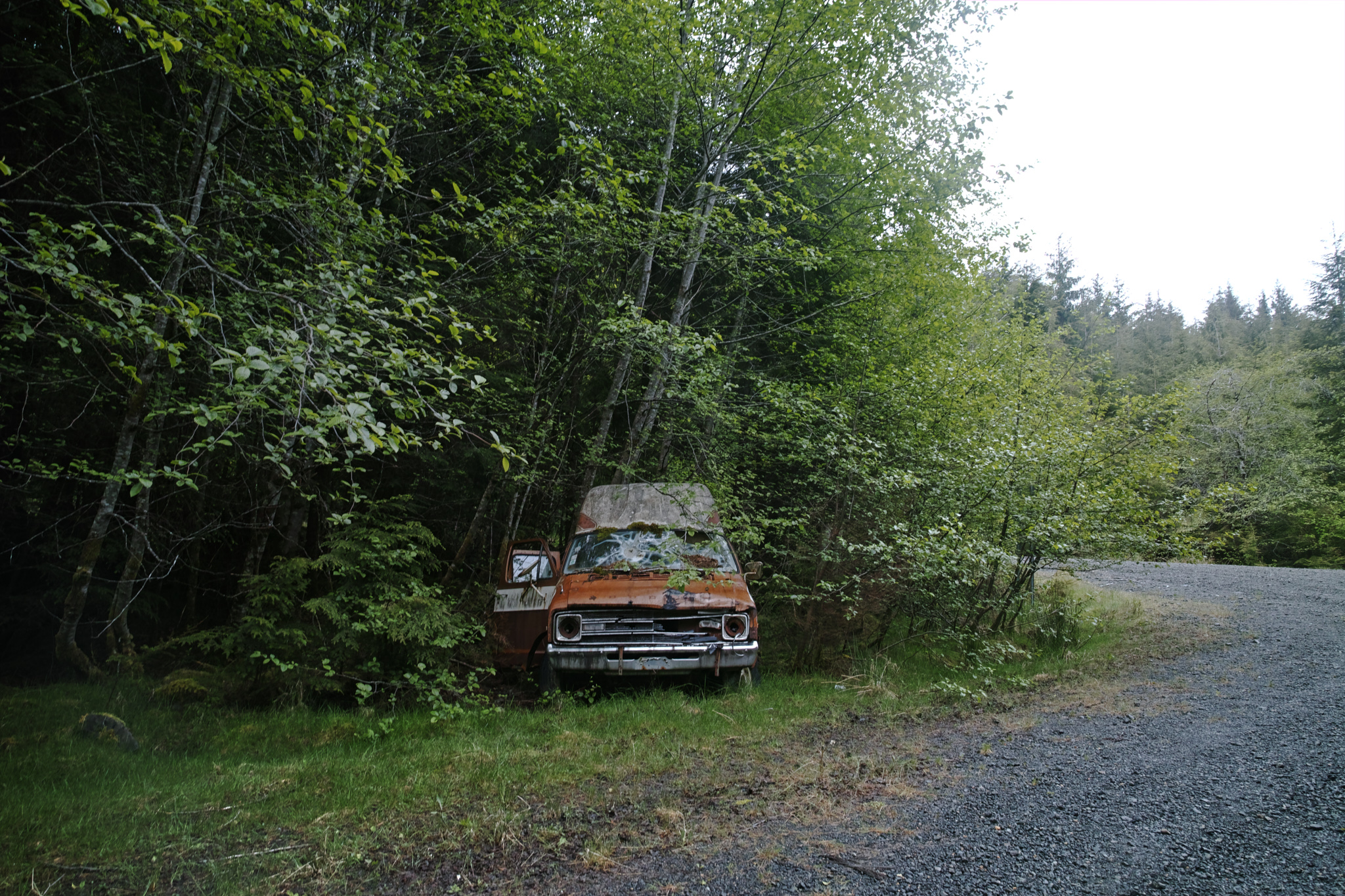
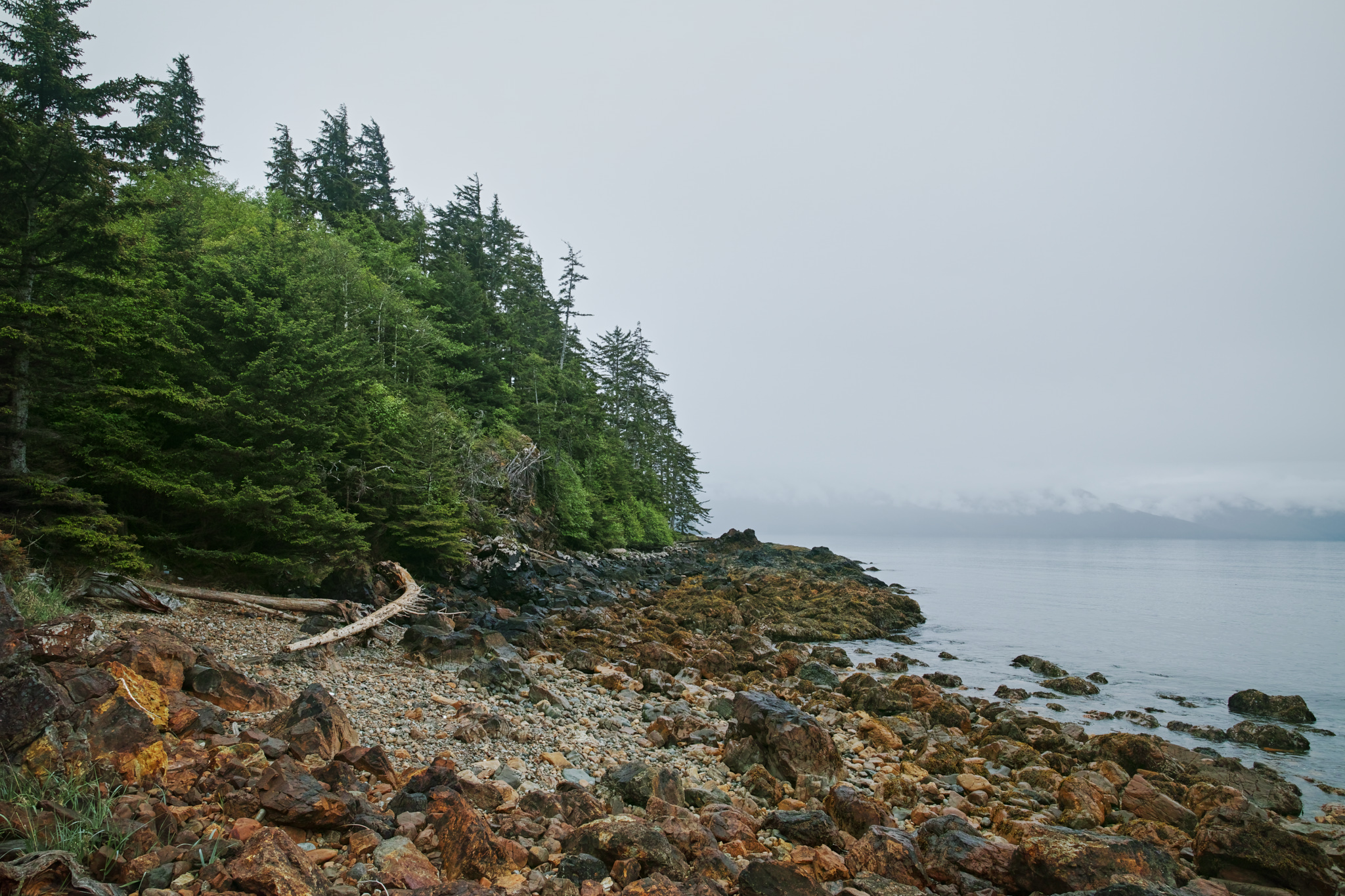
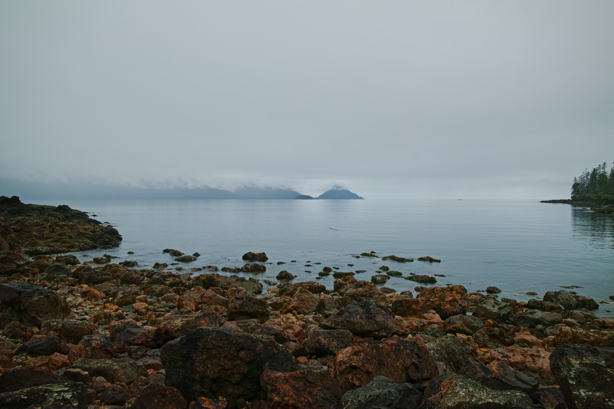
Along the way back, I pulled off wherever I felt like pulling off, wherever something caught my eye.
Something like this abandoned van?
open_in_full
info
×
Something like this abandoned van?
×
Exif Data For The Selected Image
Camera Make SIGMA Camera Model SIGMA dp0 Quattro Focal Length 14mm Aperture ƒ/5.6 Exposure Time 1/20s ISO 100
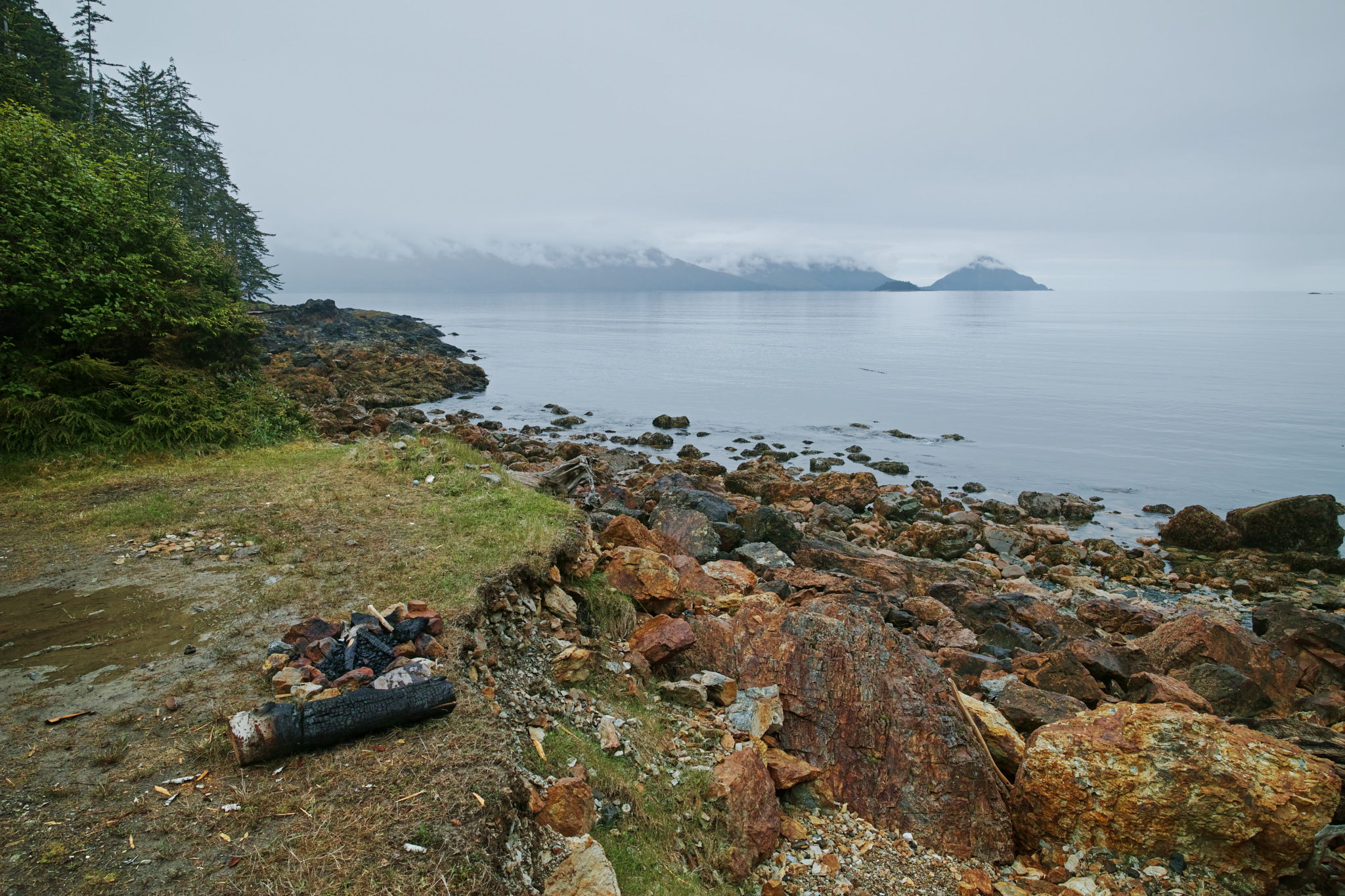
Or something like this clearing, which undoubtedly served as someone's campsite
open_in_full
info
×
Or something like this clearing, which undoubtedly served as someone's campsite
×
Exif Data For The Selected Image
Camera Make SIGMA Camera Model SIGMA dp0 Quattro Focal Length 14mm Aperture ƒ/6.3 Exposure Time 1/100s ISO 100
open_in_full
info
×
Exif Data For The Selected Image
Camera Make SIGMA Camera Model SIGMA dp0 Quattro Focal Length 14mm Aperture ƒ/6.3 Exposure Time 1/100s ISO 100
open_in_full
info
×
Exif Data For The Selected Image
Camera Make SIGMA Camera Model SIGMA dp0 Quattro Focal Length 14mm Aperture ƒ/7.1 Exposure Time 1/160s ISO 100
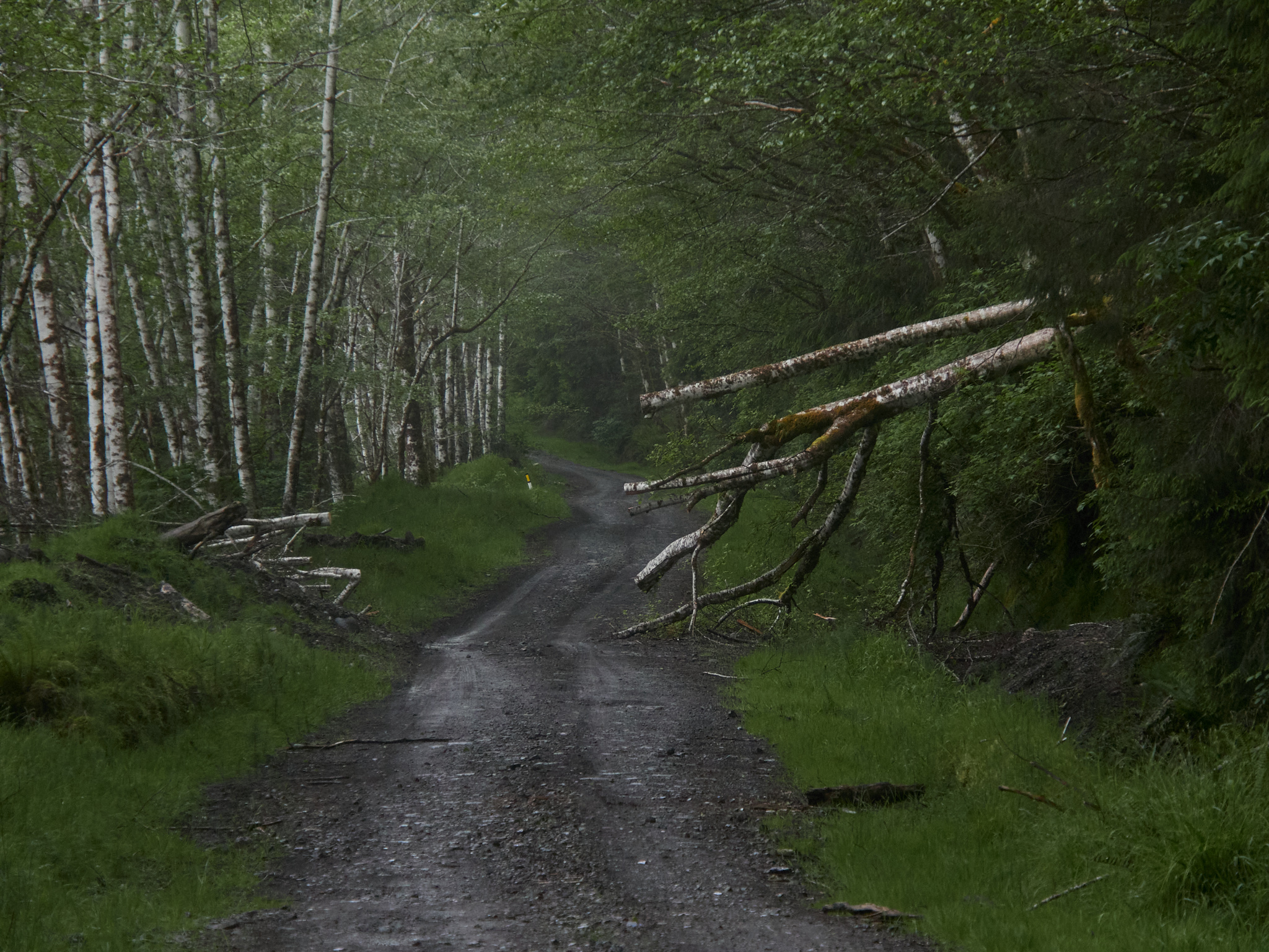
I felt torn between lingering as long as possible at various spots, and feeling the nagging sensation of hunger in my stomach. I could also tell that clouds were coming in, and I knew I would prefer driving on a dry forest road to a wet one.
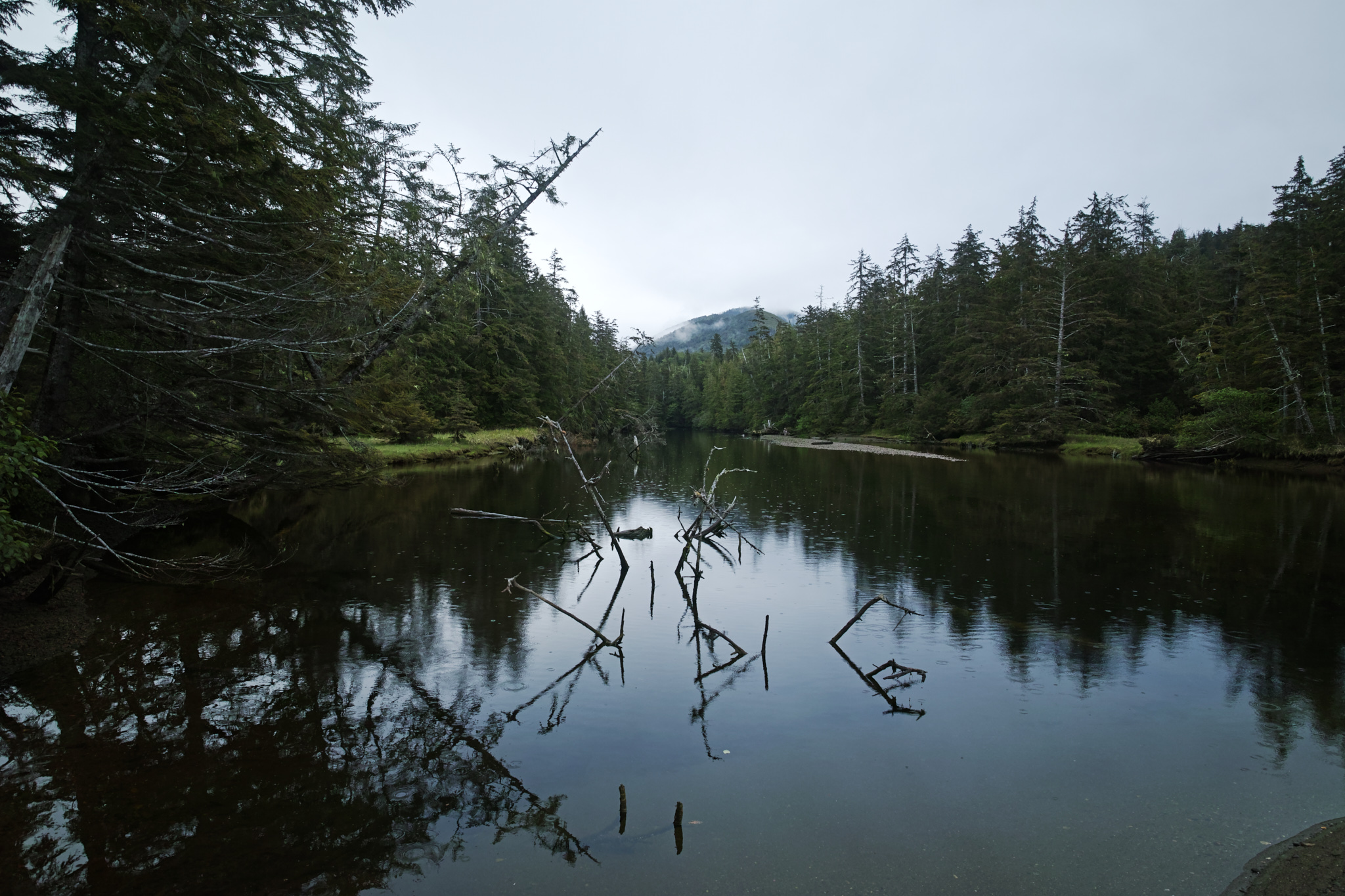
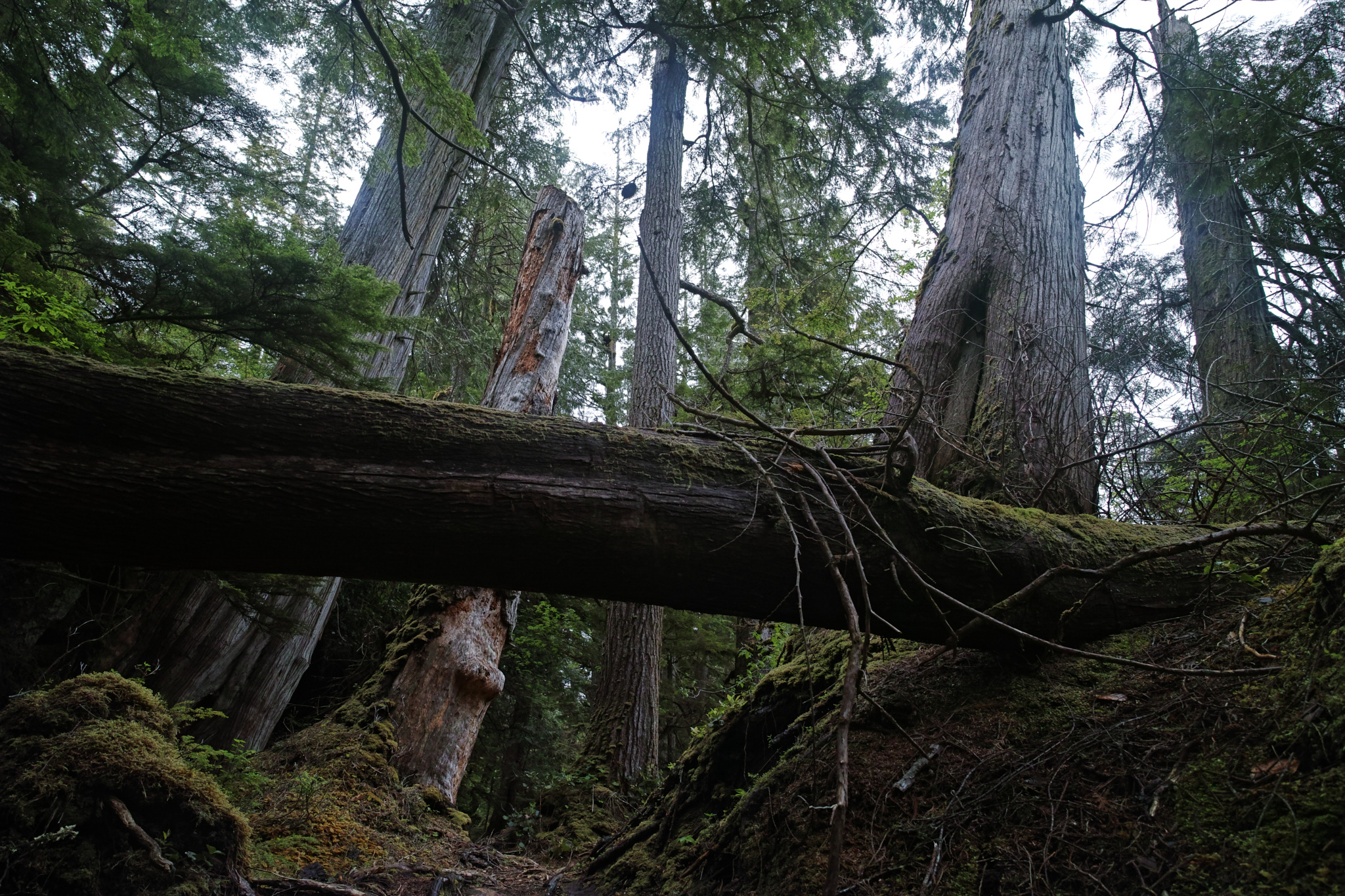
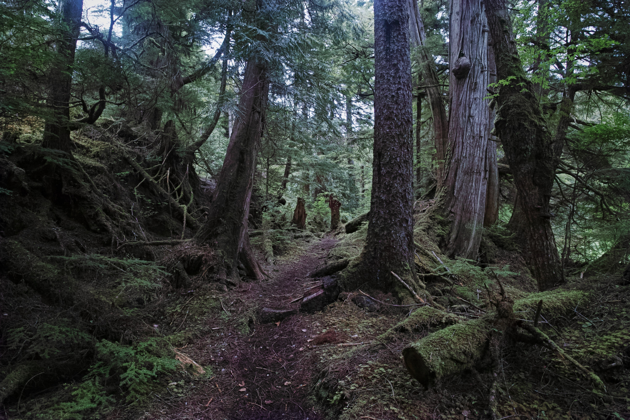
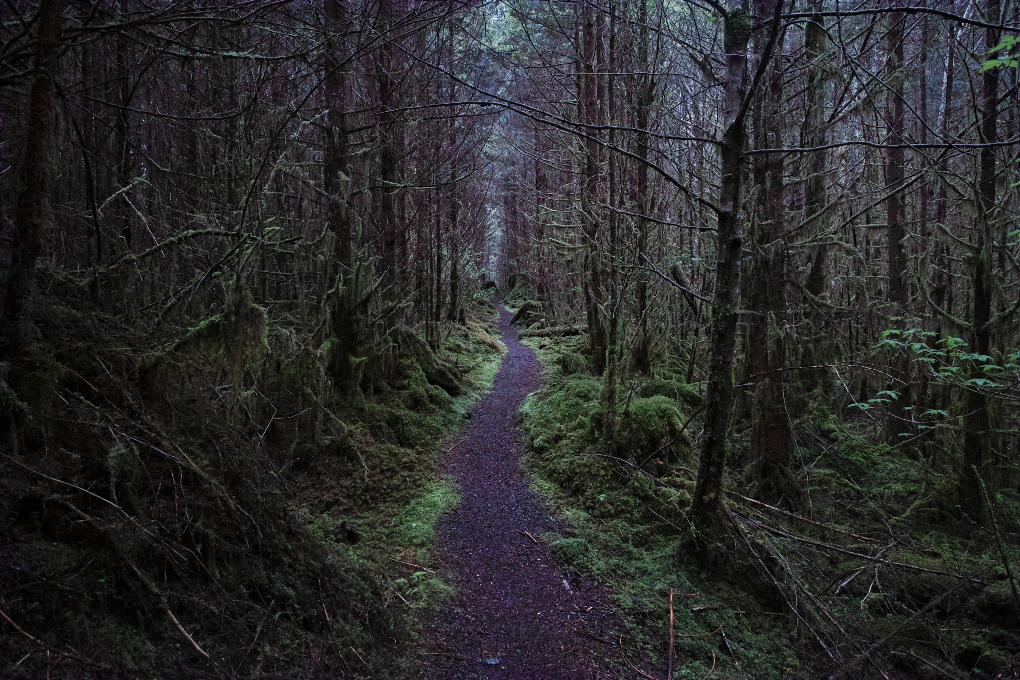
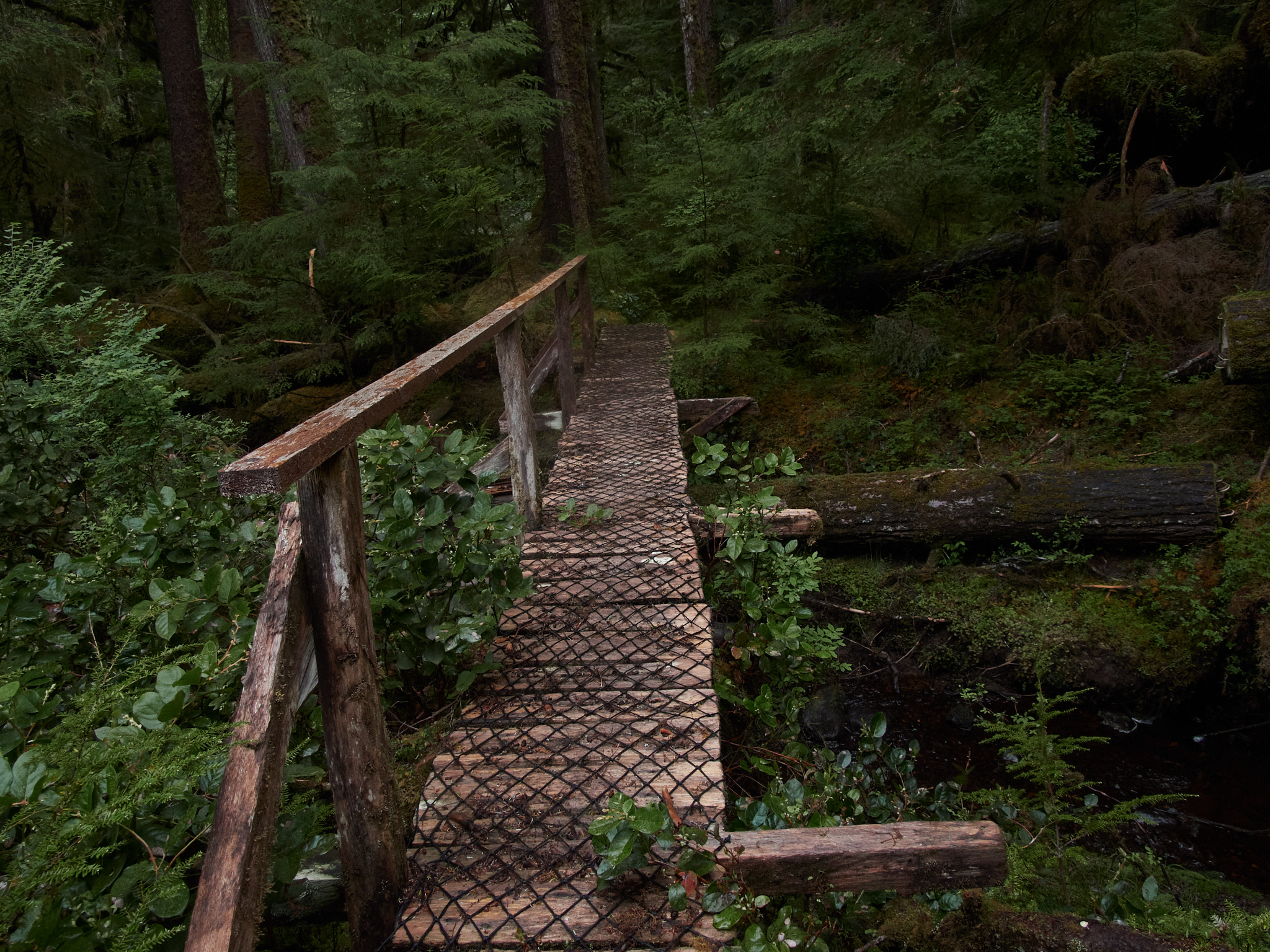
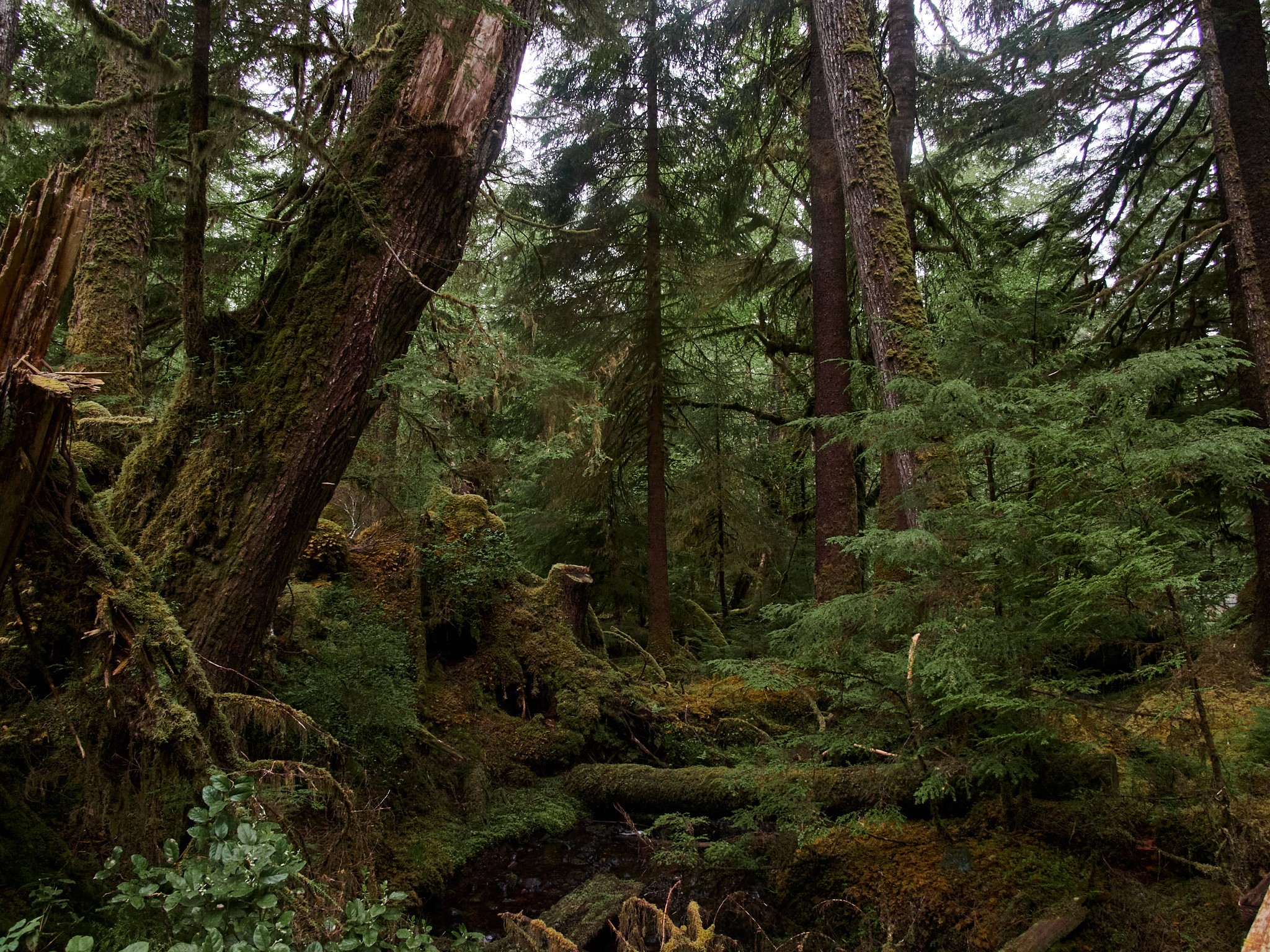
Riley Creek Trail (Partial Hike)
The Riley Creek trail is not maintained , and indeed, would have been somewhat difficult and wet to continue along. It leads to actual old growth trees, but even just the quick traversal of the initial section of the trail offered me some calm and tranquility. I would have wanted to be better prepared (and equipped) if I was going to go further than a scant 0.25 miles in.
open_in_full
info
×
Exif Data For The Selected Image
Camera Make OLYMPUS CORPORATION Camera Model E-M5MarkIII Lens Model OLYMPUS M.12-200mm F3.5-6.3 Focal Length 13mm Aperture ƒ/7.1 Exposure Time 1/250s ISO 1250 Exposure Compensation -1.3
open_in_full
info
×
Exif Data For The Selected Image
Camera Make OLYMPUS CORPORATION Camera Model E-M5MarkIII Lens Model OLYMPUS M.12-200mm F3.5-6.3 Focal Length 12mm Aperture ƒ/7.1 Exposure Time 1/250s ISO 2000 Exposure Compensation -1.3
open_in_full
info
×
Exif Data For The Selected Image
Camera Make OLYMPUS CORPORATION Camera Model E-M5MarkIII Lens Model OLYMPUS M.12-200mm F3.5-6.3 Focal Length 45mm Aperture ƒ/7.1 Exposure Time 1/250s ISO 2000 Exposure Compensation -1
open_in_full
info
×
Exif Data For The Selected Image
Camera Make OLYMPUS CORPORATION Camera Model E-M1X Lens Model M.300mm F4.0 + MC-14 Focal Length 420mm Aperture ƒ/5.6 Exposure Time 1/100s ISO 500
open_in_full
info
×
Exif Data For The Selected Image
Camera Make OLYMPUS CORPORATION Camera Model E-M1X Lens Model M.300mm F4.0 + MC-14 Focal Length 420mm Aperture ƒ/5.6 Exposure Time 1/125s ISO 500 Exposure Compensation 0.7
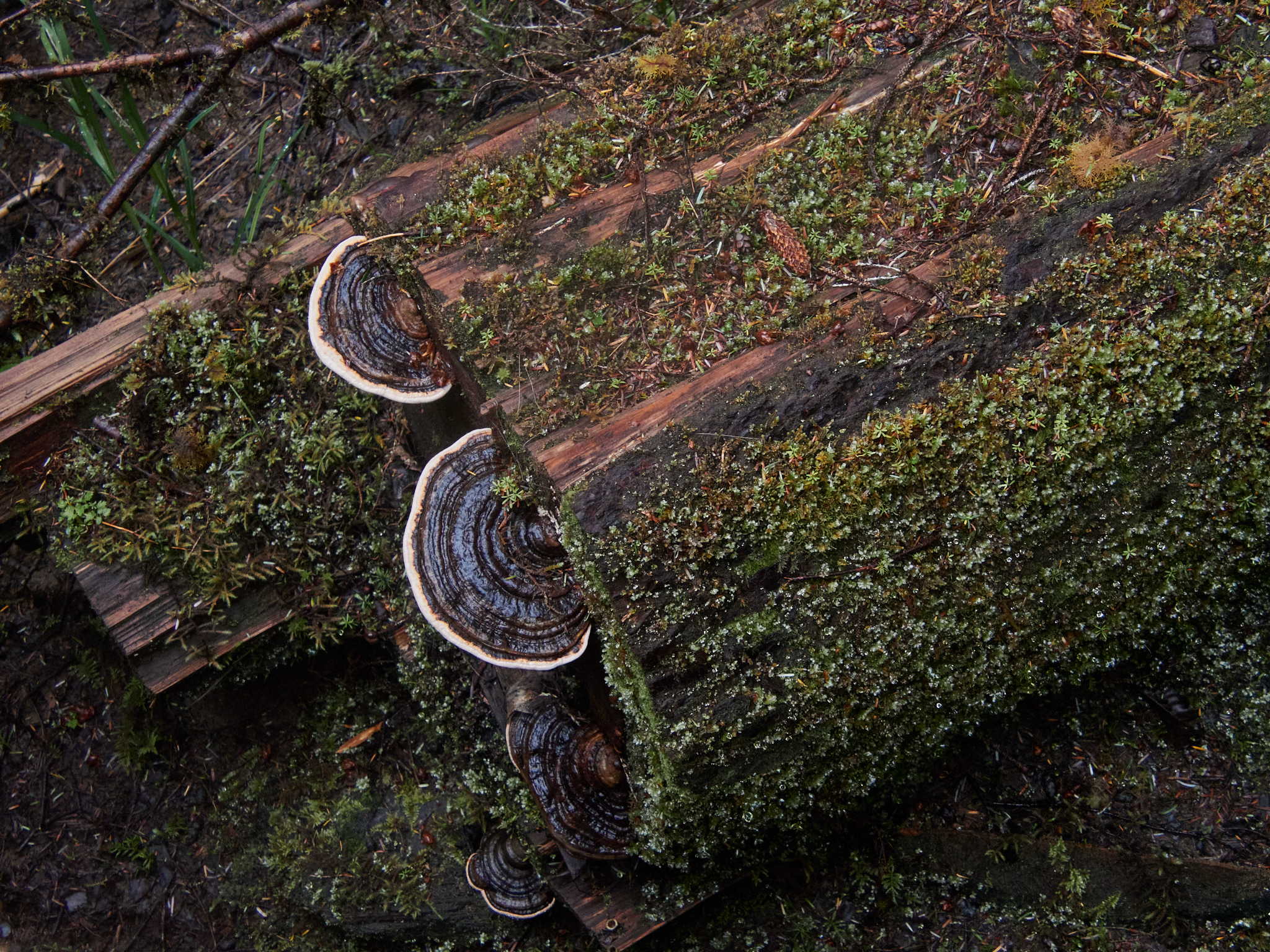
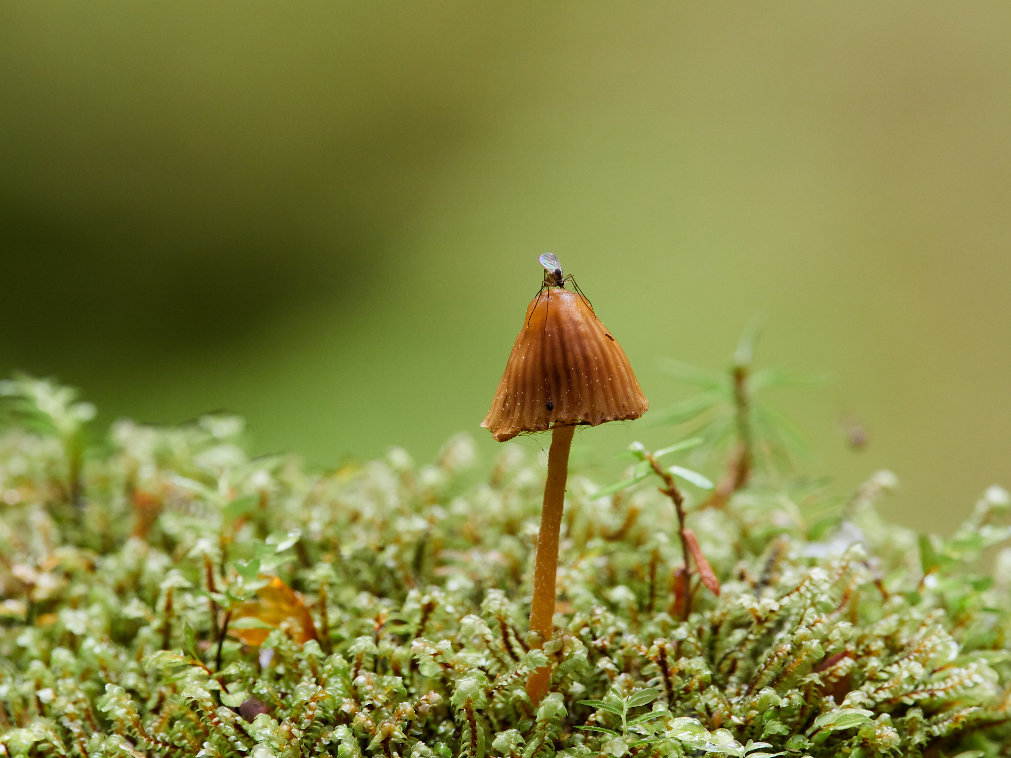
This just happens to be my all time favorite photo of a mosquito that I've ever taken!
open_in_full
info
×
This just happens to be my all time favorite photo of a <em>mosquito</em> that I've ever taken!
Basically, I had been noticing and loving the tiny mushrooms growing alongside moss on some of these fallen logs, and was taking some mushroom pictures when this mosquito decided to land on my subject. What a moment! And what incandescent wings.
×
Exif Data For The Selected Image
Camera Make OLYMPUS CORPORATION Camera Model E-M1X Lens Model M.300mm F4.0 + MC-14 Focal Length 420mm Aperture ƒ/9 Exposure Time 1/20s ISO 500 Exposure Compensation -0.3
Misc. Stops (Continued)
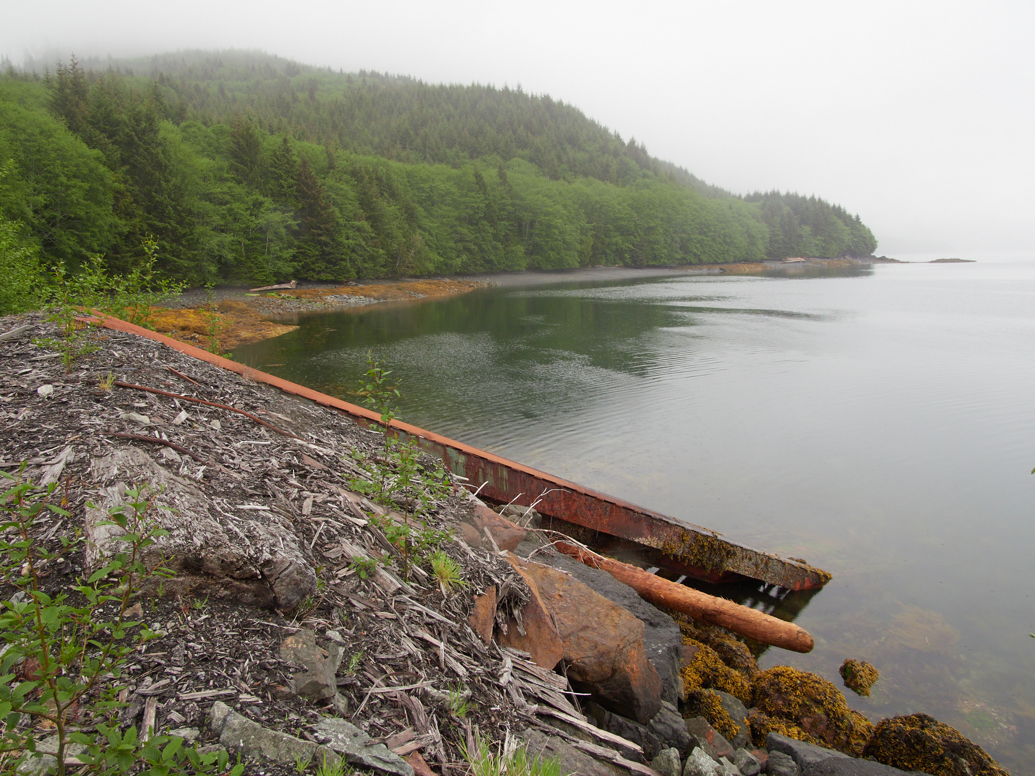
I stopped by an area that looked like it was used to load logs onto barges.
open_in_full
info
×
Exif Data For The Selected Image
Camera Make OLYMPUS CORPORATION Camera Model E-M5MarkIII Lens Model OLYMPUS M.12-200mm F3.5-6.3 Focal Length 12mm Aperture ƒ/7.1 Exposure Time 1/250s ISO 640
open_in_full
info
×
Exif Data For The Selected Image
Camera Make OLYMPUS CORPORATION Camera Model E-M5MarkIII Lens Model OLYMPUS M.12-200mm F3.5-6.3 Focal Length 34mm Aperture ƒ/7.1 Exposure Time 1/250s ISO 200
open_in_full
info
×
Exif Data For The Selected Image
Camera Make OLYMPUS CORPORATION Camera Model E-M1X Lens Model M.300mm F4.0 + MC-14 Focal Length 420mm Aperture ƒ/5.6 Exposure Time 1/800s ISO 400 Exposure Compensation -0.3
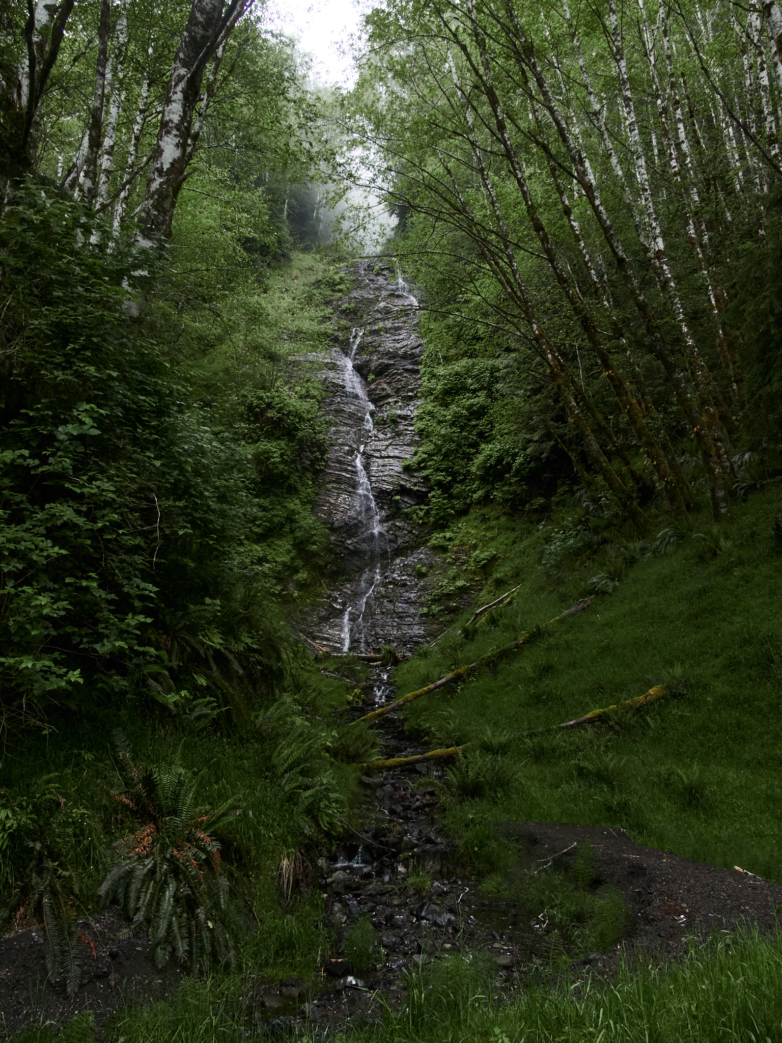
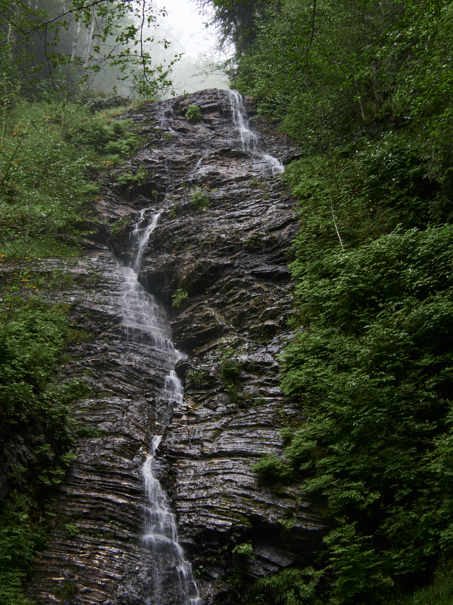
And I stopped by a small, trickly waterfall.
open_in_full
info
×
Exif Data For The Selected Image
Camera Make OLYMPUS CORPORATION Camera Model E-M5MarkIII Lens Model OLYMPUS M.12-200mm F3.5-6.3 Focal Length 13mm Aperture ƒ/7.1 Exposure Time 1/250s ISO 2500 Exposure Compensation -1.3
open_in_full
info
×
Exif Data For The Selected Image
Camera Make OLYMPUS CORPORATION Camera Model E-M5MarkIII Lens Model OLYMPUS M.12-200mm F3.5-6.3 Focal Length 87mm Aperture ƒ/7.1 Exposure Time 1/250s ISO 2500 Exposure Compensation -1.3
open_in_full
info
×
Exif Data For The Selected Image
Camera Make OLYMPUS CORPORATION Camera Model E-M5MarkIII Lens Model OLYMPUS M.12-200mm F3.5-6.3 Focal Length 42mm Aperture ƒ/11 Exposure Time 1/10s ISO 200 Exposure Compensation -1
open_in_full
info
×
Exif Data For The Selected Image
Camera Make OLYMPUS CORPORATION Camera Model E-M5MarkIII Lens Model OLYMPUS M.12-200mm F3.5-6.3 Focal Length 112mm Aperture ƒ/7.1 Exposure Time 1/250s ISO 2500 Exposure Compensation -1
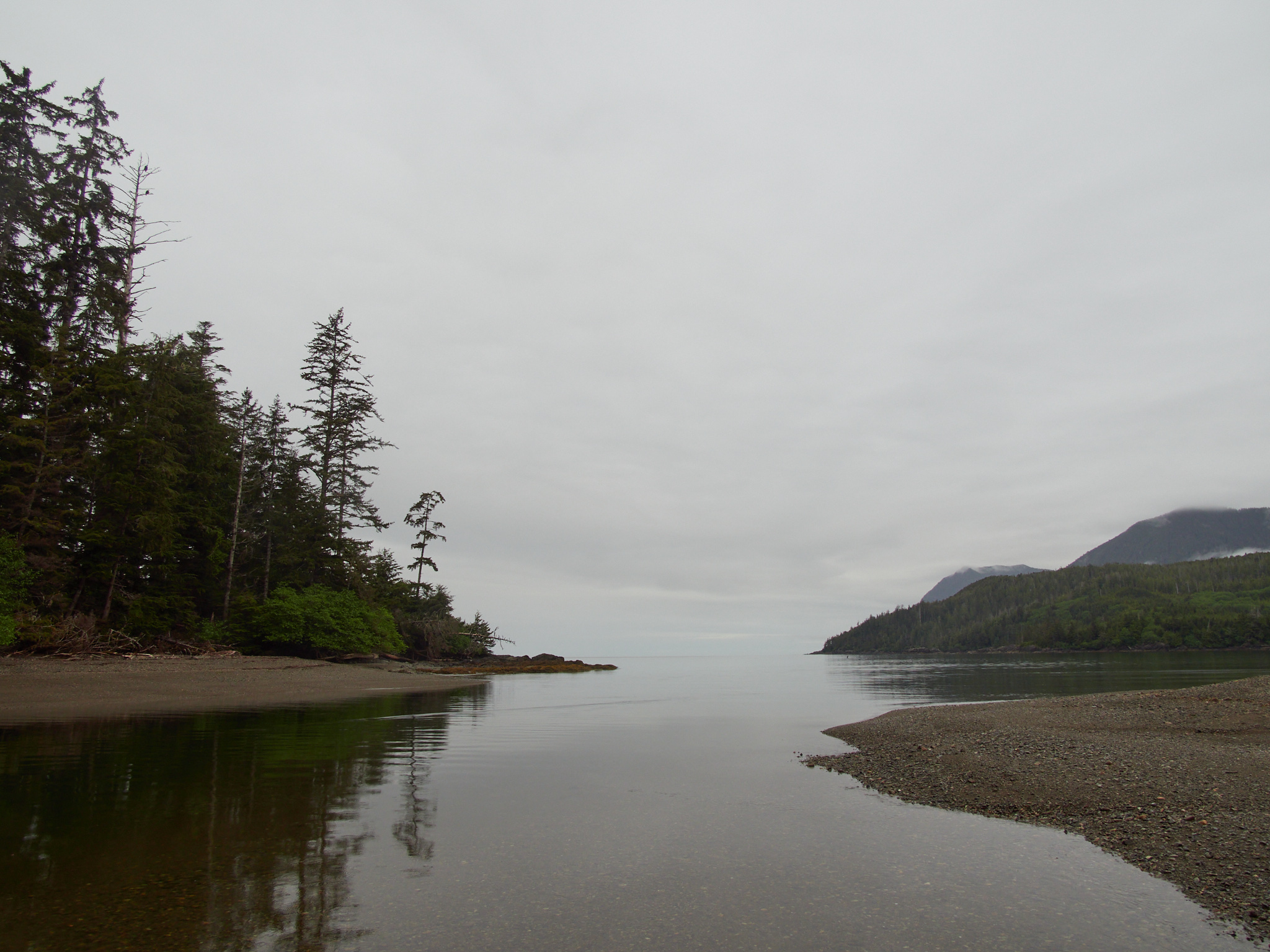
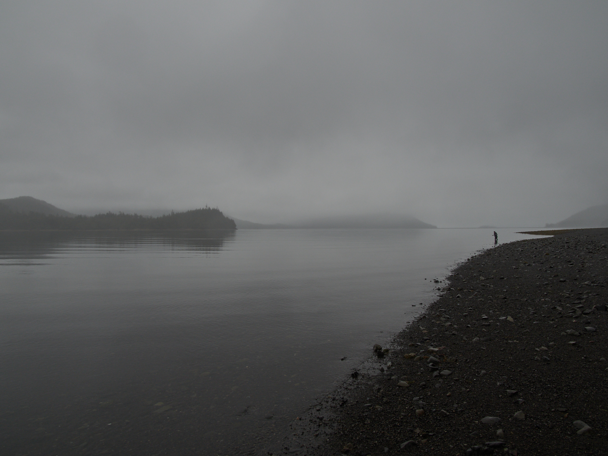
Kagan Bay (or, The Storm Before The Storm)
I emerged from the forest service road sooner than I expected, and headed past Daajing Giids to get some gas. I would have loved to have gotten some food in town, but nowhere was serving any.
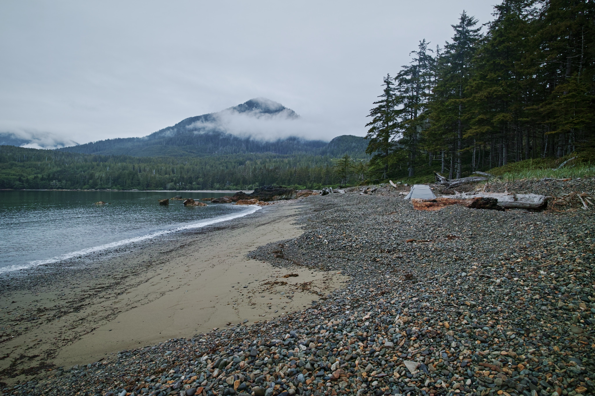
So, I checked out the nearby camping options. Kagan Bay had plenty of sites and was free. So, I set up my tent, grilled some sausages (#GrillingInTheRain ), and tucked into a well-deserved nap.
open_in_full
info
×
Exif Data For The Selected Image
Camera Make OLYMPUS CORPORATION Camera Model E-M5MarkIII Lens Model OLYMPUS M.12-200mm F3.5-6.3 Focal Length 13mm Aperture ƒ/7.1 Exposure Time 1/640s ISO 200 Exposure Compensation -1
open_in_full
info
×
Exif Data For The Selected Image
Camera Make OLYMPUS CORPORATION Camera Model E-M5MarkIII Lens Model OLYMPUS M.12-200mm F3.5-6.3 Focal Length 12mm Aperture ƒ/7.1 Exposure Time 1/640s ISO 200 Exposure Compensation -1
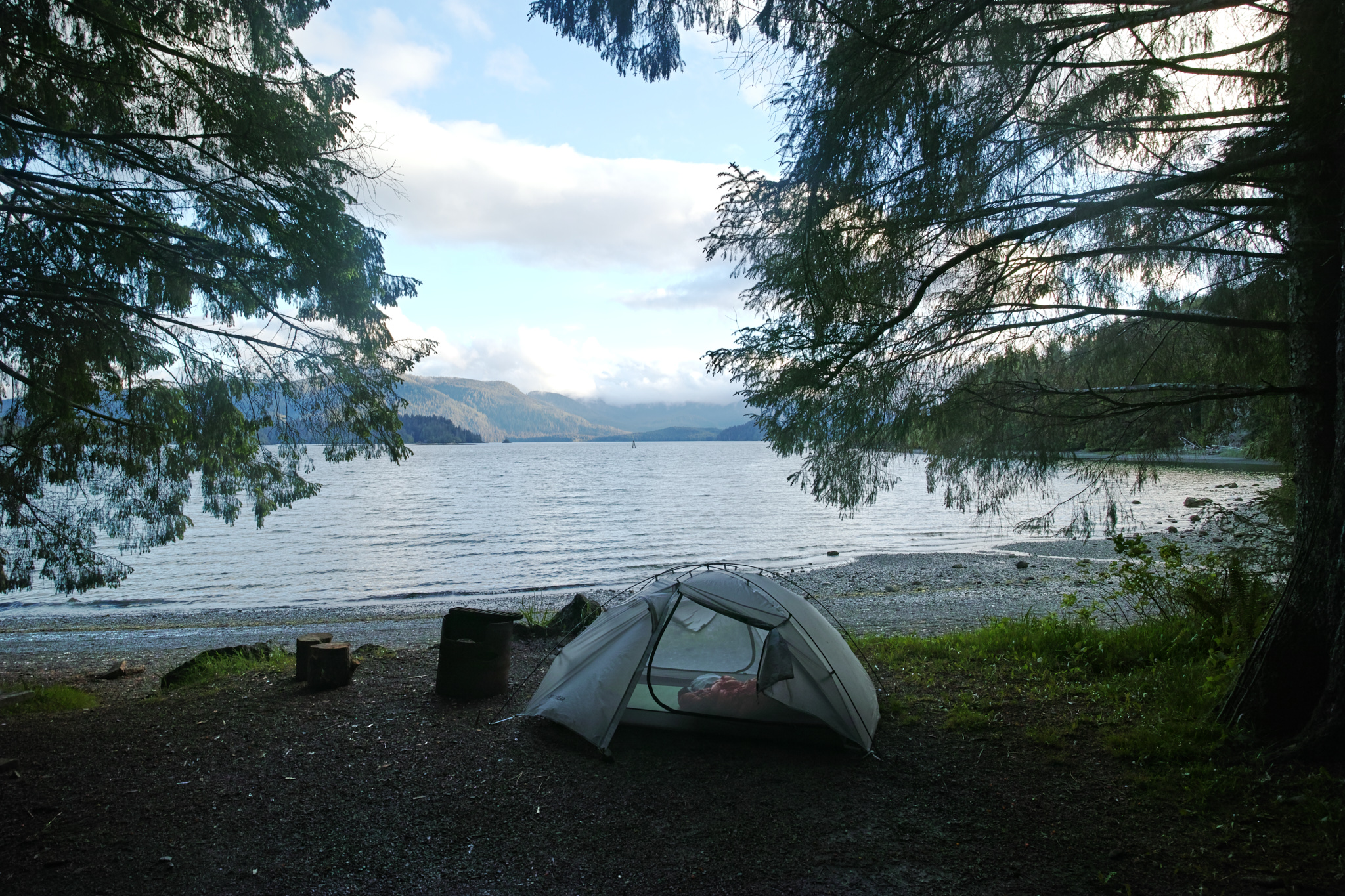
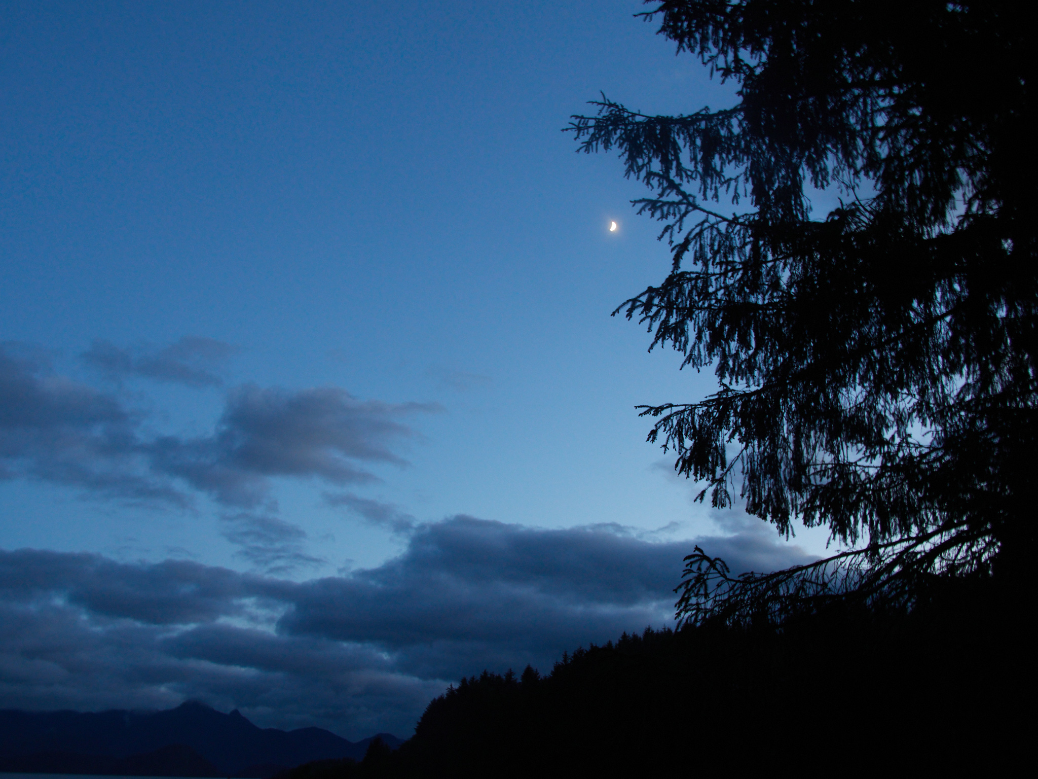
After two hours of solid sleep, I awoke to a landscape transformed.
open_in_full
info
×
Exif Data For The Selected Image
Camera Make SIGMA Camera Model SIGMA dp0 Quattro Focal Length 14mm Aperture ƒ/7.1 Exposure Time 1/40s ISO 100
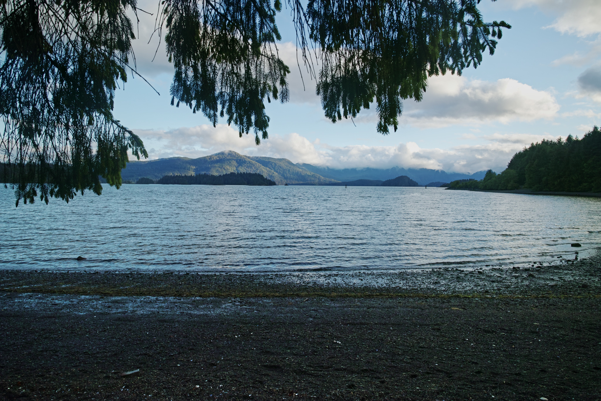
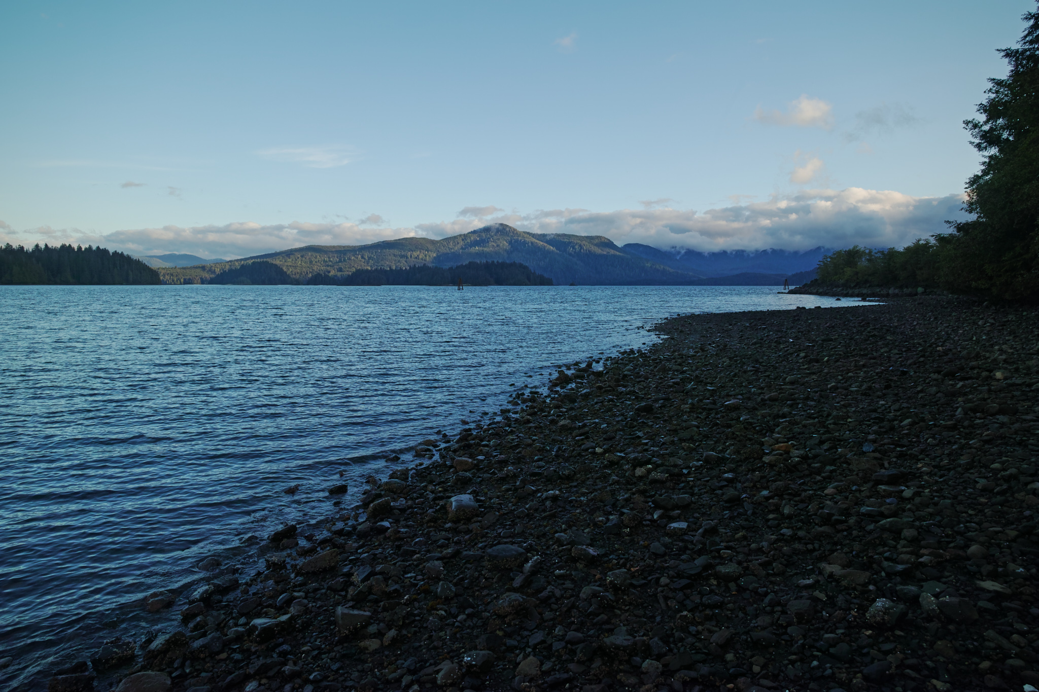
The sun was lower, the clouds had lifted.
open_in_full
info
×
Exif Data For The Selected Image
Camera Make SIGMA Camera Model SIGMA dp0 Quattro Focal Length 14mm Aperture ƒ/7.1 Exposure Time 1/80s ISO 100
open_in_full
info
×
Exif Data For The Selected Image
Camera Make SIGMA Camera Model SIGMA dp0 Quattro Focal Length 14mm Aperture ƒ/7.1 Exposure Time 1/125s ISO 100
And, I met a few campground-mates: a couple visiting the islands from 100 Mile House (a place I could now say I’ve driven through) and a Croatian who had been living and working in the north. It took a while for the gears to turn in my head and “Mislim da hrvatski je najlepši jezik” (“I think that Croatian is the most beautiful language”) to come out of my mouth, but it eventually did.
open_in_full
info
×
Exif Data For The Selected Image
Camera Make OLYMPUS CORPORATION Camera Model E-M5MarkIII Lens Model OLYMPUS M.12-200mm F3.5-6.3 Focal Length 13mm Aperture ƒ/7.1 Exposure Time 1/250s ISO 400
It was nice to chat with fellow visitors, and to share my excitement for the days ahead.
open_in_full
info
×
Exif Data For The Selected Image
Camera Make OLYMPUS CORPORATION Camera Model E-M5MarkIII Lens Model OLYMPUS M.12-200mm F3.5-6.3 Focal Length 15mm Aperture ƒ/6.3 Exposure Time 1/8s ISO 640
Stay tuned, because it will take me a good while longer before I continue with my next Haida Gwaii post…