Dead-End Detour
✍️ • 🕑 • Series: Towards the Beautiful Islands • Tags: aborted adventures • lakes • volcanoes • Wells Gray Provincial Park • state parks • park planning • dead ends • dead ends • Places: Chasm Ecological Reserve Viewpoint • Canim Beach Provincial Park • Forest Service Road towards Flourmill Volcano/Mica Mountain
Imagine that you were in my position.
You’re planning a long trip to Canada, opening with some days spent exploring parks and driving, and some days spent working. You’re going to traverse a lot of mountain ranges, and there are a number of places for longer, overnight or multi-day hikes.
You already know that some of them, like the famous Berg Lake Trail are officially closed for the entire season. You hope that others will be open.
Your hopes are in vain; your plans, naive. Not long before your travel, every trail report, every scrap of information indicates that you’re at least a month too early. Some of the roads to trailheads, even, are snowed in and inaccessible. (This is Canada in May after all.)
You’re fine sticking to lowland, non-snowy trails, but you also were originally thinking of trying to do one of the longer hikes between Kamloops and Prince George. You have no set reservations between the two cities, since B.C. Provincial Parks prohibit campsite reservations for individual nights during holiday weekends, and Victoria Day happens to be in the middle.
Searching for longer, backpacking friendly hiking areas mainly leads you to results to the south of Kamloops – the wrong direction.
Then, somewhere deep in a discussion thread in some untraceable corner of some social media platform or another, someone replies to a request for early season hiking suggestions nearish Prince George with a mention of “Flourmill Volcanoes.”
Intriguing, eh?
It’s in a corner of Wells Gray Provincial Park that is nearly inaccessible, down forest roads whose conditions are rumored to be impassable to most vehicles.
But laying in a course there means stopping by a scenic canyon overlook, visiting a lake with a Turkish-looking name, and maybe having an excuse to visit the Mahood Lake section of Wells Gray Provincial Park with its less-visited Deception, Canim, and Mahood Falls.
Would you try it?
Obviously, I did, or I wouldn’t have anything to write about…
I got up at eight in the morning in Kamloops, reorganized the car into a form where I could actually get at my belongings.
(I also brewed a long day’s worth of coffee by perching my Airbnb hosts’ single-cup Melita brewer on top of a thermos and pouring 700ml of boiled water through. Surprisingly, it worked excellent.)
Then, I hit the road.
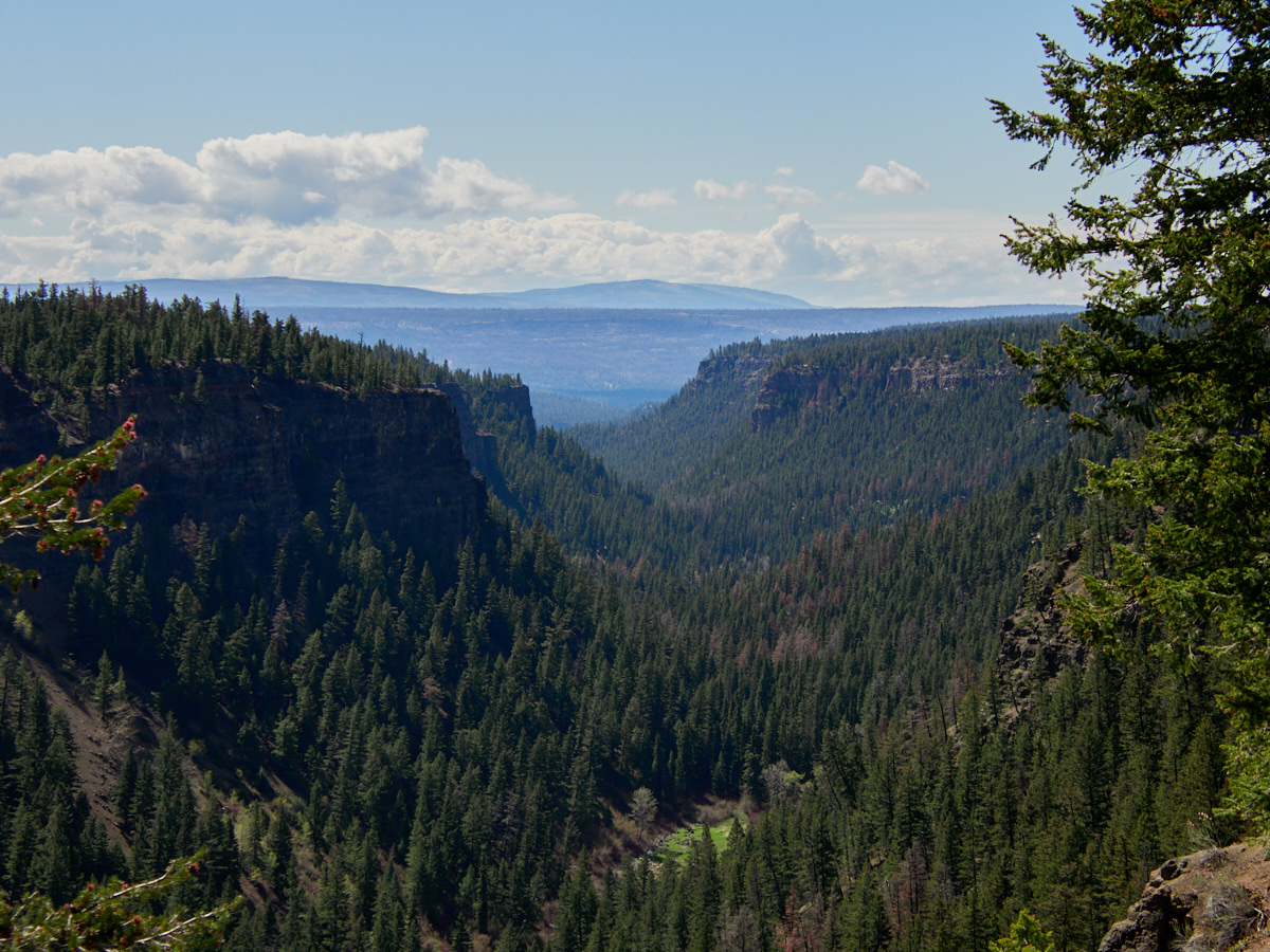
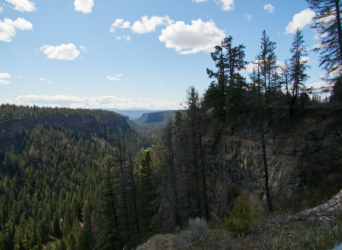
Chasm
My first stop was Chasm Ecological Reserve, where the chasm was indeed wonderful.
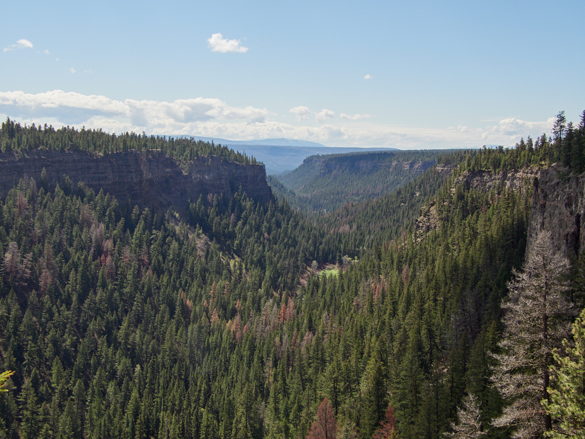
I probably would have walked around longer if I had realized that the path around the overlook is quite long and appears to continue. Alas, I had only a camera with me, having accidentally left my phone in the car.
Canim Lake
I stopped for lunch at the Canim Lake Beach, a nice, small little spot where I consumed a vast quantity of “Montreal Smoked Meat” cold cuts in a sandwich. What kind of meat? No one knows.
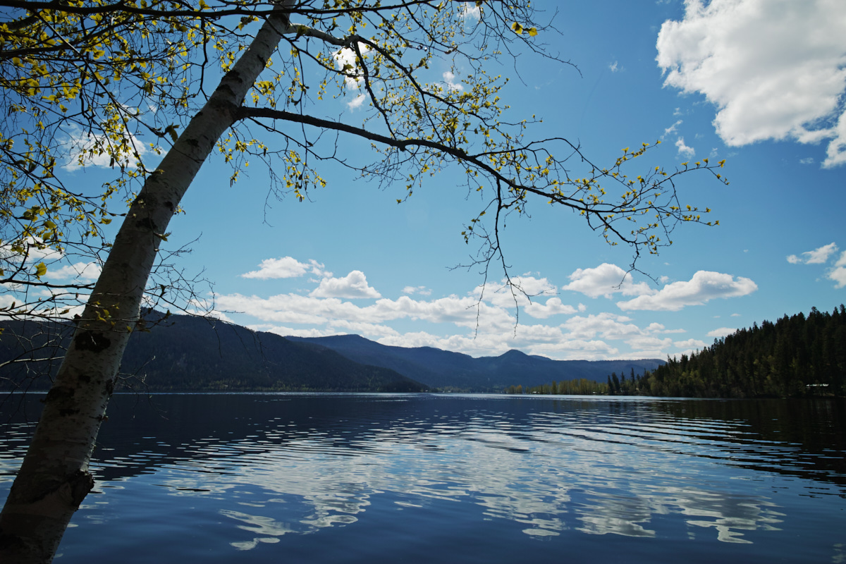
The beach area is small and home to a parking area and a few picnic tables. Apparently it’s a provincial park!
Really, though, I just stopped so I could take a selfie with the sign.
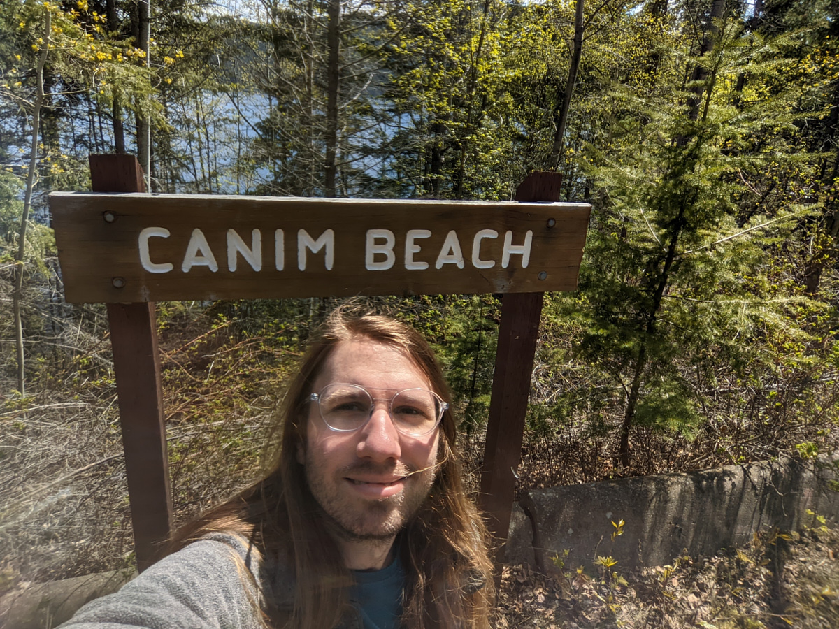
You see, “canim”, pronounced starting with a [k] is a Chinook jargon word for a particular type of canoe, but “canım” pronounced starting with a [d͡ʒ] is a Turkish term of endearment literally meaning “my soul.”
So yes, I figured I might as well enjoy the polysemy, take a selfie, post it on the ’gram, and mess with a bunch of people’s heads.
The Road to the Flourmill Volcanos
From here, my next stop was to be the Flourmill Volcanoes, a little-visited and difficult-to-access part of Wells Gray Provincial Park.
There is some information about the area online, but it’s pretty scant. To get more information on the hike and the park in which it was located, I picked up a copy of Roland Neave’s Exploring Wells Gray (at that bookstore with the closed cafe). The book is a valuable resource for visiting the park in general, and I recommend it.
My plan was just to drive to the end of a forest road, see if Spanish Creek was passable on foot, and if so, then hike in to this remote area and see some lava flows.
Wells Gray Provincial Park
Wells Gray is most famous for its waterfalls, 39 of them named. These were formed through volcanic eruptions and glacial activity. See all posts tagged 'Wells Gray Provincial Park'
Various people online and in the guidebook cautioned that the road may be in very poor condition, or impassable. If this was the case, I hoped that it would be impassable sooner rather than later, so that I could turn around without wasting too much of my day.
What do I know about the Flourmill Volcanos?
I know that they have a pretty unusual name, one that conjures up images of one of those science experiments for kids where a toy volcano erupts by adding vinegar to baking soda. Or, maybe images of Don Quixote fighting a windmill, thinking it’s a volcano, but then being crushed when a giant bag of flour improbably falls from the sky.
If your imagination isn’t as good as mine, that’s okay. The people who named the volcano were, in fact, ridiculously unimaginative too.
The Flourmill Volcanos began their Western Cartographic Life as the Fourmile Volcanos, named after the nearby Fourmile Creek. At the time, the creek was (yep) four miles from the park boundary. Imagination points: zero.
Some bureaucrat thought so too, noting that too many places shared that dumb “four mile” name. So, a few letters were switched around, and the creek and the volcanos were renamed Flourmill, making them sound super cool to yours truly.
The Flourmill Volcanoes used to be one of Wells Gray Provincial Park’s biggest tourist attractions, but the bridge leading there was removed, when logging activity ceased in the area.
This area became part of the park in the 1980s, and making it more accessible to visitors is one of the main line items in the 1986 park masterplan.
The masterplan describes the area thusly:
The Flourmill Volcanic Area, situated southwest of Clearwater Lake at the headwaters of Flourmill and Spanish Creeks. The volcanic features are among the most significant in southern British Columbia and already have a tradition of high public interest. The area exhibits elements of volcanism not presently contained or represented in Wells Gray Park. It is also an area which has been identified as one of a limited number of key recreation opportunities in the west side of the Clearwater River.
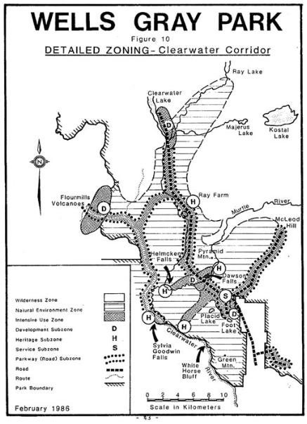
Note how the Flourmill Volcano area is off in the west, on the other side of a river, disconnected from other areas.
And, it goes on to propose that a bridge over the Clearwater River be constructed, linking the west side of the park to the east, and allowing visitors to take a circuit through the park rather than a series of dead end roads to disjunct areas.
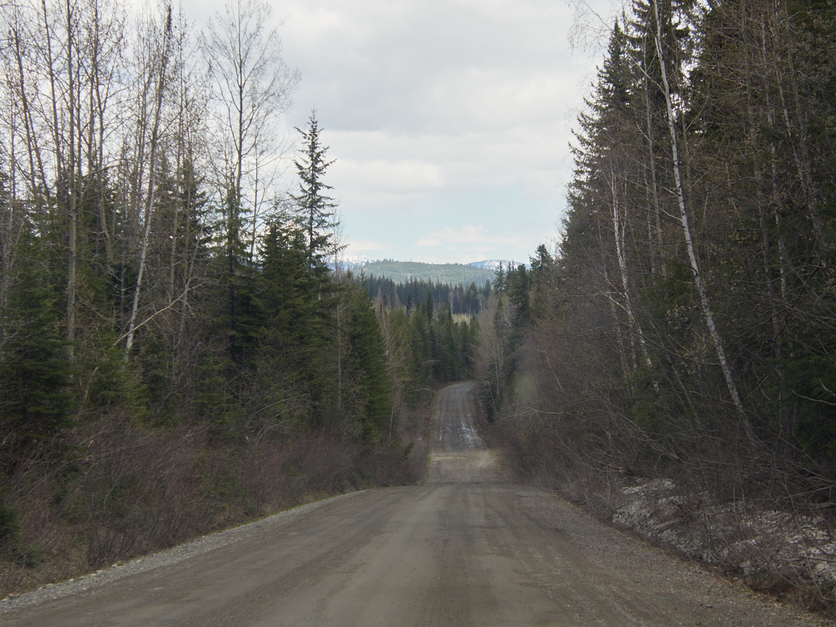
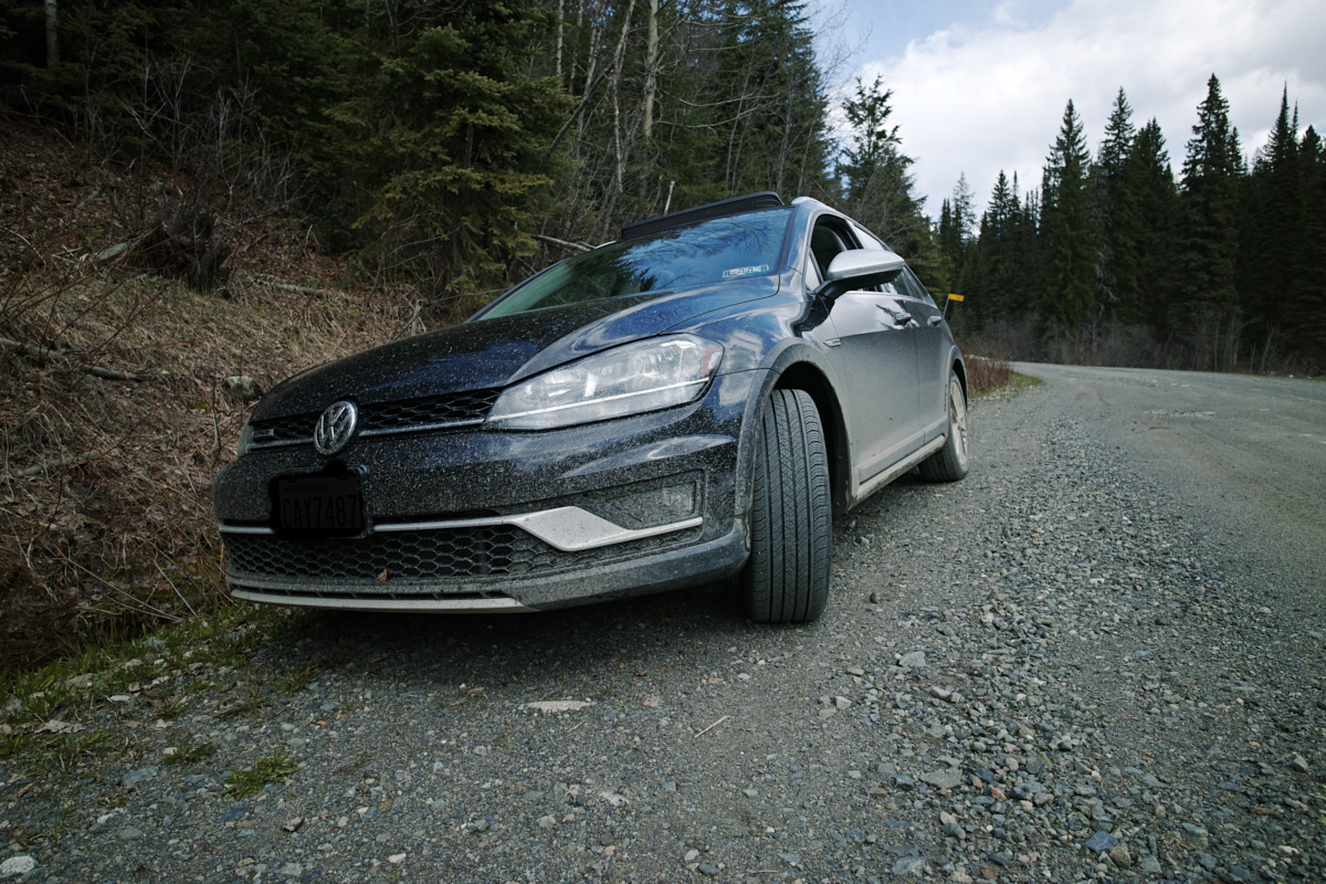
This plan has not come to fruition and the only road to the area is this:
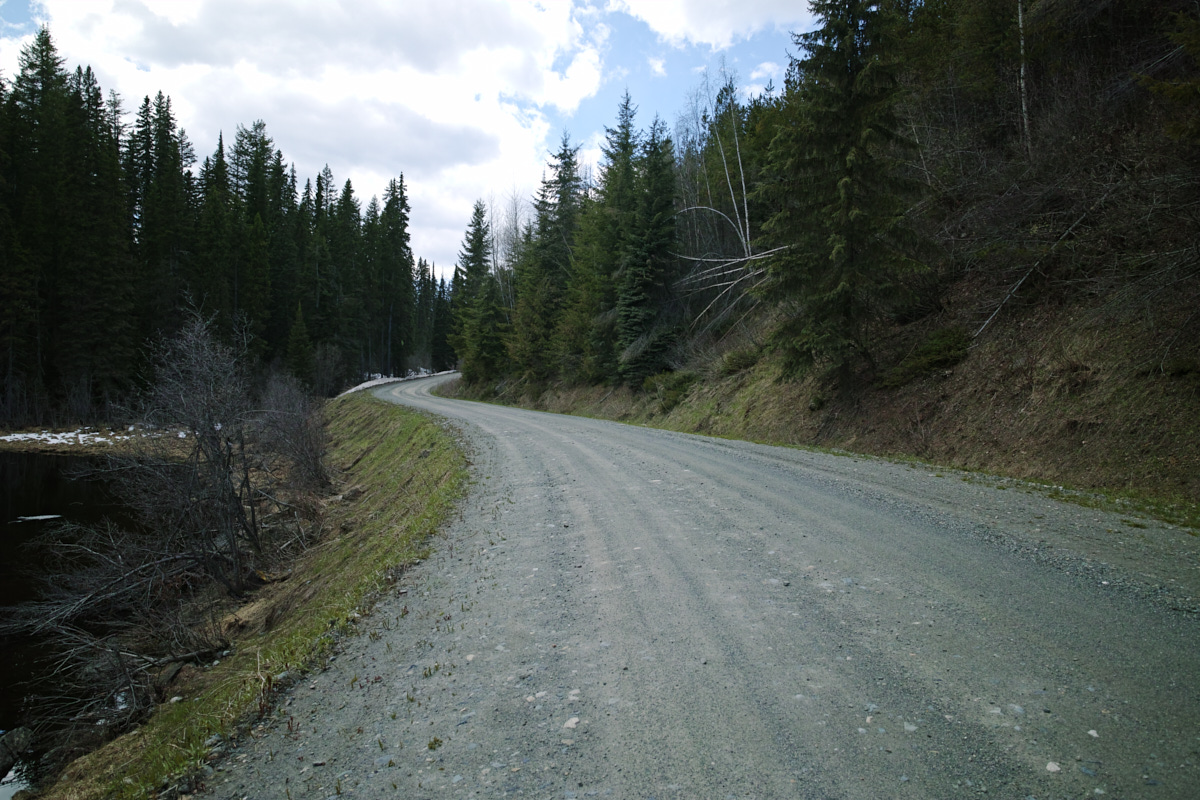
Shockingly passable, right?
There were a few large puddles deep ruts, but nothing that stopped me from driving. I didn’t pass any traffic along my route, but it had been clear almost all of the way.
It was only when I got within five kilometers of my planned parking space that my journey came to a close. It turned out that a nearby area, the Mica Mountain Snowmobile Trail was popular with snowmobiling.
The rest of the roads were covered in snow. I was not about to try to go down that, nor cross any rivers.
I came seeking knowledge, and I got what I sought. The answer was no; the road, impassable.
Some random stranger on the internet lied.
So, I drove back the way I came, wasting hours of time. I felt as if I could kiss the ground when I hit pavement again.
Then I immediately got on a different set of dirt roads so I could visit the Mahood Lake section of Wells Gray, and its less visited waterfalls…
This post was part of a series:
Thanks for reading!
If you enjoyed this post, you might enjoy these 5 similar posts:
- 2022-09-12 —A Great Day at Wells Gray!
- 2022-09-10 —Mahood Lake & The May Long
- 2022-10-13 —In the Land of the Nisg̱a’a (On the Wrong Day of the Week)
- 2022-09-22 —Rearguard Falls & Chun T'oh Whudujut Ancient Forest
- 2022-09-17 —The Road to Robson